Avalanche Awareness Week started this week! Events are happening daily across the state to prepare you for winter and get you thinking about avalanche safety.
Find out about all our events HERE. And don't forget the Utah Snow and Avalanche Workshop is this Saturday, December 6, with in-person and virtual options!
Just a few of the upcoming events this week:
- TONIGHT: 12/3 - Know Before You Go at Weber State University Outdoor Programs - 6:30 pm
- TOMORROW: 12/4 - Know Before You Go at Weber County Library - 7 pm
- TOMORROW: 12/4 - Ogden Avalanche Backcountry Bash at The Monarch - 6 pm
This morning, mountain temperatures range from the high teens to low 20s F after trace amounts to 2" of snow fell in the mountains above Ogden yesterday. Winds shifted from the NW to the E/NE overnight, and have been blowing less than 15mph.
Today, there's a possibility of some light snowfall in the morning before the NW flow leaves us dry. As an outlier, there’s some chance ridgetop winds will increase out of the East/Northeast and start to drift snow along the higher ridgelines. Note that—if this occurs—this will result in unusual loading patterns where north to westerly facing slopes may be drifted with unstable snow. As of 6:30am, easterly winds in the Ogden area have picked up more than 10mph since I started writing.
By early Friday, a warmer and wetter pattern starts moving in as a strong, upper-level jet associated with an atmospheric river makes its way towards Northern Utah. There is still uncertainty about how far south the bulk of this moisture can reach, as models continue to disagree on how much snow we'll be getting in the Northern Wasatch. BUT there's a chance of some heavy snowfall late Friday through the weekend—cross your fingers and check back tomorrow.
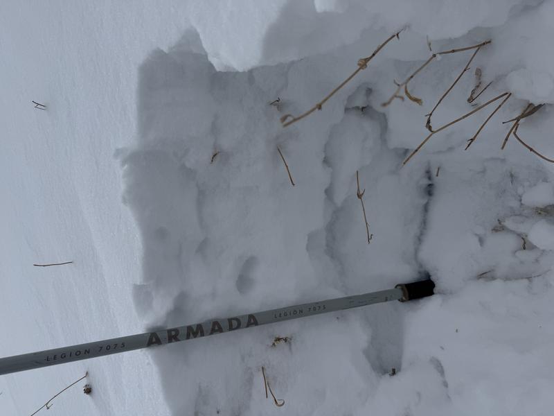
Shepard McClellan found a poorly bonded slab of new snow overly facets in the Cutler Ridge area yesterday. He also noted wind-loading on E-NE aspects above 7200' in his excellent observation you can read HERE>.
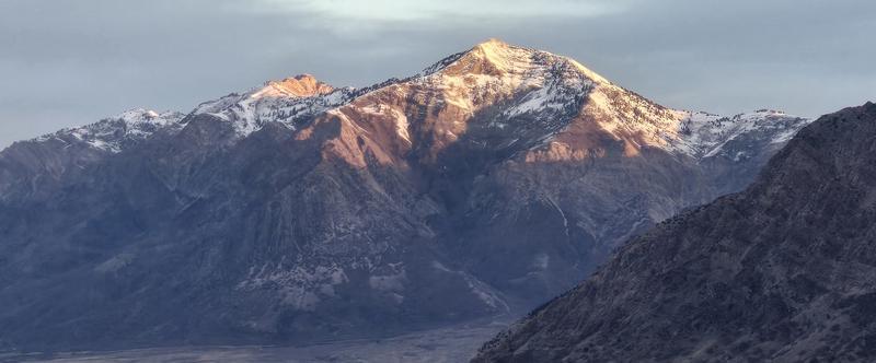
Derek DeBruin also had a solid observation from the western slope of the Ogden mountains from before the storm. He noted that snow is sparse across the Northern Wasatch, with the best coverage on shaded, higher-elevation terrain. South and sun-exposed slopes are mostly bare, and even the snow that is present is shallow and variable, especially on the ridges and upper bowls.
No recent avalanches were reported in the Ogden area mountains. Be sure to check out all observations HERE.