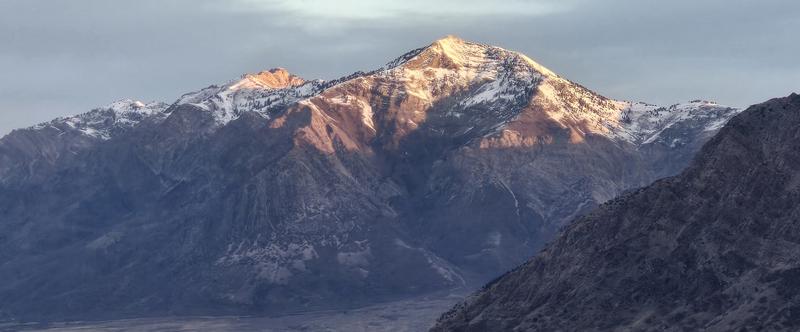
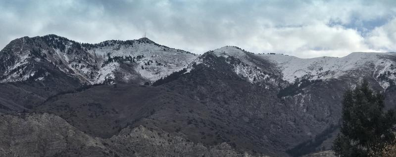
Given how little snow currently exists in the Ogden mountains, I don't think my annual satellite photo snow cover obs of where the dragons will lurk beneath the next storm is the right choice just yet (especially as this storm will likely not deliver enough snow to make for rideable terrain). Since Brooke recently surveyed conditions on the east side of the crest, I thought I'd add a few notes for the west side. Ben Lomond doesn't have continuous coverage until about 8500ft, with the exception of the westerly terrain on the town side of Chilly Peak where the snow dusts down a couple hundred feet farther. The skyline chutes off the Divide are nearly dry, souths/southwests are brown town, and southeasts and even some easts have limited patchy snow remaining. The Lewis Peak massif is almost dry, with snow relegated largely to the ridge crest. Very shallow snow cover is visible on E-N-NW terrain extending about 400-500ft below the ridgeline. This includes the out of bounds terrain just above Nordic Valley. Otherwise, snow is only really holding in relatively low-traffic zones (far upper reaches of Coldwater, One Horse, Jumpoff, and Goodale Canyons). It's a similar story on Mount Ogden, but it's holding snow a bit better. Southerlies are dry, with the snow line on westerlies around 8300ft. Northwests still have a coat of white a few hundred feet below this, leaving the upper bowls of Malan's Basin, the Strawberry backside, Strongs, Beus, etc. with a fair amount of spatial variability. Properly polar zones such as the Burn, Banana Chute, upper Coldwater, and Hells have visible coverage down to about 8000ft, and patches of snow a bit lower still.
Photos below of Ben Lomond and Mount Ogden.