Forecast for the Ogden Area Mountains

Mark Staples
Issued by Mark Staples for
Tuesday, December 13, 2022
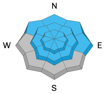
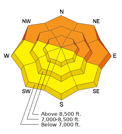
DANGEROUS AVALANCHE CONDITIONS exist on northwest, north, northeast, and east facing slopes at all elevations where the avalanche danger is CONSIDERABLE. This danger rating means you will likely trigger an avalanche in this terrain. It will be 2-5 feet deep.
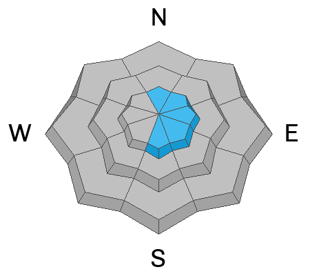
Southerly and west facing slopes harbor a buried weak layer but there have been no reported avalanches on this layer on these aspects. The main problem to watch for will be small soft slabs of wind drifted snow and sloughing of the new snow. On these slopes the avalanche danger is MODERATE.

HEADS UP - Please make sure any friends or family members who may be walking a dog, snowshoeing, etc. are aware that they can trigger avalanches on small steep slopes. Often these people aren't carrying avalanche rescue gear and prepared to deal with avalanches.
Low
Moderate
Considerable
High
Extreme
Learn how to read the forecast here
Weather and Snow
What a storm! It's great to see so much new snow. Since yesterday an additional 5-6 inches of very light snow fell (~0.2 inches of water). The exception is the Monte Cristo area where the SNOTEL site is showing about double this amount. Total snowfall since late Sunday is 2 feet of snow with 1.8-2.1 inches of water.
This morning, temperatures are generally in the mid-teens F. Winds are blowing from the west 10-18 mph gusting to 25 mph.
Today, a broad trough of low pressure with cold air descending from the north will keep temperatures cold today. High temperatures will mostly be in the upper teens. Winds may increase just a little today and blow from the northwest. Snow showers should continue on and off most of today with another 3-6 inches of light snow accumulating by tomorrow morning, but some places may see up to 8 inches of new snow.
A winter storm warning is in effect until 5pm today.
Recent Avalanches
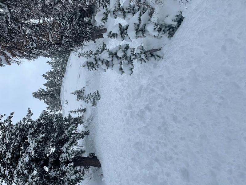
Yesterday a skier triggered an avalanche 18-24 inches deep and 80 feet wide on a northeast facing slope on Cutler Ridge on Ben Lomond Peak (photo below). Read more about it HERE.
Also, yesterday morning the Powder Mountain Ski Patrol observed a natural avalanche 3.5 feet deep and 200 feet wide on a north-northeast facing slope at 8180 feet. It appeared to initially break on a buried layer of surface hoar but then step down to the facets from mid November.
Ad
Avalanche Problem #1
Persistent Weak Layer
Type
Location
Likelihood
Size
Description
A buried persistent weak layer of faceted snow (and some surface hoar) exists throughout the Ogden area mountains buried 2-5 feet deep. It will most likely produce avalanches on northwest, north, northeast, and east facing slopes at all elevations. Even small slopes at low elevations can produce avalanches that may surprise you. See the video below of one I triggered yesterday futher south in Big Cottonwood Canyon.
On west facing and southerly facing slopes, this layer exists as well but it is capped by an ice crust and has so far not produced avalanches on these aspects.
The bad news - this layer will be dangerous and unstable for the near future. The good news - as this layer is buried deeper, it can slowly start to heal, but that won't happen this week.
Yesterday in the video below I asked Trent if he would ski a steep north facing slope in Big Cottonwood Canyon. His answer applies to the Ogden area.
Avalanche Problem #2
Wind Drifted Snow
Type
Location
Likelihood
Size
Description
Winds have been mostly light, but the snow is so incredibly light and the slightest wind will transport the new snow. Watch for shallow soft slabs of wind drifted snow at upper elevations. The greatest danger is having one of these wind slabs cause a deeper and larger avalanche fracturing on the buried persistent weak layer (see above discussion).
Avalanche Problem #3
New Snow
Type
Location
Likelihood
Size
Description
The new snow is very low density, and there should be dry loose avalanches (or sloughs) in the new snow.
Additional Information
For a detailed history of the snow and weather as of Dec 4th, visit our blog page HERE.
Check out this forecast discussion. If it's confusing, that's the point. The snowpack is dangerous, tricky and not to be trusted.
General Announcements

This information does not apply to developed ski areas or highways where avalanche control is normally done. This forecast is from the U.S.D.A. Forest Service, which is solely responsible for its content. This forecast describes general avalanche conditions and local variations always occur.