Forecast for the Ogden Area Mountains

Trent Meisenheimer
Issued by Trent Meisenheimer for
Sunday, December 11, 2022
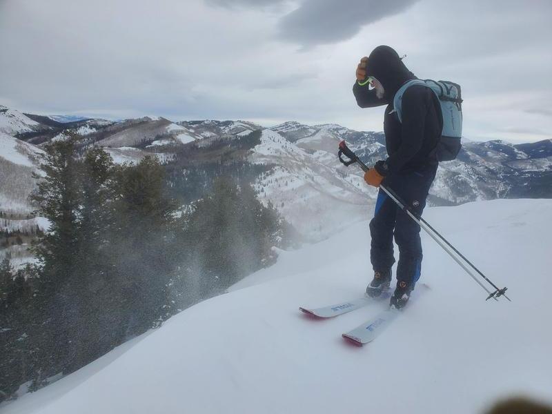
The avalanche danger is CONSIDERABLE on mid and upper elevation aspects facing northwest through north and east, where deep and dangerous human-triggered avalanches may break down 1-3' deep and over 200' wide, failing on a persistent weak layer of faceted snow. These avalanches can be triggered from a distance, so make sure there are no steep slopes above you.
Strong southerly winds will continue drifting and loading snow across the mid and upper elevations, forming both hard and soft slabs of wind-blown snow. These wind-drifted snow avalanches could be 1-2' deep and up to 150' wide.

Continue to avoid being on slopes steeper than 30˚ degrees.
Low
Moderate
Considerable
High
Extreme
Learn how to read the forecast here
Special Avalanche Bulletin
STRONG SOUTHERLY WINDS, COUPLED WITH DENSE, HEAVY SNOW, WILL MAKE THE AVALANCHE DANGER RISE OVER THE NEXT 24 HRS, POTENTIALLY REACHING HIGH AVALANCHE DANGER BY THIS EVENING. LARGE, DANGEROUS AVALANCHES BECOME MORE LIKELY AS THE STORM MATERIALIZES. AVOID BEING ON, UNDER, OR ADJACENT TO STEEP WIND-DRIFTED SLOPES AND TERRAIN STEEPER THAN 30 DEGREES.
Weather and Snow
The National Weather Service has issued a Winter Storm Warning that will go into effect this morning at 11:00 am lasting through Tuesday at 5:00 pm. A large-scale atmospheric river event is now on our doorstep. Snow will begin to develop this evening around 5:00 pm and will become heavy overnight with rates up to 2.0" per hour.
Southwest winds are blowing 25-35 mph gusting into the 40s & 50s across the upper-elevation terrain. They will continue to wreak havoc today and for the next 24 hrs before they back off Monday morning, becoming more westerly. Models agree that we could see a slight break in the action Monday morning before the cyclone redevelops over Colorado and we see wrap-around moisture on a westerly flow late Monday evening. Snowfall will continue into Tuesday and could stack up to 15-25" (1.2-2.2" snow water equivalent). Stay tuned and hold onto your hats.
Photo: Strong winds. Drew Hardesty showing us how to keep our favorite hat around.
Recent Avalanches
No new avalanche activity was reported from the Ogden area. Be sure to check out all observations HERE.
We had a late report from Friday, 12/9, of a skier who triggered a large avalanche in the Spanish Fork area. They were caught, carried, and partially buried against a tree. Details are limited, but you can find them HERE.
Ad
Avalanche Problem #1
Persistent Weak Layer
Type
Location
Likelihood
Size
Description
We have plenty of weak sugary faceted snow (persistent weak layer) scattered on almost all aspects and elevations throughout the Wasatch Range. However, what varies is the slab (the snow sitting above the weak layer). In sheltered locations, this slab might only be 10-15" inches deep, and in areas where the wind has loaded the slope, the slab could be anywhere from 1-3' feet deep and hard as a rock. In any case, we have dangerous avalanche conditions, and you can still trigger a season-ending slab avalanche failing on a persistent weak layer.
It's going to get a lot worse before it gets better. But, the good news! This problem will go away, just not this week. Remember, it's a long season, and it's shaping up to be an epic winter, don't ruin it now by getting caught in an avalanche.
Video: Drew Hardesty & Wilson from Mt. Aire.
Avalanche Problem #2
Wind Drifted Snow
Type
Location
Likelihood
Size
Description
As the southerly winds continue to blow 25-35 mph over the next 24 hours, and with plenty of snow available to transport, we can expect to find old & new slabs of wind-drifted snow dotted across the terrain. These slabs of wind-drifted snow can be soft or hard and will be most pronounced across the mid and upper-elevation slopes facing west through north through southeast. However, with such strong winds, be on the lookout for cross-loaded terrain features or drifts well off the ridgelines usually found on mid-slope breakovers. Avoid the snow that looks rounded, pillowy, or sounds hollow like a drum.
Remember, any wind slab avalanche that you trigger has the potential to step down into deeper weaker layers in the snowpack, creating a much more dangerous avalanche.
Additional Information
Our Week in Review, which highlights significant snow and avalanche events from this past Week, has been published. Mark Staples has also written an excellent piece describing the weather from the early winter.
General Announcements

This information does not apply to developed ski areas or highways where avalanche control is normally done. This forecast is from the U.S.D.A. Forest Service, which is solely responsible for its content. This forecast describes general avalanche conditions and local variations always occur.