Forecast for the Ogden Area Mountains

Greg Gagne
Issued by Greg Gagne for
Friday, November 30, 2018
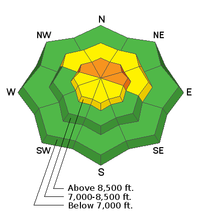
The avalanche hazard is CONSIDERABLE at the upper elevations on slopes facing northwest through east for storm snow as well as fresh wind slabs. Avalanches may break down 18-24", and possibly to the ground on upper elevation slopes facing north and northeast. Other slopes - including the mid elevations - have a MODERATE hazard. The avalanche danger is LOW at low elevations.
The dense snow has created excellent travel and riding conditions on low-angled slopes.
Low
Moderate
Considerable
High
Extreme
Learn how to read the forecast here
Special Announcements
Thanks to everyone who came out for the 2nd annual Ogden Backcountry Bash! All proceeds will go to support backcountry avalanche forecasting and education in the Ogden mountains.
Weather and Snow
Snow totals overnight in the Ogden mountains are 7" with nearly 1" of water weight. Storm totals since Wednesday range from 10-20" with a little over 2" of water weight. The snowpack is growing, and now is 2-3' at the upper elevations. Just to think, a few days before Thanksgiving most slopes were bare!
Temperatures this morning in the Ogden mountains are in the 20's F and winds are out of the west/southwest and in the teens, gusting in the 20's at the upper elevations.
Temperatures today are forecasted to be in the 20's and low 30's F with westerly winds gusting into the teens and 20's mph. After a break this morning, snowfall is expected to begin this afternoon with a few inches of snow forecasted by sunset. Additional snow overnight with 3-6" expected.
Recent Avalanches
No recent avalanches have been reported.
Ad
Avalanche Problem #1
Persistent Weak Layer
Type
Location
Likelihood
Size
Description
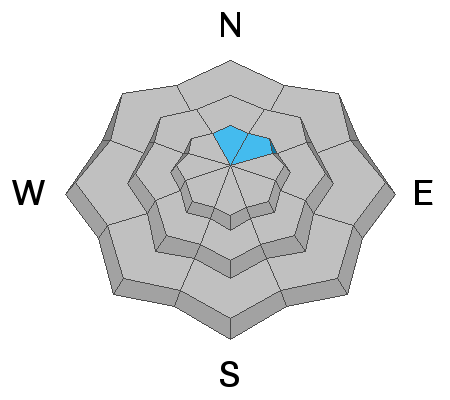
The Ogden area mountains had minimal old snow on the ground prior to Thanksgiving. A few areas at upper elevations have this old snow on N and NE aspects. The storm snow and wind drifts from the past few days will test this potential weak layer, and we will have to see how it reacts. Obvious clues are recent avalanching, and collapsing and cracking.
Avalanche Problem #2
New Snow
Type
Location
Likelihood
Size
Description
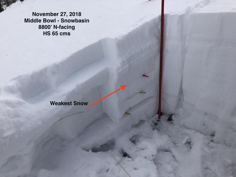
On my field day on Tuesday with the Snowbasin snow safety team we found the weakest snow to be the Thanksgiving storm snow that is now buried up to 2' deeply. This layer had begun to facet and weaken, and is now overloaded with upwards of 20" of storm and wind-driven snow at the upper elevations. On Thursday, snow safety teams from Powder Mountain found a sensitive layer of grauple down about 18".
The image below is from Tuesday (without recent storm snow) depicting the location of the weakest snow from Thanksgiving storm.
General Announcements
This information does not apply to developed ski areas or highways where avalanche control is normally done. This advisory is from the U.S.D.A. Forest Service, which is solely responsible for its content. This advisory describes general avalanche conditions and local variations always occur.