Forecast for the Ogden Area Mountains

Evelyn Lees
Issued by Evelyn Lees for
Saturday, December 1, 2018
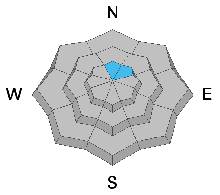
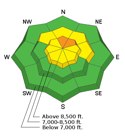
The avalanche hazard is CONSIDERABLE at the upper elevations on steep slopes facing north and northeast, especially if there are any new wind drifts in the terrain. Other steep slopes - including the mid elevations - have a MODERATE hazard for triggering a new snow slide or a wind drift. The avalanche danger is LOW at low elevations.
The dense snow has created excellent travel and riding conditions on low-angled slopes.
Low
Moderate
Considerable
High
Extreme
Learn how to read the forecast here
Special Announcements
Thanks to everyone who came out for the 2nd annual Ogden Backcountry Bash! All proceeds will go to support backcountry avalanche forecasting and education in the Ogden mountains.
Weather and Snow
Snow totals overnight in the Ogden mountains are 1 to 4". Storm totals since Wednesday range from 20" to almost 30". The snow pack is growing, and looking at upper elevation snow stakes and Snotel sites, there is now about 3 feet of snow on the ground, with 25" at the Ben Lomond trailhead. Much of that is been dense, supportable snow.
Temperatures this morning in the Ogden mountains are in the upper teens to low 20s. Winds have been troublesome for the past 24 hours, as it looks like Mt Ogden was rimed for a while, and may still be "slow" with it's low current readings. Stations that are working look to be averaging about 10 mph, with gusts in the 20s and 30s.
Temperatures today are forecasted to remain in the 20s, and any winds decreasing by mid day. Clear to partly cloudy skies today, with occasional light snow adding an inch or two. Additional snow is possible overnight into Sunday - a few inches of very low density fluff.
Recent Avalanches
We have no reports from the backcountry. Snow safety teams reported mostly stable snow yesterday - though they were able to trigger a few shallow new snow avalanches about 4" deep. However, even they have been unable to get into or see the highest terrain.
Ad
Avalanche Problem #1
Persistent Weak Layer
Type
Location
Likelihood
Size
Description
The Ogden area mountains had minimal old snow on the ground prior to Thanksgiving, and there continues to be very limited evidence of basal facets. A few suspect areas are on upper elevation slopes facing N and NE. The storm snow and wind drifts from the past few days will test this potential weak layer, and we will have to see how it reacts. Obvious clues are recent avalanching, and collapsing and cracking.
Avalanche Problem #2
New Snow
Type
Location
Likelihood
Size
Description
With over 2 feet of new snow in the past few days, sluffs and new snow soft slabs are possible on steep upper and mid elevation slopes, especially those facing the north 1/2 of the compass. Particularly identify and avoid any new wind drifts on steep slopes. Waves or pillows of snow, finding denser thick snow or cracking are all signs of wind drifts.
General Announcements
This information does not apply to developed ski areas or highways where avalanche control is normally done. This advisory is from the U.S.D.A. Forest Service, which is solely responsible for its content. This advisory describes general avalanche conditions and local variations always occur.