Forecast for the Ogden Area Mountains

Issued by Drew Hardesty on
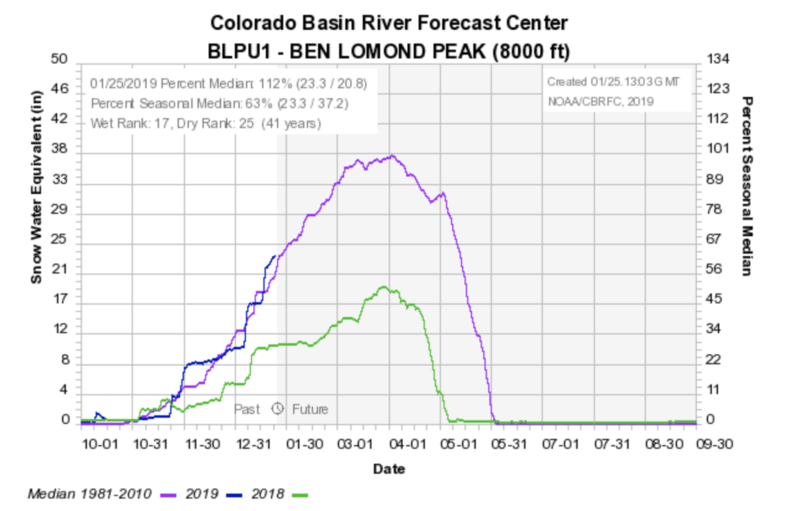
Friday morning, January 25, 2019
Friday morning, January 25, 2019
Localized areas of MODERATE danger exist for human triggered avalanches in wind drifted snow. Avoid wind loaded slopes and you'll avoid most avalanches. With such a huge load of snow over the last week, the possibility remains for slides to break deeper in the snowpack on buried persistent weak layers. With warming temps and clearing skies, wet avalanche activity will be on the rise over the weekend. Anytime the sun comes out for prolonged periods of time, the sun-kissed slopes will become wet and unstable.
Wind and sun-sheltered low angle slopes are 4 star. Low Risk, High Reward

Low
Moderate
Considerable
High
Extreme
Learn how to read the forecast here