Forecast for the Ogden Area Mountains

Drew Hardesty
Issued by Drew Hardesty on
Monday morning, January 20, 2020
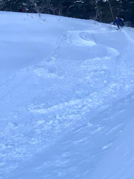
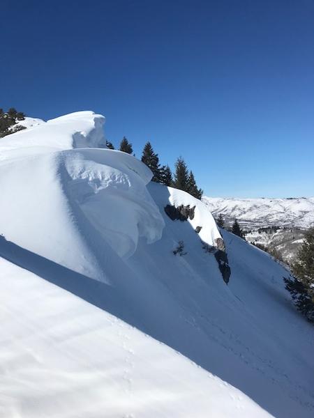
A MODERATE danger exists for sensitive human triggered wind drifts on many slopes at the mid and upper elevations. These shallow new wind drifts may be triggered at a distance, on approach, and may even pull out above you on the slope.
Wet loose avalanches will still be possible in low and mid elevation wind-sheltered terrain, particularly if greenhousing occurs.
The Avalanche Conditions are much more dangerous in the Logan area mountains and the Western Uintas. Please consult their advisories if headed that way.
Low
Moderate
Considerable
High
Extreme
Learn how to read the forecast here
Special Announcements
We are very sad to report an avalanche fatality from Saturday above Farmington Canyon. An 18 year old male snowmobiler was caught, fully buried and killed. Preliminary info available HERE. Our deepest condolences go out to the friends, family, rescuers, and everyone affected by this tragic accident.
Weather and Snow
We have partly cloudy-becoming overcast skies with temps in the upper 20s to low 30s. Winds curiously appear light along the ridgelines but mid-elevation anemometers are spinning as expected with the overall weather picture. They're averaging 25mph with gusts to 35. Riding conditions are excellent in the wind and sun sheltered terrain. Greg was up on the Cutler ridge yesterday and Derek DeBruin the day before. Brian Smith also has a good report from yesterday. Their obs -as well as many others-can be found HERE.
Recent Avalanches
No significant avalanches reported from the Ogden area mountains yesterday. Some minor wet loose noted during the heat of the day. Brian Smith noted some minor sluffing, below -
Ad
Avalanche Problem #1
Wind Drifted Snow
Type
Location
Likelihood
Size
Description
Shallow new drifts will be particularly sensitive and may be triggered at a distance today. These will be most pronounced on west to north to east facing slopes at the mid and upper elevations. The new drifts will be landing on a variety of weak snow surfaces across the compass. Remember that avalanches involving buried surface hoar often run on lower angle slopes. Mid-slope and mid-elevation ridgelines will be every bit as suspect as the usual steep upper elevations...if not more so.
CORNICE: Several days of strong winds have created large and sensitive cornices along the exposed ridgelines. Some of these cornices have dropped naturally, and many observers have noted they are quite sensitive as you approach them. Large cornices often collapse and break much further back than expected, so be sure to give them a wide berth when traveling along the exposed ridgelines. Photo Brian Smith
General Announcements
This information does not apply to developed ski areas or highways where avalanche control is normally done. This forecast is from the U.S.D.A. Forest Service, which is solely responsible for its content. This forecast describes general avalanche conditions and local variations always occur.