Forecast for the Ogden Area Mountains

Drew Hardesty
Issued by Drew Hardesty on
Tuesday morning, January 21, 2020
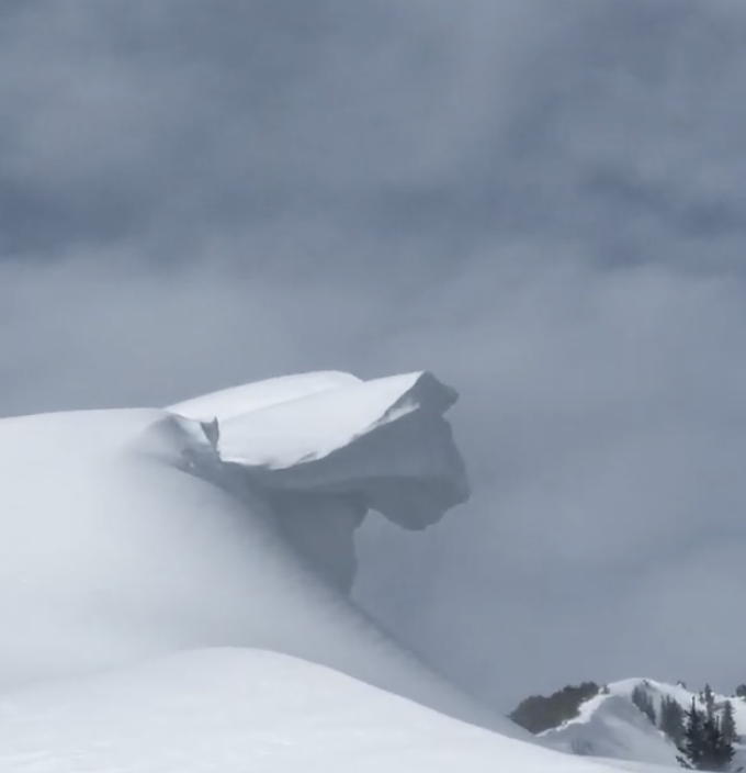
A mostly LOW avalanche danger exists in the Ogden area mountains. Remember that LOW danger does not mean NO danger. Isolated wind slab and minor sluffing may be found in the higher elevations. Cornices must be given a wide berth if traveling along or beneath the ridgelines.
The Avalanche Conditions are much more dangerous in the Logan area mountains and the Western Uintas. Please consult their advisories if headed that way.
Low
Moderate
Considerable
High
Extreme
Learn how to read the forecast here
Special Announcements
We are very sad to report an avalanche fatality from Saturday above Farmington Canyon. An 18 year old male snowmobiler was caught, fully buried and killed. Preliminary info available HERE. Our deepest condolences go out to the friends, family, rescuers, and everyone affected by this tragic accident.
Weather and Snow
Skies are mostly cloudy with temps in the upper 20s to low 30s. Winds are 15-20mph with gusts to 35. The highest ridgeline anemometers are blowing 30-40mph with gusts to 50.
Sun, wind, and warm temps have taken their toll on the snow surfaces in recent days, but one can still find joy in the wind and sun protected terrain.

For today, we'll see mostly cloudy skies. Temps will be in the mid-30s down low, the upper 20s up high. Winds will be westerly at 10-15mph. A stronger system passes by to the north tonight through tomorrow, but spillover may offer 4-8" in the higher terrain. Ridging builds back in for late week into the early weekend with a somewhat active pattern setting up for early next week.
Recent Avalanches
No significant avalanches reported from the Ogden area mountains yesterday other than minor wind slab noted high along the Ogden skyline. Some older minor natural cornice failure was noted by some observers.

On Sunday in the Salt Lake area mountains, the third of a party of three, while traversing high along the Mill B South and Mineral Fork ridgeline, triggered and was briefly caught and carried in an estimated 12-18" deep and 100' wide soft slab avalanche. The initial avalanche in turn sympathetically triggered a similar one, estimated to be 400' wide...and perhaps another one or more along the ridgeline heading north. These avalanches are on steep west to southwest facing slopes at 10,200'.
The failure plane most likely involves a facet/crust combination formed Wednesday/Thursday during the quick window of high pressure and survived the punishing pre-frontal southwest winds.
I mention this because of the uncertain nature of this type of avalanche. I suspect this layering is limited in scope and distribution but backcountry skiers/riders should be aware of this event.

The avalanche fatality from Saturday likely failed on weak snow formed prior to New Year's. This layering has been noted across the Ogden and SL mountains but has not been reported in any avalanches but this one...despite miles of terrain skiied and ridden.
Ad
Avalanche Problem #1
Normal Caution
Type
Location
Likelihood
Size
Description
Owing to the sun, warmth, and wind, it appears that most of the weak snow surfaces, including surface hoar, suffered great degradation over the past 24-36 hours and any new snow should bond favorably.
Isolated rogue wind drifts may still exist in the highest alpine terrain. Minor sluffing is still possible on the steepest northerly aspects. Normal caution.
Cornices should still be given a wide berth. (pc McIntyre)
Additional Information
Remember, forecasts are guidance not gospel. If you are seeing different conditions than expected or finding more alarming snow tests than you like, adjust your terrain choices accordingly.
General Announcements
This information does not apply to developed ski areas or highways where avalanche control is normally done. This forecast is from the U.S.D.A. Forest Service, which is solely responsible for its content. This forecast describes general avalanche conditions and local variations always occur.