Forecast for the Moab Area Mountains

Eric Trenbeath
Issued by Eric Trenbeath for
Monday, April 1, 2019
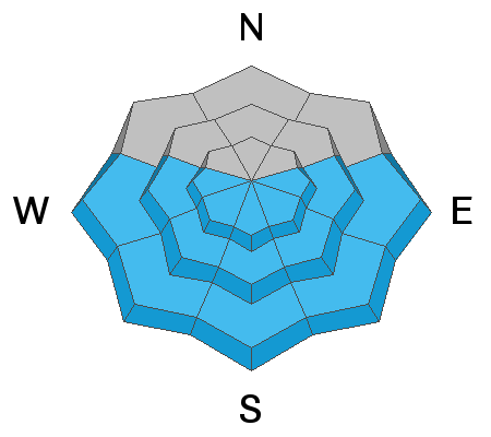
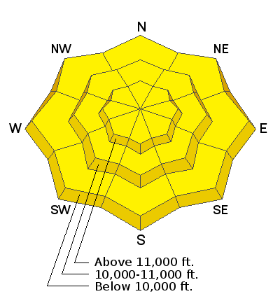
Today the danger is MODERATE for avalanches involving the new snow on slopes steeper than about 35 degrees at mid and upper elevations. Utilize slope cuts, and choose terrain wisely with regard for consequences. Even a small sluff could sweep you over a cliff or push you into trees. As the day heats up there will be a rising MODERATE danger for wet slide activity on sun exposed slopes. Roller balls and pinwheels are signs of instability. Get off of steep slopes as they become wet and sloppy. And finally, there is an isolated or MODERATE danger for triggering a pocket of wind drifted snow on steep, upper elevation slopes that face NW-N-E.
Low
Moderate
Considerable
High
Extreme
Learn how to read the forecast here
Special Announcements
Utah has a rich history of avalanches. From the earlier mining days of Alta to the start of avalanche research and snow science in the US in Little Cottonwood Canyon in 1939. Snowpack and weather data has been collected from the Alta Guard Station every year since making it the longest snow plot history in the US. These roots made the UAC an early leader in avalanche education and forecasting.
Couple of new interesting things to read and listen to: (1) The latest blog by Drew "Roping the Wind (Slab)", and (2) UAC podcast featuring Lynne Wolfe - guide, avalanche educator, editor of The Avalanche Review, mentor, role model. This is a can't-miss episode!
Weather and Snow
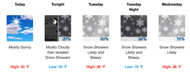
Skies are clear, WNW winds are light, and 10,000' temps are around 10 degrees. Yesterday's storm system put down 8" of low density snow in Gold Basin, and up to 10" at upper elevations. This provided a much needed refresh. Travis Nauman, and Armin Howell were up yesterday and reported fun conditions with light, fluffy powder on a supportable base. The sun will be on it today so get it while you can! Today look for mostly sunny skies, light westerly winds, and high temps in the low 30's. Looking ahead, the next system will affect our area on Wed, with another storm lined up for the weekend.
New snow totals in Gold Basin (10,000')
Snotel totals at the Geyser Pass Trailhead (9600')
Winds at 11,000 feet on Abajo Peak (11,330') about 45 miles south.
National Weather Service point forecast.
Recent Avalanches
Numerous loose, dry avalanches within the new snow were observed on steep slopes yesterday.
For a list of avalanches this season go here.
Ad
Avalanche Problem #1
New Snow
Type
Location
Likelihood
Size
Description
Most of the instability within the new snow will have settled out out by today, but it is still possible to trigger loose, dry, sluffs, particularly in steep, upper elevation terrain. Though mostly small and manageable, sluffs could entrain a fair amount of snow once they get going. Utilize slope cuts, and choose your terrain wisely with regard for consequences such as being swept over a cliff or into trees.
Avalanche Problem #2
Wet Snow
Type
Location
Likelihood
Size
Description
As the sun heats the new snow it will become susceptible to loose, wet avalanches. The danger will occur on east facing slopes first, followed by south, and then west. Roller balls and pinwheels are signs of instability. Get off of steep slopes as they become wet and sloppy.
Avalanche Problem #3
Wind Drifted Snow
Type
Location
Likelihood
Size
Description
Wind transported snow was observed yesterday along upper elevation ridge crests. Today, be on the lookout for recent deposits of wind drifted snow on upper elevation slopes that face primarily NW-N-E. Recent wind slabs will be soft, and not well connected, but if you triggered one in an area of more extreme terrain, it could take you for quite a ride.
General Announcements
Your information can save lives. If you see anything we should know about, please help us out by submitting snow and avalanche observations HERE. You can also call me at 801-647-8896, or send me an email: [email protected].
Support the UAC through your daily shopping. When you shop at Smith's, or online at REI, Backcountry.com, Patagonia, NRS, Amazon, eBay by clicking on these links, they donate a portion of your purchase to the UAC. If you sell on eBay, you can have your See our Affiliate Page for more details on how you can support the UAC when you shop
This forecast is from the U.S.D.A. Forest Service, which is solely responsible for its content. This forecast describes general avalanche conditions and local variations always occur.