Forecast for the Moab Area Mountains

Issued by Eric Trenbeath on
Monday morning, March 10, 2025
Monday morning, March 10, 2025
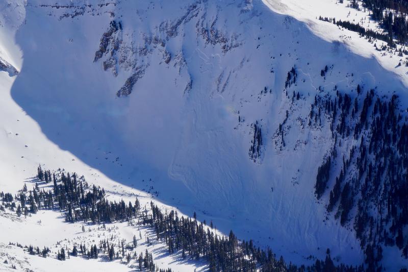
Although the likelihood is decreasing, the avalanche danger remains CONSIDERABLE on steep slopes near and above treeline that face NW-N-NE-E. In these areas, you can trigger deep and dangerous avalanches from 2-4 feet deep failing on buried weak layers of faceted snow. In some cases, these un-survivable avalanches could fail at the ground taking out the entire season's snowpack. A MODERATE danger for this type of avalanche exists on W and E aspects near and above treeline, and on lower elevation northerly aspects. Avoidance of slopes steeper than 30 degrees in these areas is the only real safe strategy.
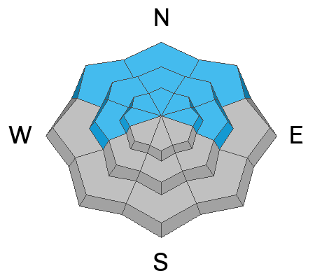
A strong sun and very warm temperatures again today will create a MODERATE danger for loose, wet avalanches on sun exposed slopes. The danger follows the sun with east facing slopes affected first and westerly aspects getting hit later in the day. Signs of instability include roller balls, pinwheels, and sloppy wet snow. Stay off of, and out from under steep slopes as they become wet and sloppy.

Low
Moderate
Considerable
High
Extreme
Learn how to read the forecast here