Forecast for the Moab Area Mountains

Eric Trenbeath
Issued by Eric Trenbeath on
Monday morning, February 3, 2025
The overall danger is LOW and human-triggered avalanches are unlikely. Small avalanches remain possible in isolated areas or extreme terrain.

As the heatwave continues, expect an increasing likelihood for small, loose wet avalanches, especially if we see any sunshine today. Pay attention to the snow surface and avoid steep slopes that are becoming wet and sloppy.
Low
Moderate
Considerable
High
Extreme
Learn how to read the forecast here
Special Announcements
Check out the latest edition of the UAC podcast with Moab forecaster Dave Garcia where he talks about the challenges of forecasting for our remote and isolated range with limited information.
Urgent battery replacement required for anyone who received batteries from one of our participating "Batteries for Beacons" shops. Please review the "Batteries for Beacons" replacement notice on our blog. Batteries distributed through our "Batteries for Beacons" program this year have shown to be inadequate length.
Geyser Pass Road: Surface is mainly snowpacked and icy above and bare dirt down low. AWD with good tires recommended.
Grooming Conditions: Trails have not been groomed since Wednesday.
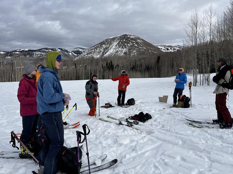
A huge shout out to this great crew who turned out to improve their avalanche awareness and rescue skills at our Backcountry 101 course this weekend!
Weather and Snow
6 A.M. Snow and Weather Data
24 Hour Snow: 0" 72 Hour Snow: 0" Season Total Snow: 63" Depth at Gold Basin: 28"
Winds on Pre-Laurel Peak: SW 20-25 Temp: 40° F Percent of Normal (SWE): 72%
Weather
Southwest winds continue their 48 hour rein of terror and it's a sweltering 40°F up there this morning at 10,000'. Up on Pre Laurel Peak at 11,400' temperatures are just below freezing. Today will be a few days warmer than yesterday with continued breezy conditions and lingering high clouds. Things start to cool off slightly on Wednesday. An active pattern resumes later in the week but as has been the case for the majority of this season, most of the action will be to the north.
General Conditions
Sustained southwest winds and very warm temperatures make me think of a hairdryer being turned on to our meager snowpack. Snow is disappearing quickly from southerly aspects and many are bare. Above treeline, northerly aspects aren't much better after a barrage of north wind events in mid-January. Near treeline and below the snowpack is thin, variable, and largely faceted through.
Very warm temperatures and a lack of an overnight re-freeze are increasing the likelihood for loose, wet avalanches. I've got some uncertainty about this, but as the surface snow becomes damp and cohesive, it will develop a propensity to slide off looser, cohesionless snow underneath. This is generally a solar side of the compass concern but many of those slopes are bare or very thin so I think the threat is overall quite limited. However, due to the extremely warm temperatures, and underlying poor snowpack structure, we may also experience some wet activity on polar aspects below treeline. Best practice is to avoid steep slopes that are wet and sloppy.
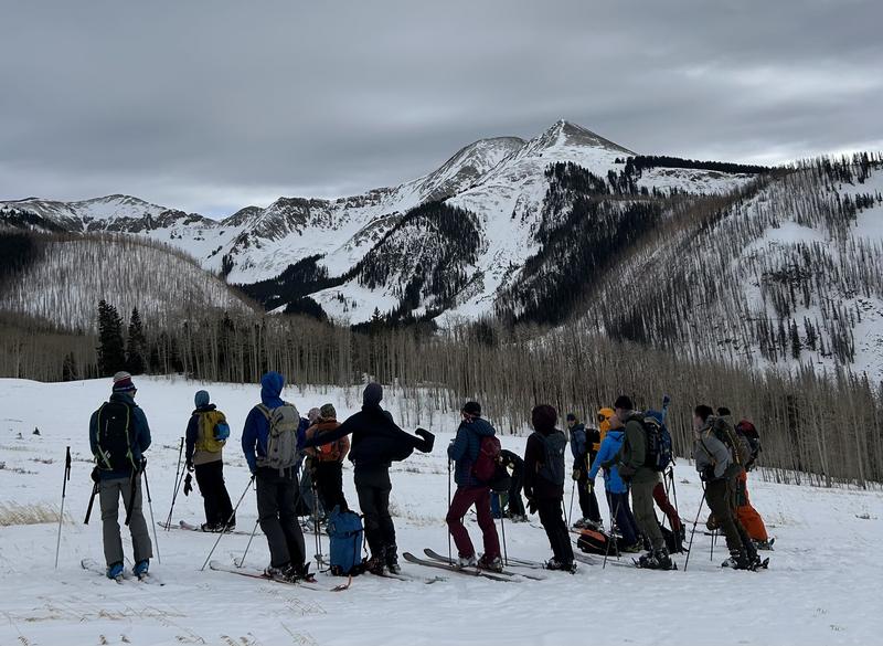
South facing slopes are going fast (photo above), while northerly aspects above treeline are faring only slightly better (photo below).
Snowpack and Weather Data
Gold Basin SNOTEL site (10,000')
SNOTEL site near Geyser Pass Winter Trailhead (9600')
Wind Station on Pre-Laurel Peak (11,400')
NWS forecast for the La Sal Mountains.
Recent Avalanches
Ad
Avalanche Problem #1
Normal Caution
Type
Location
Likelihood
Size
Description
Low danger doesn't mean no danger, and here are a few things to keep in mind as you travel through the backcountry today.
  • Loose Wet Avalanches - We are experiencing an unusual mid-winter heat wave and consecutive night without a re-freeze. Surface snow is becoming damp and consolidated on top of a weak, facted snow structure. I think the threat is overall minimal, but pay attention to the snow surface and avoid steep slopes that are wet and sloppy.
  • Persistent Weak Layer - Our snowpack is generally weak and faceted in many areas. This is different than your typical late-season low danger. If you are getting into big lines and steep terrain, it is always wise to evaluate the snowpack first. Look for slabs over weak layers. Reduce your risk by avoiding likely trigger points like shallow rocky areas, steep convexities, and thin slab margins.
  • Wind Drifted Snow - The La Sals are a high, islolated, wind swept mountain range and snow is often transported and then deposited as slabs of wind drifted snow. The current threat is isolated to specific terrain features and avalanches will be small, but they could sweep you off your feet and carry you over a cliff in the wrong location. Remain cautious of smooth, rounded, hollow feeling, areas, especially when in consequential terrain.
Additional Information
Sign up for text alerts to get the most up to date information about changing conditions, road plowing, special avalanche announcements.
Follow us on Instagram @utavy_moab
General Announcements
This forecast is from the U.S.D.A. Forest Service, which is solely responsible for its content. This forecast describes general avalanche conditions and local variations always occur.