Join us at our 2nd Annual Blizzard Ball

Forecast for the Moab Area Mountains

Issued by Chris Benson on
Wednesday morning, February 10, 2021
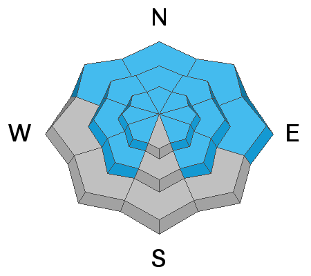
The avalanche danger remains CONSIDERABLE on steep slopes above treeline facing NW-NE-SE, and deep and dangerous human triggered avalanches failing on persistent weak layers are likely in these areas. Recent deposits of wind-drifted snow have added additional stress in these areas. Avalanches can be triggered from a distance and break wider and farther than expected. A MODERATE avalanche danger exists near treeline and below. Generally, LOW danger can be found on low elevation, south-facing terrain.
Stick to slopes less than 30 degrees and avoid being underneath or adjacent to avalanche terrain.
Low
Moderate
Considerable
High
Extreme
Learn how to read the forecast here
Special Announcements
We are filled with grief to report four fatalities from a skier triggered avalanche in the Wasatch Mountains on Saturday. All were well known members of the backcountry community. Here is the preliminary report. Additionally, yet another avalanche fatality has occurred in WA; preliminary report. In a little over a week, there have been 16 avalanche fatalities across the U.S. Conditions are dangerous in most regions and ours is no exception. Please stay conservative in your terrain choices.

The Geyser Pass Road is plowed. Conditions are snow-packed and icy and all-wheel drive is recommended.
The Lower Utah Nordic Alliance (LUNA) is planning on grooming today.
Weather and Snow
24 Hour Snow 1" 72 Hour Snow 1" Base Depth in Gold Basin 39" Wind SW 2 mph Temp 22 F
Over the last 24 hours, about 1" of snow has fallen with light SW winds. Today, expect lingering snow showers, partly cloudy skies followed by clearing this afternoon with highs near 35 F and light westerly winds. Models suggest a series of systems beginning to impact the area starting Friday. Stay tuned.
Wind, temperature, humidity on Pre Laurel Peak (11,700')
Snotel site near Geyser Pass Trailhead (9600')
Storm totals at the Gold Basin study plot (10,000')
Snowpack Discussion
We received about 1" of snow and might get a few more today, but this won't change the avalanche danger. Wind and warm temperatures have created variable conditions but settled powder can still be found below treeline on sheltered northerly aspects. On sunny slopes, the snow surface has crusted over, and coverage remains thin. Many slopes on almost every aspect have a weak snowpack structure. Yesterday, on a SW aspect at 9,600', I observed a soft slab overlying weak facets that produced several failures under moderate-loading steps with sudden-collapse fracture character. While breaking trail in open meadows, I got two collapses and one shooting crack.
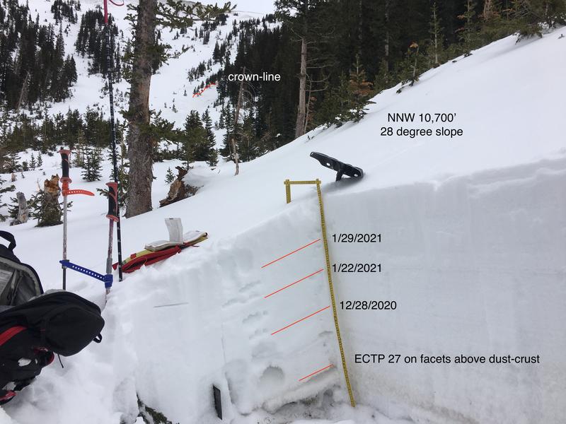
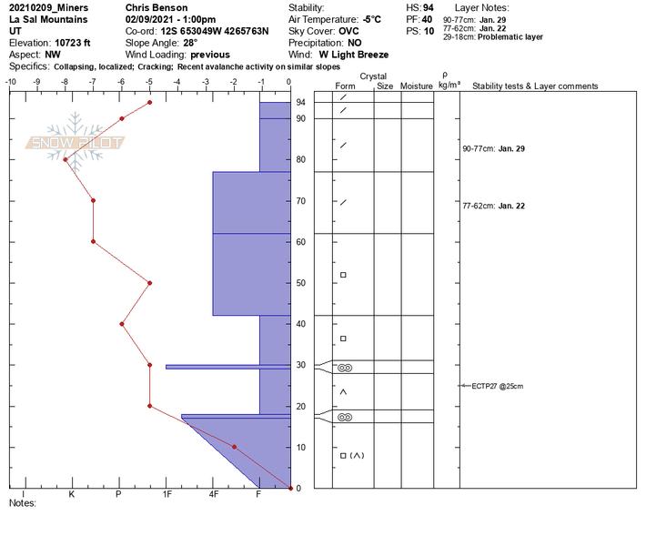
The most dangerous areas are near and above treeline on NW-E-SE aspects. I investigated a relatively recent avalanche on a NNW aspect in Miners Basin. The pattern we are seeing throughout the range is that stubborn slabs continue to fail on weak layers buried deep in the snowpack. These slabs have the potential to propagate far and wide. This is especially true in areas that have been wind loaded. These slabs are growing more stubborn, BUT, don't be fooled by the absence of cracking and collapsing. Although these warning signs are becoming less frequent, the underlying poor-snowpack structure may still produce large and destructive avalanches.
Yesterday, Charlie Ramser provided this observation.
Recent Avalanches
Ad
Avalanche Problem #1
Persistent Weak Layer
Type
Location
Likelihood
Size
Description
Persistent weak layers of weak, sugary, faceted snow are present on many aspects and elevations. On slopes facing NW-N-E-SE, slabs 1'-3' deep exist on top of these weak layers. While recent warm temperatures and time have helped the snowpack gain some strength, deep and dangerous, human-triggered avalanches remain likely in these areas. The danger increases with elevation and human triggered avalanches remain likely above treeline, particularly on slopes with recent deposits of wind drifted snow.
Avalanche Problem #2
Wind Drifted Snow
Type
Location
Likelihood
Size
Description
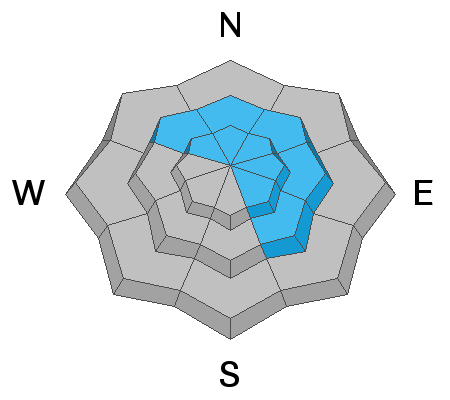
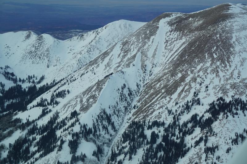
Over the last week, winds have been eroding westerly aspects and loading snow onto more easterly aspects near and above treeline. Cross-loading has occurred on slopes facing NW-E-SE. Recent wind drifts are recognizable by their smooth rounded appearance and they may sound or feel hollow like a drum. Avoid slopes that appear to be wind-loaded, especially those with an easterly component to their aspect.
Aerial photo of Mt. Peale (2/8/2021) showing southeasterly and east-facing, cross-loaded gullies where dangerous wind slabs are perched above weak underlying snow.
General Announcements
This forecast is from the U.S. Forest Service, which is solely responsible for its content. This forecast describes general avalanche conditions and local variations always occur.