We are filled with grief to report four fatalities from a skier triggered avalanche in the Wasatch Mountains on Saturday. All were well known members of the backcountry community. Here is the
preliminary report. In a little over a week, there have been 15 avalanche fatalities across the U.S. Conditions are dangerous in most regions and ours is no exception. Please stay conservative in your terrain choices.
The Geyser Pass Road is plowed. Conditions are snow-packed and icy and all-wheel drive is recommended.
The Lower Utah Nordic Alliance (LUNA) groomed all trails on Saturday.
24 Hour Snow 0" 72 Hour Snow 0" Base Depth in Gold Basin 38" Wind WSW 15 mph Temp 28F
Over the last 24 hours, westerly winds ranged from 15-20 mph and shifted to the SW overnight. Today, expect SW winds 15-25 mph with gusts to 35 mph. Skies will be mostly cloudy with high temps at 10,000' near 33 F. Zonal flow (westerly) overhead is delivering a weak system that will bring a chance for precipitation today and this evening. Radar indicates light precipitation bands over the La Sals as of this morning. Scattered rain and snow showers will result in the mountains receiving 1-2" of snow by tomorrow. Models suggest a series of systems beginning to impact the area starting Friday. Stay tuned.
Snowpack Discussion
Wind and warm temperatures have created variable conditions but settled powder can still be found below treeline on sheltered northerly aspects. On sunny slopes, the snow surface has crusted over and coverage remains quite thin. Moderate westerly winds this week have scoured exposed, windward slopes while alternately loading leeward, easterly facing slopes. Cross loading has also occurred on slopes facing NW-N-E-SE. Observations from Sunday reported fresh drifts on some of these aspects and dangerous slabs 2'-3' deep are perched above the weak underlying snowpack. These slabs are growing more stubborn by the day BUT, don't be fooled by the absence of cracking and collapsing. Although these obvious warning signs are becoming less frequent, the underlying poor-snowpack structure may still produce large and destructive avalanches.
On Sunday 2/7/201, Eric Trenbeath and Dave Garcia gleaned this
observation. Travis Nauman and Kelly Quinn sent in this
observation as well. Yesterday, Charlie Ramser provided this
observation and I did another flyover of the La Sal mountains yesterday:
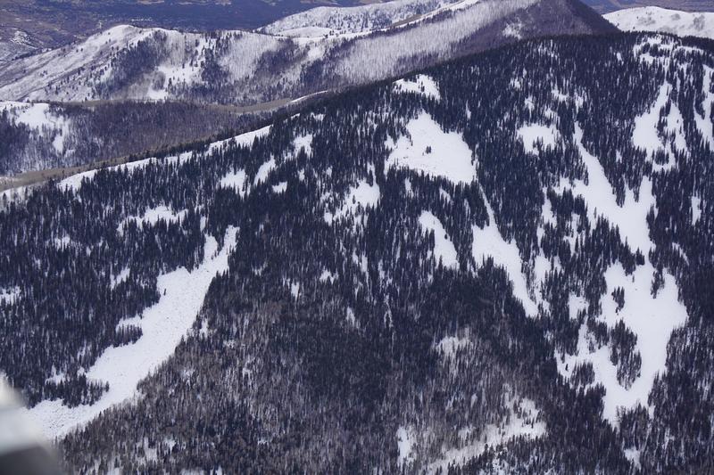
Northeast aspect below treeline. (South Mtn. Glades). Low snow-cover prevails.
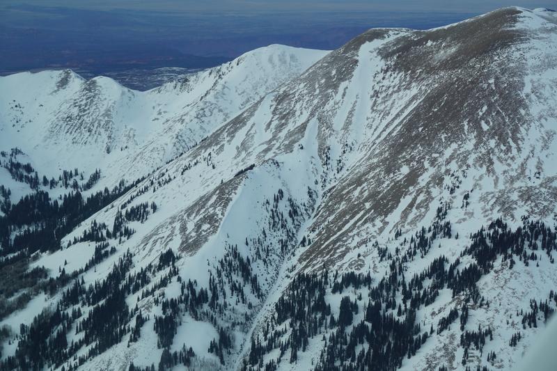
South aspect of Mt. Peale. Note wind-loaded SE and E aspects in the drainage.
Upper Dark Canyon, with MT. Mellenthin and Laurel Peak on the right. No surprise here, but good verification to see wind-swept ridges and wind-loaded N-NE-E aspects.
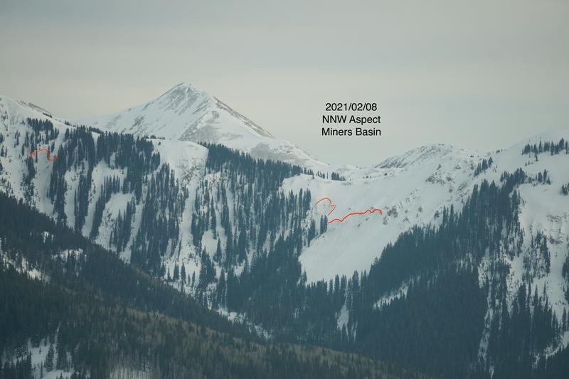
This was more of a surprise. This NNW aspect in Miners Basin had a couple of crowns. They probably ran sometime last week- after the snow that fell on 2/3/2021. The largest looks to be about 250' wide and to have run about 500' vertically. Hard to tell how deep these are, but maybe about 1'. It doesn't appear that they have been filled-in by recent wind.