Forecast for the Moab Area Mountains

Eric Trenbeath
Issued by Eric Trenbeath for
Friday, February 1, 2019
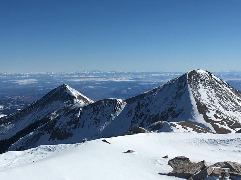
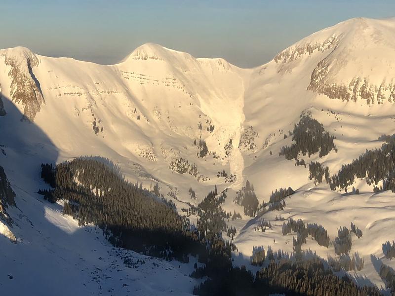
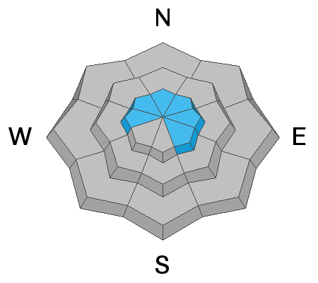
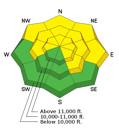
The avalanche danger is MODERATE today, but deep and dangerous, human triggered avalanches, failing on a buried persistent weak layer are still possible. You are most likely to encounter this problem on slopes steeper than about 35 degrees that face W-N-SE. The danger is greatest on slopes with a northerly component and local observers and I are going to continue to avoid this type of terrain. There also remains an isolated, or MODERATE possibility for triggering an old, hard wind slab in exposed areas. Suspect smooth, rounded pockets, or ribbons of hard snow that feel hollow underneath. Most S-SW facing terrain offers generally LOW danger.
Low
Moderate
Considerable
High
Extreme
Learn how to read the forecast here
Special Announcements
We will be offering a Backcountry 101 avalanche course on Feb 8, 9. It's a great way to up your avalanche knowledge with both classroom, and hands on field instruction. Click here for more details and to register. Much thanks to Moab Gear Trader for sponsoring this course! Please visit them for all of your winter backcountry needs.
Weather and Snow
Skies are clear, westerly winds are light, and 10,000' temps are in the low teens. It's going to he another gorgeous day in the mountains before things start to change, so get up and enjoy the beautiful weather before snow returns on Sunday! Clouds will move into the area tomorrow ahead of the first in a series of Pacific storm systems to affect our area. We may see a few showers by afternoon, but the real action looks like it will come Sunday, with heavy snowfall, and strong SW winds. Up to a foot to a foot of snow seems likely by Monday.
The snow surface is getting tired and worn, but in my travels yesterday I still managed to find quite a bit of soft snow out there. Observers early this week reported the same. Check out observations from Brian Hays, Dave Garcia, and Nate Ament. Snow conditions notwithstanding, the beautiful weather and million dollar views make a trip up to the mountains worth it.
Base depth in Gold Basin: 58"
New snow totals in Gold Basin (10,000')
Snow totals at the Geyser Pass Trailhead (9600')
Wind, temperature, and humidity on Pre Laurel Peak (11,700')
National Weather Service point forecast.
Mann's Peak, and Mount Tomasaki, with the San Juan Mountains in the distance. Dave Garcia photo.
Recent Avalanches
I've completed the final report on Friday's fatal avalanche. Our deepest sympathies continue to go out to the family and friends of local Monticello resident, Scott Pehrson Jr. who was killed in the accident. Much thanks to San Juan, and Grand County Search and Rescues, Classic Air Medical and the Utah Department of Public Safety, Snowbird, Wasatch Powder Bird Guides, and professional dog teams from Wasatch Backcountry Rescue, Alta, and Park City ski patrols.
Ad
Avalanche Problem #1
Persistent Weak Layer
Type
Location
Likelihood
Size
Description
Time and warmer temperatures are helping to strengthen the snowpack, but persistent weak layers are called that because they persist! Our layer of concern is the early December snow that has turned to weak, sugary facets. Since Christmas Eve, regular storms have now piled more than 4' of snow on top of this layer. Add wind drifting, and we've seen avalanches up to 8' deep. The danger is greatest on steep, upper elevation slopes facing NW-N-E, and last Friday's fatal avalanche shows how real the danger is.
Avalanche Problem #2
Wind Drifted Snow
Type
Location
Likelihood
Size
Description
Though growing increasingly unlikely, areas of wind drifted snow may pose a few problems in upper elevation, wind exposed terrain. Most of these wind slabs are welded into place, but if they break, they could fail several feet deep. Expect to find old drifts on the lee sides of ridge crests and terrain features such as gully walls, sub-ridges, and rock outcroppings. Avoid areas that have a smooth, rounded appearance, or that feel hollow underneath.
Additional Information
Grooming: Trails are groomed and will be in excellent condition this morning!
General Announcements
Your information can save lives. If you see anything we should know about, please help us out by submitting snow and avalanche observations HERE. You can also call me at 801-647-8896, or send me an email: [email protected].
Support the UAC through your daily shopping. When you shop at Smith's, or online at REI, Backcountry.com, Patagonia, NRS, Amazon, eBay by clicking on these links, they donate a portion of your purchase to the UAC. If you sell on eBay, you can have your See our Affiliate Page for more details on how you can support the UAC when you shop
This advisory is from the U.S.D.A. Forest Service, which is solely responsible for its content. This advisory describes general avalanche conditions and local variations always occur.