Forecast for the Logan Area Mountains

Toby Weed
Issued by Toby Weed for
Saturday, April 22, 2023
Yesterday’s snowfall and extensive drifting elevated the avalanche danger to CONSIDERABLE on upper elevation slopes steeper than 30°. Natural avalanches are possible and people could trigger 1 to 2-foot thick slab avalanches of wind-drifted snow. Heightened conditions are also found in drifted mid-elevation terrain. Less snow accumulated at lower elevations, overnight temperatures stayed cold, and the danger is LOW.
Make conservative decisions if you venture into upper elevations. Evaluate snow and terrain carefully.
Low
Moderate
Considerable
High
Extreme
Learn how to read the forecast here
Special Announcements
The UAC is sad to report that a resident was killed by a roof avalanche on Monday, April 17th, in the Town of Brighton. A report is available HERE. Many communities still have a lot of snow on roofs that could produce similar avalanches.
Weather and Snow
We found pretty darn good powder conditions yesterday considering the date, with unbelievable coverage and significantly more and dryer new snow as you get higher up in the mountains. We observed extensive drifting at all elevations on Beaver Mt and small shooting cracks were apparent in shallow drifts. Although not the fine cold smoke we became accustomed to this winter, spring powder conditions were fantastic in safe terrain. (We usually avoid being in avalanche terrain by staying off and out from under slopes >30°)

The 8400’ Tony Grove Snotel reports 8 inches of heavy new snow in the last 24 hours. It’s 20° F with 131” of total snow. It’s 15° F and west winds decreased overnight, currently blowing 15 mph from the west at the 9700' CSI Logan Peak weather station.

Here is the NWS point forecast (36 hrs) for upper elevations in the central Bear River Range:
Today: A 30 percent chance of snow showers, mainly between 9am and noon. Partly sunny, with a high near 31. West northwest wind 5 to 9 mph. Total daytime snow accumulation of less than a half inch possible.
Tonight: Mostly clear, with a low around 17. Wind chill values as low as 9. Northwest wind 5 to 7 mph becoming southeast after midnight.
Sunday: Mostly sunny, with a high near 37. East wind 6 to 8 mph becoming southwest in the afternoon.

Unsettled weather will continue into next week, with gradually rising temperatures and sunny conditions expected Wednesday and Thursday.
Recent Avalanches
  • An observer reports intentionally triggering a shallow avalanche of wind-drifted storm snow on Friday near Steam Mill Peak on a drifted northeast-facing slope at 9100'. The report is HERE
  • For a list of recent avalanches in the Logan Zone go HERE.
  • Find a list of all recent observations & avalanches from across Utah go HERE.
Ad
Avalanche Problem #1
Wind Drifted Snow
Type
Location
Likelihood
Size
Description

  • In windy terrain people could trigger fresh slabs of wind-drifted snow a foot or two thick. These could produce avalanches wider than expected that might run pretty fast and far on smooth slick slopes and well-greased avalanche paths.
  • Shallow soft slab or loose avalanches of new snow are possible on steep slopes with sufficient recent accumulations. Small avalanches might knock you off your feet and send you for a slide on slick and hard underlying snow. If you venture into steep terrain today be aware of trees, cliffs, or other potential terrain traps you could be swept into.
Additional Information
An observer intentionally triggered this shallow wind slab avalanche near Steam Mill Peak yesterday. People might find larger, more dangerous wind slabs at upper elevations today.
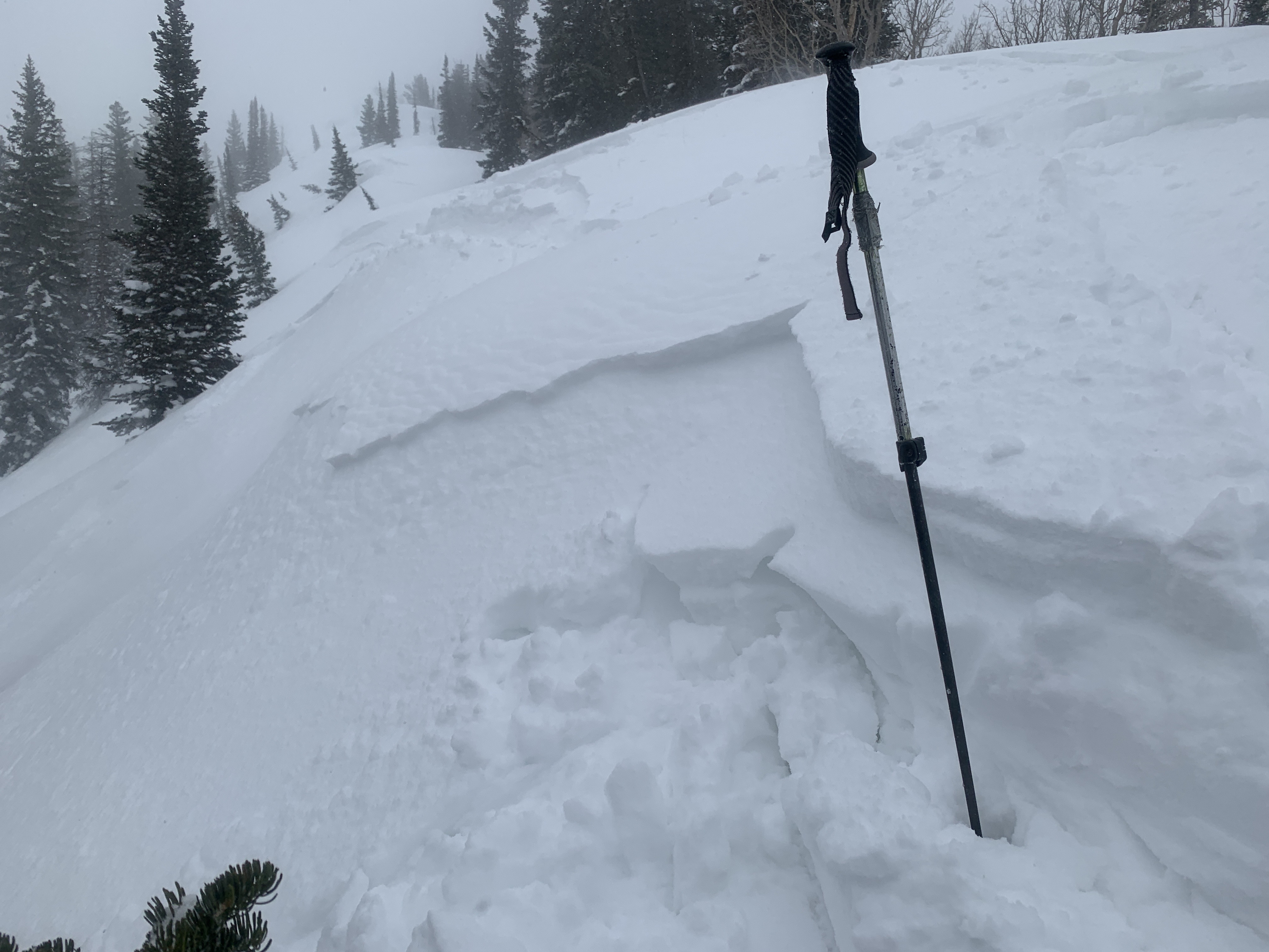
Heavy snowfall and drifting elevated the avalanche danger in the mountains yesterday, and there is still around 11' of snow on the ground at 8400'.
General Announcements
  • Please submit your observations from the backcountry HERE.
  • For a list of avalanche classes from the Utah Avalanche Center go HERE
  • For information on where you can ride your sled or snow-bike, check out this map of the winter travel plan for the Logan and Ogden Ranger Districts HERE, and a close up of the Tony Grove and Franklin Basin Areas HERE.
This forecast is from the U.S.D.A. Forest Service, which is solely responsible for its content. This forecast describes general avalanche conditions and local variations always occur.