Forecast for the Logan Area Mountains

Toby Weed
Issued by Toby Weed for
Friday, April 21, 2023
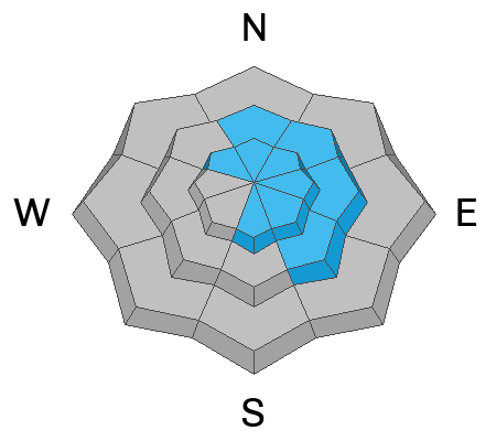
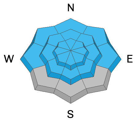
Heavy snowfall and drifting from increasing southwest winds will elevate avalanche danger to MODERATE on slopes steeper than 30° at all elevations. As heavy snow accumulates and is drifted into avalanche starting zones at upper elevations, CONSIDERABLE danger may develop. Natural avalanches will be possible and people could easily trigger 1 to 2-foot thick slab avalanches of wind-drifted snow.
Make conservative decisions if you venture into upper-elevation terrain. Evaluate snow and terrain carefully.
Low
Moderate
Considerable
High
Extreme
Learn how to read the forecast here
Special Announcements
The UAC is sad to report that a resident was killed by a roof avalanche on Monday, April 17th, in the Town of Brighton. A report is available HERE. Many communities still have a lot of snow on roofs that could produce similar avalanches.
Weather and Snow
The National Weather Service has continued a Winter Storm Warning for the Bear River Range in Idaho through today. It looks like a foot or more could accumulate on upper-elevation slopes in the Logan Zone today, heavy snowfall is visible on Beaver Mt's webcams, and winds blowing from the southwest are intensifying significantly already this morning. Rapid accumulations and drifting will elevate the avalanche danger in the backcountry, and dangerous conditions could develop this afternoon in exposed upper-elevation terrain.

The 8400' Tony Grove Snotel reports a few inches of new snow and 21° F with 125" of total snow. It's 14° F and the wind is increasing this morning, currently blowing 32 mph from the southwest and gusting to 40 mph at the 9700' CSI Logan Peak weather station.

Here is the NWS point forecast (36 hrs) for Upper Elevations in the northern Bear River Range:
Today: Snow. The snow could be heavy at times. Widespread blowing snow, mainly after 4pm. High near 34. Breezy, with a west southwest wind 16 to 25 mph, with gusts as high as 33 mph. Chance of precipitation is 100%. Total daytime snow accumulation of 10 to 14 inches possible.
Tonight: A 50 percent chance of snow, mainly before 10pm. Patchy blowing snow before 10pm. Mostly cloudy, with a low around 19. Breezy, with a west wind 19 to 24 mph decreasing to 6 to 11 mph after midnight. Winds could gust as high as 34 mph. New snow accumulation of less than one inch possible.
Saturday: A 30 percent chance of snow. Partly sunny, with a high near 36. West wind 6 to 9 mph. Little or no snow accumulation expected.

Unsettled weather will continue into next week, with gradually rising temperatures and sunny conditions expected Wednesday and Thursday.
Recent Avalanches
It is a pleasure to report no new avalanches in the past several days.... For a list of recent avalanches in the Logan Zone go HERE.
Find a list of all recent observations & avalanches from across Utah go HERE.
Ad
Avalanche Problem #1
Wind Drifted Snow
Type
Location
Likelihood
Size
Description

  • In windy terrain people could trigger freshly formed slabs of wind-drifted snow a foot or two thick. These could be wider than expected and might run pretty fast and far on smooth slick slopes and well-greased avalanche paths.
Avalanche Problem #2
New Snow
Type
Location
Likelihood
Size
Description
  • Rapid accumulations of new snow will elevate the danger on steep slopes at all elevations. Although most sunny slopes at low elevations are burnt off, there is still sufficient coverage for avalanches in northerly-facing terrain.
  • Shallow soft slab or loose avalanches of new snow might knock you off your feet and send you for a slide on slick and hard underlying snow.
  • If you venture into steep terrain today be aware of trees, cliffs or other potential terrain traps that you could be swept into.
Additional Information
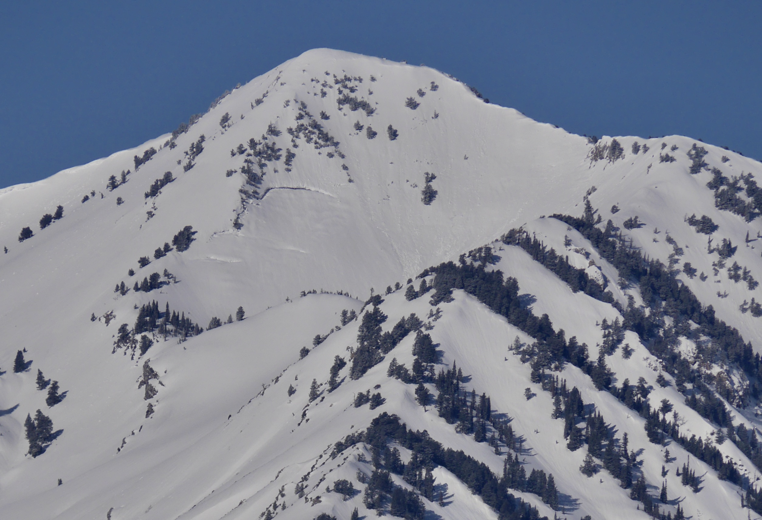
Big glide cracks are clearly visible on the shoulder of Wellsville Cone (4-19-23)
General Announcements
  • Please submit your observations from the backcountry HERE.
  • For a list of avalanche classes from the Utah Avalanche Center go HERE
  • For information on where you can ride your sled or snow-bike, check out this map of the winter travel plan for the Logan and Ogden Ranger Districts HERE, and a close up of the Tony Grove and Franklin Basin Areas HERE.
This forecast is from the U.S.D.A. Forest Service, which is solely responsible for its content. This forecast describes general avalanche conditions and local variations always occur.