The UAC is sad to report that a resident was killed by a roof avalanche on Monday, April 17th, in the Town of Brighton. A report is available
HERE. Many communities still have a lot of snow on roofs that could produce similar avalanches.
Seems as though winter is still here despite the date. A welcome cool down and a few inches of new snow made for nice dust on crust conditions in smooth terrain yesterday. Colder temperatures are expected to persist for a while and this will really help matters by slowing the melt off. A few more inches could accumulate today on upper elevation slopes and mountain temperatures will remain well below freezing.
*People might trigger small avalanches on slopes steeper than 30° with significant accumulations of drifted snow.
Another foot or so of new snow is forecast to fall on upper elevation slopes tomorrow, so the fresh powder outlook is pretty good for the weekend.
The 8400' Tony Grove Snotel reports 19° F and there is 125" of total snow. It's 10° F and the wind is blowing around 15 mph from the west-northwest this morning at the 9700' CSI Logan Peak weather station.
Here is the NWS point forecast (36 hrs) for Upper Elevations in the Central Bear River Range:
Today: Snow showers, mainly after 7am. High near 25. Wind chill values as low as 3. West northwest wind 9 to 18 mph. Chance of precipitation is 80%. Total daytime snow accumulation of 2 to 4 inches possible.
Tonight: Snow showers before 10pm, then a chance of snow showers after 4am. Low around 17. Wind chill values as low as 5. West wind 10 to 17 mph. Chance of precipitation is 80%. New snow accumulation of around an inch possible.
Friday: A chance of snow showers before 7am, then snow after 7am. The snow could be heavy at times. High near 30. Wind chill values as low as 6. Breezy, with a west southwest wind 15 to 20 mph increasing to 21 to 26 mph in the afternoon. Winds could gust as high as 40 mph. Chance of precipitation is 100%. New snow accumulation of 9 to 13 inches possible.
This weekend's forecast calls for clouds and snow showers persisting but daytime temperatures rising a bit.
It is a pleasure to report no new avalanches in the past several days.... For a list of recent avalanches in the Logan Zone go
HERE.
Find a list of all recent observations & avalanches from across Utah go
HERE.


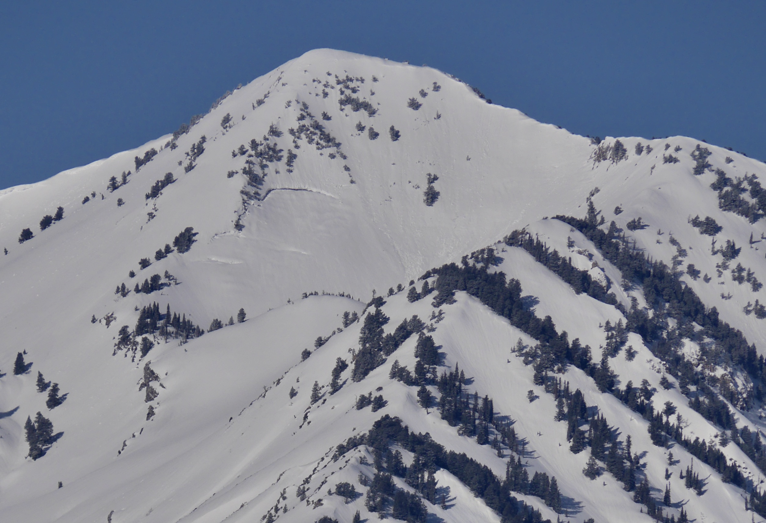 Big glide cracks are clearly visible on the shoulder of Wellsville Cone (4-19-23)


