Forecast for the Logan Area Mountains

Toby Weed
Issued by Toby Weed for
Wednesday, April 19, 2023
Heightened avalanche conditions exist on slopes steeper than 30° in drifted upper and mid elevation terrain. There is MODERATE danger, and people could trigger soft slab avalanches of wind drifted storm snow. Temperatures dropped well below freezing overnight, refreezing the saturated snow, and there is LOW danger at low elevations today.

Evaluate snow and terrain carefully.
Low
Moderate
Considerable
High
Extreme
Learn how to read the forecast here
Weather and Snow
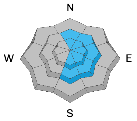
You'll find nice shallow powder conditions in the backcountry, especially in smooth terrain. Several inches of new snow fell across the zone yesterday and overnight, with significantly deeper accumulations at upper elevations. Overnight moderate winds blowing mostly from the west drifted fresh snow into avalanche starting zones, creating wind slabs that might be pretty easy for people to trigger this morning. Stability should increase fairly rapidly.

The 8400' Tony Grove Snotel reports 8 inches of new snow with 1.2" SWE in the last 24 hours. It's 13° F and there is 128" of total snow. It's 6° F and the wind is blowing around 20 mph from the west-northwest this morning at the 9700' CSI Logan Peak weather station.

Here is the NWS point forecast (36 hrs) for Upper Elevations in the Central Bear River Range:
Today: A 20 percent chance of snow showers after 3pm. Partly sunny, with a high near 25. Wind chill values as low as -8. West wind 10 to 20 mph.
Tonight: A 30 percent chance of snow showers, mainly after 3am. Mostly cloudy, with a low around 12. Wind chill values as low as -2. West wind 15 to 20 mph decreasing to 8 to 13 mph after midnight. New snow accumulation of around an inch possible.
Thursday: Snow showers likely. Mostly cloudy, with a high near 29. Wind chill values as low as 6. West wind 10 to 15 mph increasing to 16 to 21 mph in the afternoon. Chance of precipitation is 70%. New snow accumulation of 2 to 4 inches possible.

Clouds, snow showers, and cooler temperatures will continue through the week, with a few inches of accumulation possible both Thursday and Friday. This weekend's forecast calls for clouds and showers persisting but daytime temperatures rising.
Recent Avalanches
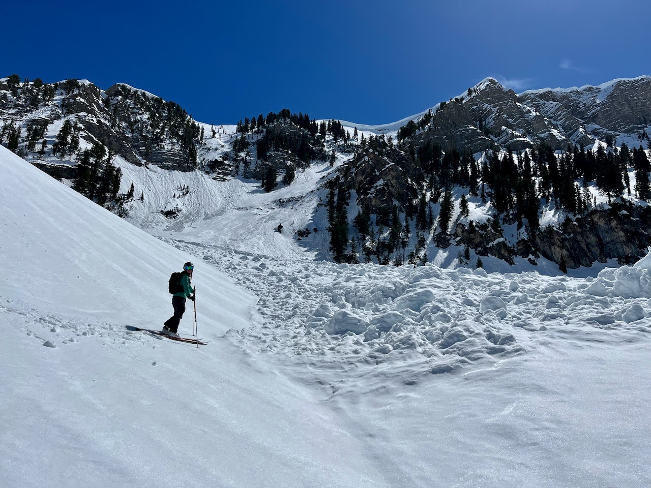
It is a pleasure to report no new avalanches in the past several days.... For a list of recent avalanches in the Logan Zone go HERE.
Find a list of all recent observations & avalanches from across Utah go HERE.
Ad
Avalanche Problem #1
Wind Drifted Snow
Type
Location
Likelihood
Size
Description

  • In windy terrain people could trigger freshly formed slabs of wind drifted snow around a foot thick. These could be wider than expected and might run pretty fast and far on smooth slick slopes and well-greased avalanche paths.
  • People might trigger soft slab and loose avalanches of storm snow on steep slopes with significant accumulations, even in sheltered terrain. Even if they are too small to bury you they could knock you off your feet and send you for a slide on slick and hard underlying snow.
  • If you venture into steep terrain today be aware of trees, cliffs or other potential terrain traps that you could be swept into by even a small avalanche.
Additional Information
Belle checking out the debris from a huge recent natural avalanche that came roaring out of the Z Gully, in High Creek (4-16-23)
General Announcements
  • Please submit your observations from the backcountry HERE.
  • For a list of avalanche classes from the Utah Avalanche Center go HERE
  • For information on where you can ride your sled or snow-bike, check out this map of the winter travel plan for the Logan and Ogden Ranger Districts HERE, and a close up of the Tony Grove and Franklin Basin Areas HERE.
This forecast is from the U.S.D.A. Forest Service, which is solely responsible for its content. This forecast describes general avalanche conditions and local variations always occur.