31st Annual Backcountry Benefit - September 12th - Tickets Available Here!

Forecast for the Logan Area Mountains

Toby Weed
Issued by Toby Weed on
Monday morning, April 17, 2023
Warmth and high angle sun will rapidly elevate the avalanche danger to MODERATE at all elevations. CONSIDERABLE danger could develop in some places by afternoon, with large natural cornice falls, glide avalanches, and wet avalanches possible.
Evaluate snow and terrain carefully.
Low
Moderate
Considerable
High
Extreme
Learn how to read the forecast here
Weather and Snow
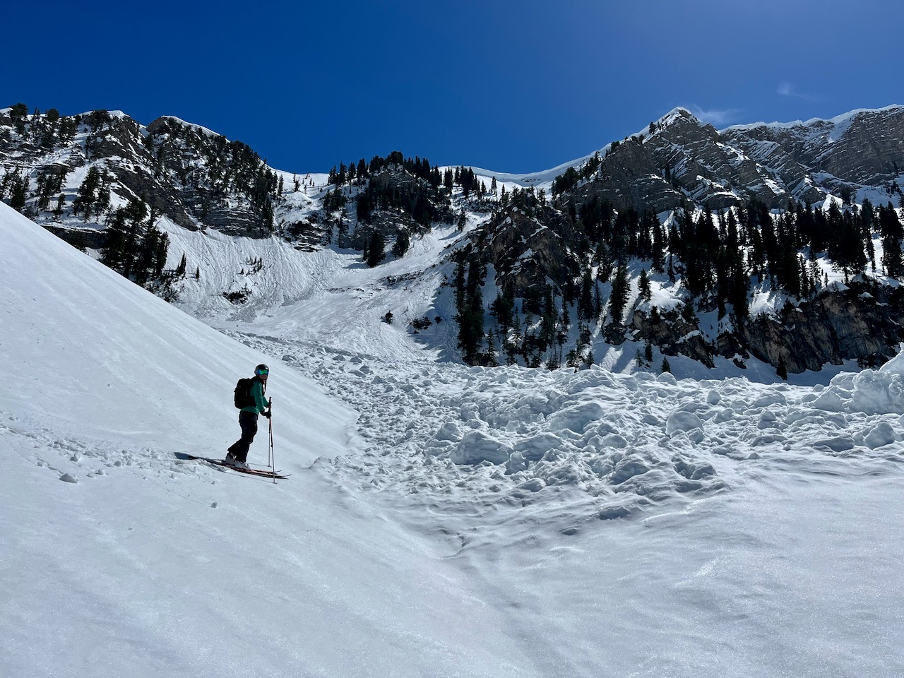
We found nice spring conditions yesterday, with large piles of wet avalanche debris everywhere in steep terrain under cliffs and cornices, challenging travel in places. The saturated snow at lower elevations was soft and sticky in the afternoon and I would post-hole deeply in slushy snow just trying to access the fishing hole. The snow has burnt off of many sunny low elevation slopes, but there is way more snow than normal for this time of year elsewhere.
In the spring it's a good idea to get in the habit of getting out early, so you can finish up early and avoid being in avalanche terrain late in the day when the snow is softened by warmth and more prone to avalanching. This is the case today, and the snow on sunny slopes and at lower elevations is likely to become too soft earlier than it did yesterday.

The 8400' Tony Grove Snotel reports a balmy 42° F and there is 124" of total snow. It's 34° F and the wind is blowing 32 mph (with gusts close to 50 mph) from the south-southwest this morning at the 9700' CSI Logan Peak weather station.
Here is the NWS point forecast (36 hrs) for Upper Elevations in the Central Bear River Range:
Today: Mostly sunny, with a high near 46. North wind 6 to 11 mph becoming southwest 12 to 17 mph in the afternoon.
Tonight: A chance of rain and snow showers before 9pm, then snow showers likely. Mostly cloudy, with a low around 27. West southwest wind 9 to 16 mph becoming northwest after midnight. Chance of precipitation is 60%. New snow accumulation of less than a half inch possible.
Tuesday: Snow showers. The snow could be heavy at times. Some thunder is also possible. High near 33. Wind chill values as low as 10. Breezy, with a west southwest wind 13 to 18 mph increasing to 21 to 26 mph in the afternoon. Chance of precipitation is 90%. New snow accumulation of 7 to 11 inches possible.

Cooler temperatures and clouds will prevail through the remainder of the work week.
Recent Avalanches
It is a pleasure to report no new avalanches in the past few days.... For a list of last week's avalanches in the Logan Zone go HERE.
Find a list of all recent observations & avalanches from across Utah go HERE.
Ad
Avalanche Problem #1
Wet Snow
Type
Location
Likelihood
Size
Description
  • Wet avalanches are generally unlikely this morning, but will become more likely in steep terrain as the snow is softened by sun and seasonal warmth in the afternoon.
  • Low elevation, north facing slopes and forested or cliffy areas still hold several feet of snow, and it will soften up and become more dangerous this afternoon due to the warmth.
  • Natural avalanches are possible in the heat of the day. Stay well away from and avoid being on slopes under the huge ridge top cornices, and avoid all slopes with emerging or widening glide cracks. Glide Avalanches are a concern in steep terrain with a smooth ground surface.
Additional Information
Belle is checking out the debris from a huge recent natural avalanche that came roaring out of the Z Gully, in High Creek (4-16-23)
Widespread natural wet loose avalanches occurred across the Logan Zone with last week's warmup. Similar activity is possible today as temperatures at upper elevations climb toward 50° F again.
General Announcements
  • Please submit your observations from the backcountry HERE.
  • For a list of avalanche classes from the Utah Avalanche Center go HERE
  • For information on where you can ride your sled or snow-bike, check out this map of the winter travel plan for the Logan and Ogden Ranger Districts HERE, and a close up of the Tony Grove and Franklin Basin Areas HERE.
This forecast is from the U.S.D.A. Forest Service, which is solely responsible for its content. This forecast describes general avalanche conditions and local variations always occur.