Forecast for the Logan Area Mountains

Toby Weed
Issued by Toby Weed for
Friday, March 22, 2019
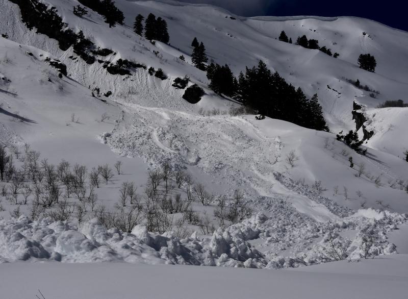
MODERATE: Rain fell on the snow at lower elevations last night, and heightened wet avalanche conditions exist this morning. Snow is falling above about 7000,' and accumulations today will cause rising danger at upper elevations. Human triggered loose and soft slab avalanches of new snow will become increasingly possible. Also, south winds will cause heightened danger of shallow slab avalanches involving wind drifted snow.
  • Evaluate snow and terrain carefully.
Low
Moderate
Considerable
High
Extreme
Learn how to read the forecast here
Weather and Snow
The Tony Grove Snotel at 8400' reports a couple inches of heavy snow, with .3" SWE overnight. It's 29ºF this morning and there is 82" of total snow with 102% of average SWE for the date. It's 22ºF at the 9700' CSI Logan Peak weather station, and south winds are currently averaging around 20 mph. Rain at lower elevations and snow up high will cause increasing danger and heightened avalanche conditions in the backcountry today.
Widespread rain and snow will return today. A brief break in the rain and snow tonight into tomorrow morning will be followed by another Pacific storm system with widespread precipitation across much of the state during the upcoming weekend. Expect rain in Cache Valley and snow showers in the mountains today, with a chance of some Thunder in the afternoon. 3 to 7 inches of accumulation is possible up high. High temperatures at 8500' expected be around 33ºF, with 10 to 18 mph south winds. Snow showers will continue tonight, with 2 to 4 additional inches possible. Expect low temperatures around 26º F, and 15 mph west-southwest winds. Snow showers are possible tomorrow morning, with mostly cloudy skies, high temperatures around 36ºF, and 11 mph west-southwest wind.
Recent Avalanches
No new avalanches were reported in the Logan Zone this week.
Ad
Avalanche Problem #1
Wet Snow
Type
Location
Likelihood
Size
Description
Avalanches of wet snow are possible today as snow in lower elevation terrain is soaked by rain. Rain adds significant weight to the snow while melting crusts and weakening the snow structure.
  • Avoid travel in low elevation gullies and stay out from under steep slopes with rain-softened saturated snow.
Wet avalanches entaining saturated new snow can get quite large and be rather destructive. (3/12/19 wellsville Mountain Wilderness.
Avalanche Problem #2
New Snow
Type
Location
Likelihood
Size
Description
Loose sluffs and soft slabs of new snow will become increasingly possible as fresh snow accumulates on steep mountain slopes today. The new snow may not bond well with the old in some areas, especially on upper elevation north facing slopes plagued by sugary weak surface snow or surface hoar.
Well developed surface hoar was observed this week at upper elevations. In most places this was destroyed by east winds Tuesday and Wednesday, but it may have survived in some areas.
Avalanche Problem #3
Wind Drifted Snow
Type
Location
Likelihood
Size
Description
Watch for and avoid wind drifted snow on steep upper elevation slopes. You could trigger shallow wind slab avalanches, and these could travel fast and far in places on a slick sun-crust from last week's warm up. Use caution in upper elevation areas where drifts form, like on the lee side of major ridges and in and around terrain features like sub-ridges, gullies, scoops, tree stringers, and cliff bands.
Stay off and out from under large ridge top cornices, which are likely to break further back than expected and could trigger avalanches on steep slopes below.
Additional Information
I will update this forecast tomorrow morning.
Enjoy spring skiing at Snowbasin Resort. The UAC has discount Snowbasin tickets available. HERE
General Announcements
The new weather station at the WSU Bloomington Canyon Yurt is up and running. Data available HERE
Now is a great time to practice companion rescue techniques with your backcountry partners. You should check out and use the new Avalanche Beacon Training Park we set up at the Franklin Basin trailhead. Special thanks to Northstars Ultimate Outdoors, USU Outdoor Program, and Beaver Mountain Ski Patrol for helping us to make this possible.
The Beaver Mountain Backside is the backcountry, and it is avalanche terrain. Same goes for the steep rocky terrain adjacent to Cherry Peak Resort. If you leave a ski area boundary, you and your partners should carry and practice with avalanche rescue equipment and follow safe backcountry travel protocols.
Check out the improved weather links, road conditions, and weather links for each forecast region on the new UAC IOS App. Do you use the NOAA point forecast? If so, now you can bookmark your favorite weather locations in "My Weather" in the App. HERE
Are you new to the backcountry or looking to refresh your skills? The UAC has released a free 5-part avalanche skills eLearning series. HERE
If you would like to get the daily advisory by email you subscribe HERE.
Support the UAC through your daily shopping. When you shop at Smith's, or online at REI, Backcountry.com, Patagonia, NRS, Amazon, eBay by clicking on these links, they donate a portion of your purchase to the UAC. If you sell on eBay, you can have your See our Affiliate Page for more details on how you can support the UAC when you shop
Remember your information can save lives. If you see anything we should know about, please help us out by submitting snow and avalanche observations. HERE You can call us at 801-524-5304, email by clicking HERE, or include #utavy in your Instagram.
This forecast is from the U.S.D.A. Forest Service, which is solely responsible for its content. The forecast describes general avalanche conditions and local variations always occur.