Forecast for the Logan Area Mountains

Issued by Toby Weed on
Friday morning, March 13, 2020
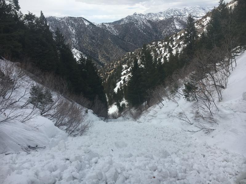
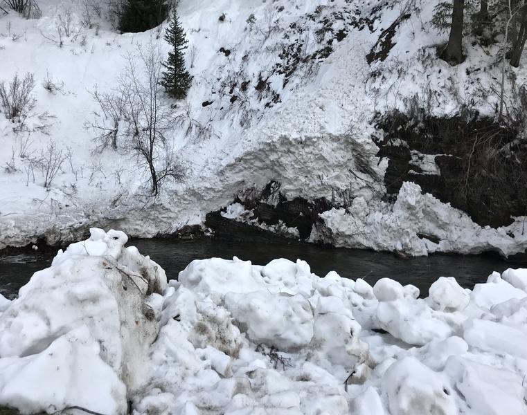
Overnight temperatures dropped below freezing at all stations in the Logan Zone and the avalanche danger is LOW this morning. The wet snow is stable and avalanches are unlikely until warm daytime temperatures and strong March sun soften the snow in the middle of the day. Areas with heightened wet avalanche conditions and MODERATE danger will once again develop in sunny terrain, and people could trigger wet avalanches on very steep slopes.
- Use normal caution, but continue to evaluate snow and terrain carefully.

Low
Moderate
Considerable
High
Extreme
Learn how to read the forecast here
Special Announcements
Thanks to the generous support of our Utah ski resorts and Ski Utah, we have discount lift tickets available. All proceeds from these go towards paying for avalanche forecasting and education! Get your tickets HERE.
Weather and Snow
It's 23°F at the 8400' Tony Grove Snotel. There is 83 inches of total snow containing around 112% of normal Snow Water Equivalent. It's 25°F at the 9700' CSI Logan Peak weather station. The wind has been battling this morning at upper elevations and it is currently blowing about 5 mph out of the east.
The snow is re-frozen and stable this morning, but strong march sun and warm temperatures will soften it up again during the day in sunny terrain. In the afternoon, people could trigger wet avalanches on very steep slopes with melt-softened, saturated snow.
Here is what we found in the Central Bear River Range on Tuesday,
Today will be warm and sunny in the northern mountains as a weakening storm moves into southern Utah this afternoon. Daytime highs will reach 40°F in the mountains with east-southeast winds blowing 7-10 mph. There is a chance of snow showers late tonight. It will be partly cloudy with low temperatures around 23°F and 9 to 17 mph south wind. Expect snow showers in the mountains tomorrow, with 3 to 7 inches possible, high temperatures again near 40°F, and 18 mph south-southwest winds.
Recent Avalanches
We observed several natural, wet avalanches in Logan Canyon over the weekend, most on northerly facing slopes at lower and mid elevations. Yesterday, I noticed a recent deeper long running natural wet avalanche on the southeast side of Mitton Peak in the Wellsvilles, but I'm not sure when it slid.
On Saturday, a very close call occurred when a skier was caught from behind and carried on top of the wet debris at least 800 vt' in a wet avalanche around 2:30 in the afternoon in the North Syncline Gully. The avalanche occurred on a north facing slope and the estimated start of the avalanche was at about 7800'. The party is unsure if they triggered the avalanche or if it was a natural from above.

We had a look at a recent natural wet avalanche that hit and dammed the Logan River over the weekend. The low elevation snow in the area was saturated and unsupportable....
Avalanche Problem #1
Wet Snow
Type

Location

Likelihood

Size

Description
On some slopes the snow is saturated and unconsolidated, especially in shallow rocky terrain and at low and mid elevations. Once warmth and sun soften up the surface re-freeze crust from overnight and you start sinking deeply into the wet snow, you could trigger wet avalanches on very steep slopes.

A natural wet avalanche in the Dugway Cirque filled the Logan River with about 12' of debris over the weekend. (March 8, 2020)
Tuesday's new snow quickly became saturated with warming temperatures and yesterday observers again noted loose wet activity on steep slopes. Riders could trigger wet avalanches on steep slopes with saturated, melt-softened snow again today. When the wet snow gets soft and unsupportable, it is time to head home or move to a cooler and/or shadier aspect.
- Avoid being on or under steep slopes with melt-softened saturated snow.
- Roller balls, pinwheels, and naturally occurring sluffs or other avalanches indicate potential for wet avalanche activity.
- Avoid ridge top cornices, which can break much further back than expected and could start avalanches on slopes below.
Additional Information
Sunday, I was taking pictures of fresh natural wet avalanche debris above Guiniva-Malibu Campground when I accidently caught another one starting to fall off cliffs down-canyon...
General Announcements
EMAIL ADVISORY. If you would like to get the daily advisory by email you subscribe HERE.
Remember your information can save lives. If you see anything we should know about, please help us out by submitting snow and avalanche observations....HERE. You can also call us at 801-524-5304, email by clicking HERE, or include #utavy in your tweet or Instagram.
This forecast is from the USDA Forest Service, which is solely responsible for its content. The forecast describes general avalanche conditions and local variations always occur.
We will update this forecast before about 7:30 tomorrow morning.