Forecast for the Logan Area Mountains

Issued by Paige Pagnucco on
Wednesday morning, March 11, 2020
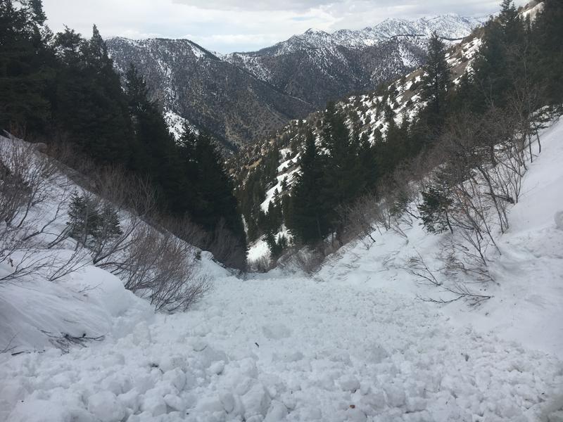
Heightened avalanche conditions exist in the backcountry and areas with MODERATE danger can be found at all elevations in the Logan zone. People could trigger wet avalanches on steep slopes with saturated, melt-softened snow, and some natural, wet avalanches are possible during the heat of the day. Cornices may also sag or break off as daytime heating occurs.
- Evaluate snow and terrain carefully.

Low
Moderate
Considerable
High
Extreme
Learn how to read the forecast here
Weather and Snow
It's 26°F at the 8400' Tony Grove Snotel. There is 85 inches of total snow containing around 117% of normal Snow Water Equivalent. It's 23°F at the 9700' CSI Logan Peak weather station, and southwest winds are currently blowing 20-25 mph.
It was fairly warm yesterday and the new snow became saturated quite quickly at all elevations. Due north facing slopes harboring drier snow rode quite well though started to feel slightly damp by afternoon. Heightened avalanche conditions exist in the Logan backcountry. People could trigger wet avalanches on steep slopes with saturated snow.
Today will be warm and windy in the mountains as a shallow cold front brushes by the area this afternoon. Daytime highs will reach 40 F in the mountains with southwest winds blowing 15-25 mph. There is the potential for some light rain and/or snow flurries in the afternoon during frontal passage. Skies are expected to be mostly clear for the remainder of the week with mountain daytime temperatures in the high 30's F, overnight temperatures in the low 20's F, and winds generally out of the west blowing 10-20 mph. A more active pattern moves in on Saturday with the return of wet, unsettled, and cooler weather.
Recent Avalanches
We observed several natural, wet avalanches in Logan Canyon over the weekend, most on northerly facing slopes at lower and mid elevations.
On Saturday, a very close call occurred when a skier was caught from behind and carried on top of the wet debris at least 800 vt' in a wet avalanche around 2:30 in the afternoon in the North Syncline Gully. The avalanche occurred on a north facing slope and the estimated start of the avalanche was at about 7800'. The party is unsure if they triggered the avalanche or if it was a natural from above.

On Wednesday, we had a look at a recent natural wet avalanche that hit and dammed the Logan River last weekend. The low elevation snow in the area was saturated and unsupportable....
Avalanche Problem #1
Wet Snow
Type

Location

Likelihood

Size

Description
Despite last night's cooler temperatures, the snowpack remains saturated and unconsolidated, especially at low and mid elevations.


A natural wet avalanche in the Dugway Cirque filled the Logan River with about 12' of debris over the weekend. (March 7, 2020)
Yesterday's new snow quickly became saturated with warming temperatures and observers noted loose wet activity on steep slopes by the afternoon. Riders could trigger wet avalanches on steep slopes with saturated, melt-softened snow again today, and natural, wet avalanches may also still be possible in the midday heat on some very steep slopes. When the snow is saturated, it is time to move to a cooler and/or shadier aspect or lower angle terrain.
- Avoid being on or under steep slopes with saturated snow.
- Roller balls, pinwheels, and naturally occurring sluffs or other avalanches indicate potential for wet avalanche activity.
- Avoid ridge top cornices, which can break much further back than expected and could start avalanches on slopes below.
General Announcements
Thanks to the generous support of our Utah ski resorts and Ski Utah, we have discount lift tickets available. All proceeds from these go towards paying for avalanche forecasting and education! Get your tickets HERE.
EMAIL ADVISORY. If you would like to get the daily advisory by email you subscribe HERE.
Remember your information can save lives. If you see anything we should know about, please help us out by submitting snow and avalanche observations....HERE. You can also call us at 801-524-5304, email by clicking HERE, or include #utavy in your tweet or Instagram.
This forecast is from the USDA Forest Service, which is solely responsible for its content. The forecast describes general avalanche conditions and local variations always occur.
We will update this forecast before about 7:30 Friday morning.