Forecast for the Logan Area Mountains

Issued by Toby Weed on
Tuesday morning, March 10, 2020
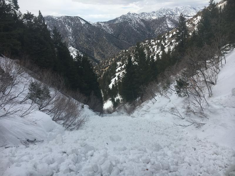
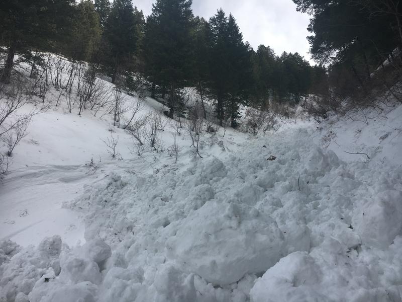
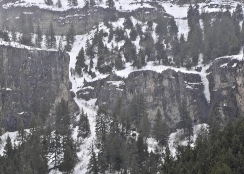
Heightened avalanche conditions exist in the backcountry and areas with MODERATE danger can be found at all elevations in the Logan Zone. People could trigger wet avalanches on steep lower and mid elevation slopes with saturated, melt-softened snow, and some natural wet avalanches are possible during the heat of the day. Up higher, human triggered avalanches of recently wind drifted snow, cornice falls, and avalanches of new snow are possible in steep terrain.
- Evaluate snow and terrain carefully.

Low
Moderate
Considerable
High
Extreme
Learn how to read the forecast here
Special Announcements
The Utah Avalanche Center's Avy Awareness Auction is currently underway with tons of great gear, jewelry, artwork and experiences available. Visit the auction page HERE to help support the UAC's spring avalanche awareness and outreach efforts.
Weather and Snow
It's 26°F and there is 5 inches of new snow with 0.5" SWE from overnight at the 8400' Tony Grove Snotel. There is 88 inches of total snow containing around 118% of normal Snow Water Equivalent. It's 20°F at the 9700' CSI Logan Peak weather station, and west winds are currently blowing about 20 mph.
It rained overnight on already soft and saturated snow on lower elevation slopes. About 5 inches of new snow fell at upper elevations, drifted this morning by moderate west winds in exposed upper elevation terrain. Heightened avalanche conditions exist in the Logan backcountry. People could trigger wet avalanches on lower elevation slopes with saturated snow, and avalanches of new and/or wind drifted new snow up higher.
A couple of weak weather systems will bring a chance of showers through midweek. A low pressure system off the California coast will move inland late in the week, impacting mainly southern Utah and points south. Snow showers will taper off by afternoon and it'll be partly sunny in the mountains later today. Daytime temperatures will be pretty warm again today at lower elevations, in the mid 40s. 8500' high temperatures are expected to be around 38°F, and west-northwest winds will blow 9 to 13 mph along the ridges. It will be mostly clear tonight with low temperatures around 22°F, and 9 to 17 mph west winds. It will be sunny and several degrees warmer tomorrow, with 8500' high temperatures around 43°F, and west-southwest winds will blow 13 to 21 mph.
Recent Avalanches
We observed several natural wet avalanches in Logan Canyon over the weekend, most on northerly facing slopes at lower and mid elevations.
On Saturday, A very close call occurred when a skier was caught from behind and carried on top of the wet debris at least 800 vrt' in a wet avalanche at around 2:30 in the afternoon in the North Syncline Gully... The avalanche occurred on a north facing slope, and the estimated start of the avalanche was at about 7800'. The party is unsure if they triggered the avalanche or if it was a natural from above.


Avalanche Problem #1
Wet Snow
Type

Location

Likelihood

Size

Description
I under forecasted the wet avalanche problem over the weekend, and dangerous conditions existed on northerly facing mid elevation slopes in Logan Canyon. We noticed several natural avalanches on Sunday, and I was taking pictures of fresh natural wet avalanche debris above Guiniva-Malibu Campground when I accidently caught another one starting to fall off cliffs just down-canyon...

A natural avalanche is beginning to fall off the cliffs just west the Amphitheater Gully above Guinava-Malibu Campground. (Sunday afternoon, 3-8-2020)
Temperatures stayed well above freezing at lower elevations again overnight, and rain fell on already melt-softened saturated snow. A few inches of heavy snow accumulated on mid elevation slopes, insulating the warm, and saturated snow that was on the surface last week. People could trigger wet avalanches on steep slopes with saturated melt-softened snow again today, and natural wet avalanches may also still be possible in the midday heat on some very steep slopes.
- Roller balls, pinwheels, and naturally occurring sluffs or other avalanches indicate potential for wet avalanche activity.
- Avoid being on or under steep slopes with saturated snow.
Avalanche Problem #2
Wind Drifted Snow
Type

Location

Likelihood

Size

Description
About 5 inches of new snow fell on upper elevation slopes overnight, and westerly winds are blowing around 20 mph at upper elevations this morning, which is certainly strong enough to drift snow around. People could trigger avalanches of wind drifted new snow on steep slopes at upper elevations, most likely on slopes facing the eastern half of the compass...
- Cracking is a red flag, indicating unstable snow.
- Watch for and avoid drifts near ridge lines and in and around terrain features like cliff bands, scoops, gully walls, and sub-ridges.
- Avoid ridge top cornices, which can break much further back than expected and could start avalanches on slopes below.
Avalanche Problem #3
New Snow
Type

Location

Likelihood

Size

Description
People could trigger shallow soft slabs or loose avalanches (sluffs) of new snow in steep upper and mid elevation terrain, even on sheltered slopes. Even small avalanches can be a problem if you're dragged into trees or other terrain traps.
Additional Information
A cross country skier was charged and trampled by a moose in upper Green Canyon recently, resulting in a very shaken skier and a broken ski pole. The big beasts are out and about, and they can be pretty grumpy this time of year. People and dogs need to yield the packed trail to the moose and give them lots of room.
General Announcements
Thanks to the generous support of our Utah ski resorts and Ski Utah, we have discount lift tickets available. All proceeds from these go towards paying for avalanche forecasting and education! Get your tickets HERE.
EMAIL ADVISORY. If you would like to get the daily advisory by email you subscribe HERE.
Remember your information can save lives. If you see anything we should know about, please help us out by submitting snow and avalanche observations....HERE. You can also call us at 801-524-5304, email by clicking HERE, or include #utavy in your tweet or Instagram.
This forecast is from the USDA Forest Service, which is solely responsible for its content. The forecast describes general avalanche conditions and local variations always occur.
I will update this forecast before about 7:30 Wednesday morning.