Forecast for the Logan Area Mountains

Toby Weed
Issued by Toby Weed for
Sunday, February 5, 2023
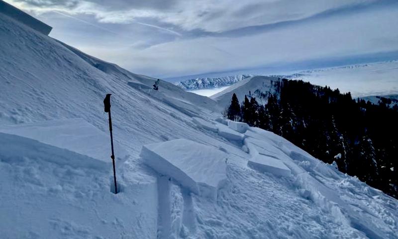
Heavy snowfall and drifting from south winds will elevate backcountry avalanche danger today. Heightened conditions and MODERATE danger will develop at all elevations, and the danger could rise to CONSIDERABLE on drifted upper elevation slopes later this afternoon. People could trigger slab avalanches of wind drifted snow, and some of these might be initiated quite easily or even remotely.
  • Evaluate snow and terrain carefully.
Low
Moderate
Considerable
High
Extreme
Learn how to read the forecast here
Weather and Snow
Strong winds from the south early this morning drifted more snow in exposed terrain and built wind slabs, in some cases on weak surface snow. Heavy snowfall and drifting will cause rising avalanche danger in the backcountry today and tonight.
Winds at the CSI Logan Peak weather station increased significantly early this morning and are blowing from the south-southeast at around 40 mph, with gusts pushing 60 mph, and it's 25° F at 9700'. There is around 8 feet of total snow at and above around 8500' in the central Bear River Range.

The National Weather Service has issued a Winter Weather Advisory through Monday. Expect snow to fall heavily at times today, with 6 to 10 inches of accumulation possible on upper elevation slopes, high temperatures at 8500' will top out around 28° F this morning but drop in the afternoon to around 20° F, with fairly strong winds from the south this morning, swinging around from the west this afternoon.
Tonight snow will continue with 4 to 8 inches possible, low temperatures around 15° F and 20 mph wind blowing from the west-northwest.
Monday snow will taper off, with 3 to 5 inches possible Expect high temperatures around 22° F and 20 mph winds blowing from the west-northwest.
We could see a little sun on Tuesday, but a little more snow seems likely on Wednesday.
Recent Avalanches
A skier took one step out onto a recently drifted north facing slope on Friday and easily triggered a pretty good sized avalanche of wind drifted snow near the ridge in upper Logan Dry Canyon. We've counted a handful of human triggered avalanches and dozens of large natural avalanches in the Logan Zone due to last weekend's productive storm. For a list of local avalanches go HERE

Find a list of all recent observations & avalanches from across Utah HERE.
A skier took one step onto an obvious fresh wind slab and triggered a good sized avalanche near Logan Peak Friday.
Ad
Avalanche Problem #1
Wind Drifted Snow
Type
Location
Likelihood
Size
Description
Winds blowing from the south overnight and this morning are drifting snow into lee slope avalanche starting zones and in places creating stiffer slabs on weak surface snow consisting of small-grained faceted snow and perhaps surface hoar. Heavy snowfall and increasing winds from the south and then west are in the forecast for today, and significant additional drifting and wind slab creation can be expected. Fresh wind slabs having formed on weak surface snow are likely to be pretty sensitive to human triggers, and some avalanches today might be remotely triggered, from a distance.
  • Avoid corniced slopes and stiffer drifts on steep slopes near ridges and in and around terrain features like cliff bands, sub-ridges, mid-slope break-overs, and gully walls.
  • The fresh drifts are pretty obvious today but don't be fooled into trusting them, and fresh powder today could start to hide older drifts. Some wind slabs formed on weak surface snow and could be quite sensitive, while other harder slabs may allow a person to get well out on them before releasing like a mouse trap.
  • The good news is riding conditions are excellent on lower angle slopes, especially in shaded, northerly terrain where surface hoar is present.
Avalanche Problem #2
New Snow
Type
Location
Likelihood
Size
Description
As storm snow stacks up on steep slopes (steeper than 30°) with weak surface snow, small soft slab and loose avalanches of new snow will become increasingly possible for people to trigger, even in more sheltered terrain.
  • even small avalanches can be dangerous if you are swept into trees or other terrain traps
Additional Information
General Announcements
  • Please submit your observations from the backcountry HERE.
  • For a list of avalanche classes from the Utah Avalanche Center go HERE
  • For information on where you can ride your sled or snowbike, check out this map of the winter travel plan for the Logan and Ogden Ranger Districts HERE, and a close up of the Tony Grove and Franklin Basin Areas HERE.
This forecast is from the U.S.D.A. Forest Service, which is solely responsible for its content. This forecast describes general avalanche conditions and local variations always occur.