Forecast for the Logan Area Mountains

Issued by Toby Weed on
Monday morning, February 24, 2020
The snow is stable, avalanches are unlikely, and the danger is LOW on most slopes in the backcountry. Exceptions and heightened conditions exist on steep drifted slopes at upper elevations, where the danger is MODERATE and people could trigger shallow slab avalanches of wind drifted new snow.
- Use normal caution, and evaluate upper elevation snow and terrain carefully.

Low
Moderate
Considerable
High
Extreme
Learn how to read the forecast here
Special Announcements
The UAC's Avy Awareness Auction is currently underway with tons of great gear, jewelry, artwork and experiences available. Visit the auction page HERE to help support the UAC's spring avalanche awareness and outreach efforts.
Weather and Snow
It's 15°F at the 8400' Tony Grove Snotel, and there is about 5 inches of new snow with 0.4" Snow Water Equivalent. There is 89 inches of total snow, containing 121% of normal . West winds were quite strong overnight for several hours at the 9700' CSI Logan Peak weather station, with hourly average wind speeds close to 40 mph and gusts in the 60s. The winds veered from the northwest this morning and have moderated a bit. They are currently blowing around 25 mph, and temperatures have dropped to 6°F.
The snow is stable on most slopes in the Logan Zone and avalanches are unlikely. Exceptions today will be found on drifted upper elevation slopes facing the eastern half of the compass. Yesterday's snow surface was a bit crusty in sunny terrain, but recrystallized powder conditions were nice, soft, and smooth on shady slopes. We are still finding the best riding conditions on sheltered slopes and in lower angled terrain.

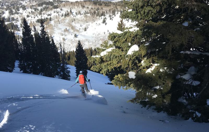
We are finding nice soft and smooth recrystallized powder in sheltered shady terrain, with the best riding on lower angled slopes.
We'll see mostly cloudy skies today, with a chance of snow showers, 8500' high temperatures around 14°F, and 14 to 18 mph west-northwest winds. Wind chill values will be as low as -17°F. High pressure will gradually build into the region through the remainder of the week. It will be mostly cloudy tonight, but clearing, with low temperatures around 1°F, north-northwest winds 10 to 17 mph, and wind chills around -13°F. Tomorrow will be sunny with high temperatures near 18°F, 5 to 9 mph north wind, switching from the west, and wind chills around -14°F.
Recent Avalanches
No avalanches were reported in the Logan Zone over the weekend, and lots of people were out in the backcountry.
Avalanche Problem #1
Wind Drifted Snow
Type

Location

Likelihood

Size

Description
West winds picked up and were quite strong for several hours last night, with hourly average wind speeds near 40 mph and gusts in the 60s on Logan Peak. A few inches of snow fell at the same time, and shallow fresh drifts formed on upper elevation slopes. These are likely to be sensitive today, and people could trigger small slab avalanches.
- Cracking is a red flag, indicating unstable snow.
- Watch for and avoid drifts near ridge lines and in and around terrain features like cliff bands, scoops, gully walls, and sub-ridges.
- Avoid ridge top cornices, which can break much further back than expected and could start avalanches on slopes below.
Additional Information
Many slopes are quite slick and treacherous due to rain and rime events earlier in February. You could encounter slippery and dangerous "slide for life" conditions in steep terrain with a hard snow surface or a shallowly buried thick crust. An ice ax and crampons may be needed for many of the steeper mountaineering routes.
We found a thick and solid crust in Hattie's Bowl last week. The bomber crust is widespread in lower elevation terrain.
General Announcements
Thanks to the generous support of our Utah ski resorts and Ski Utah, we have discount lift tickets available. All proceeds from these go towards paying for avalanche forecasting and education! Get your tickets HERE.
EMAIL ADVISORY. If you would like to get the daily advisory by email you subscribe HERE.
Remember your information can save lives. If you see anything we should know about, please help us out by submitting snow and avalanche observations....HERE. You can also call us at 801-524-5304, email by clicking HERE, or include #utavy in your tweet or Instagram.
This forecast is from the USDA Forest Service, which is solely responsible for its content. The forecast describes general avalanche conditions and local variations always occur.
I will update this forecast before about 7:30 Wednesday morning.