UDOT PLANNED AVALANCHE CLOSURES!!

Forecast for the Logan Area Mountains

Toby Weed
Issued by Toby Weed for
Saturday, January 5, 2019
MODERATE: The snow is stable on most slopes, and avalanches are generally unlikely. Even so, pockets with heightened conditions exist on isolated and perhaps unexpected slopes due to stiff wind drifted snow, and dangerous triggered hard slab avalanches may fail on a sugary or faceted persistent weak layer. Drifting will cause increasing danger today, and a Pacific storm will cause the danger to rise further tomorrow.
Evaluate snow and terrain carefully, and avoid steep slopes with stiff wind drifted snow.
Low
Moderate
Considerable
High
Extreme
Learn how to read the forecast here
Weather and Snow
The snow is stable in most areas and avalanches are generally unlikely. But, triggered avalanches involving stiff wind drifted snow are possible on very steep drifted slopes in the backcountry. Drifts formed with the strong east winds on 12/31/18 in unusual places at all elevations, and a party of three riders triggered a large and dangerous hard slab avalanche on a south facing slope in Providence Canyon yesterday.
The Tony Grove Snotel at 8400' reports 29º F this morning and there's 39"of total snow containing 83% of average SWE. It's a warm 25º F at the 9700' CSI Logan Peak weather station, and south winds are currently averaging about 30 mph and gusting to around 45 mph.
An upper level trough will approach Utah tonight and generate widespread precipitation tonight through Sunday. A couple of trailing weather disturbances will impact mainly the northern half of the forecast area Sunday night through Monday. We'll see increasing clouds today, with a high temperature at 8500' around 34º F and 16 to 23 mph southwest wind. Tonight it will snow, with 2 to 4 inches of accumulation possible, a low temperature around 18º F and 26 to 30 mph south-southwest wind. Tomorrow, we'll see continue snowfall and wind, temperatures falling to around 18º F, and 16 to 24 mph west wind with gusts around 40 mph.

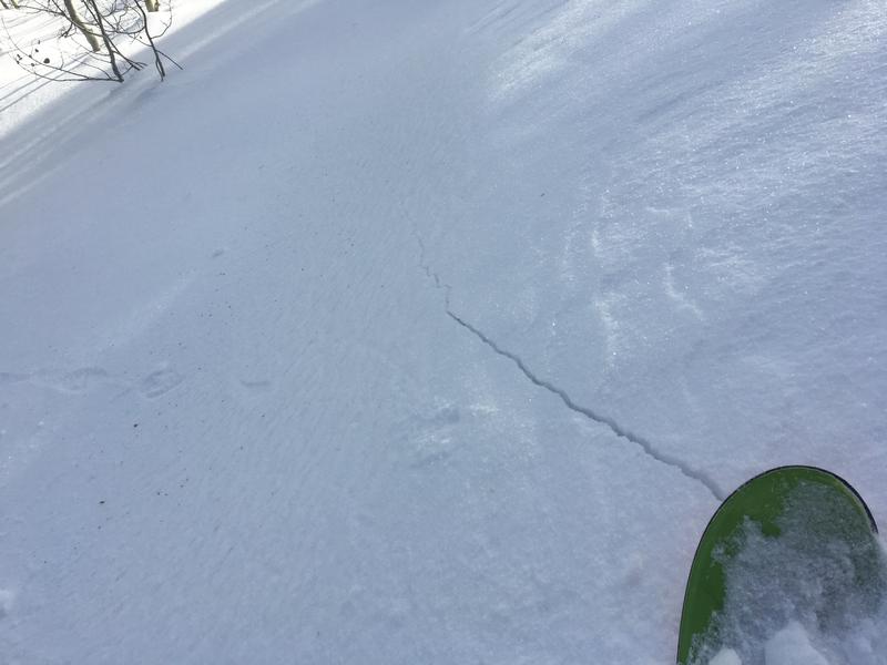
The shallow snow on the ground in many areas has become loose, sugary, and faceted in the past couple weeks, and this week's very cold temperatures didn't help. We've found particularly weak snow at mid and lower elevations in the backcountry, and anywhere where the total snow is fairly shallow. At upper elevations and in deeper areas, weak sugary snow exists just under the surface. Feathery surface hoar is widespread across the zone. In most cases, lacking a slab of stronger snow on top for now, the sugary snow is currently stable despite it's weakness.
Recent Avalanches
Yesterday afternoon, 3 lucky riders triggered a large hard slab avalanche on a south facing slope at about 9000' in elevation near Providence Peak. Luckily nobody got caught in the 4' to 6' deep and 300' wide avalanche consisting of wind drifted snow and failing on a sugary or faceted persistent weak layer. See Report HERE
Ad
Avalanche Problem #1
Wind Drifted Snow
Type
Location
Likelihood
Size
Description
Some hard wind drifts formed on sugary faceted snow, and pockets with heightened avalanche conditions exist on isolated drifted slopes at all elevations. Although unlikely today, triggered avalanches consisting of stiff wind drifted snow remain possible. You might encounter drifts in unusual or unexpected places due to strong east winds on the last day of 2018.
  • Watch for and avoid drifted snow on the lee sides of major ridges and in and around terrain features like cliff bands, scoops, gullies, stringers, and sub-ridges.
  • Avoid steep slopes that have a smooth, rounded appearance, or that sound hollow like a drum.
  • Hard wind slabs have a nasty tendency to let you get well out on them before releasing.
  • Cracking in the snow is a red flag indicating potential instability.
Avalanche Problem #2
Persistent Weak Layer
Type
Location
Likelihood
Size
Description
Some hard wind drifts formed on top of sugary or faceted snow, and if you trigger an avalanche today it is likely to fail on a persistent weak layer and it could be pretty big.
Additional Information
I will update this forecast tomorrow morning.
The Beaver Mountain Backside is the backcountry, and it is avalanche terrain. If you cross the ski area boundary, you and your partners should carry and practice with avalanche rescue equipment. As always in the backcountry, practice safe backcountry travel protocols.
Feathery surface hoar is widespread across the zone and has been observed at all elevations including ridge lines and in avalanche starting zones. If this stuff stays intact when it's buried, it could become another problematic persistent weak layer.
General Announcements
The new UAC IOS mobile app is now available on the app store. Check out the new "My Weather" feature. HERE
Check out the new free online avalanche course series developed by the Utah Avalanche Center. This is a great way to refresh your skills or prepare you for a Backcountry 101 or Level 1 class. HERE
Now is a great time to practice companion rescue techniques with your backcountry partners. Here is our practice video.
If you would like to get the daily advisory by email you subscribe HERE.
Support the UAC through your daily shopping. When you shop at Smith's, or online at REI, Backcountry.com, Patagonia, NRS, Amazon, eBay by clicking on these links, they donate a portion of your purchase to the UAC. If you sell on eBay, you can have your See our Affiliate Page for more details on how you can support the UAC when you shop
Remember your information can save lives. If you see anything we should know about, please help us out by submitting snow and avalanche observations. HERE You can call us at 801-524-5304, email by clicking HERE, or include #utavy in your Instagram.
This forecast is from the U.S.D.A. Forest Service, which is solely responsible for its content. The forecast describes general avalanche conditions and local variations always occur.