Forecast for the Logan Area Mountains

Issued by Toby Weed on
Thursday morning, January 2, 2020
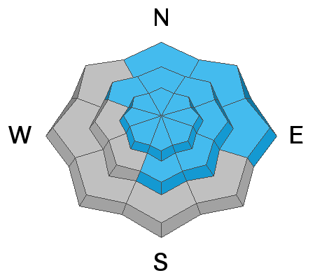
Heavy snowfall and strong westerly winds created dangerous avalanche conditions and CONSIDERABLE danger in the backcountry. Human triggered avalanches are likely today on drifted upper and mid elevation slopes, and possible at all elevations, even in normally sheltered terrain.
- Evaluate snow and terrain carefully. Use caution while route finding, and make conservative decisions.
Low
Moderate
Considerable
High
Extreme
Learn how to read the forecast here
Weather and Snow
It's 21°F at the 8400' Tony Grove Snotel this morning, and there's about 10 inches of new snow in the last 24 hours, with 1.4" SWE for the storm so far. There is 53 inches of total snow, with 112% of average SWE for the date. It's 13°F on Logan Peak, and northwest winds are currently blowing around 20 mph.
Dangerous avalanche conditions exist on drifted upper and mid elevation slopes, and people are likely to trigger avalanches in the backcountry today. Natural avalanches of wind drifted new snow are possible in some areas.
Here's a short video from the saddle on Beaver Mt. Backside yesterday..
More snow is likely today in the mountains, with 1 to 3 inches possible. It will be cloudy, with 8500' temperatures falling to around 19°F and west-northwest wind 10 to 15 mph. It will be cloudy tonight, with some snow showers possible. Low temperatures are expected to be around 11°F, with 11 to 15 mph west winds. It will be cloudy on Friday with high temperatures around 25°F and 14 mph west wind.
Recent Avalanches
A skier triggered a small soft slab of wind drifted snow Monday in the Mount Naomi Wilderness (5th Sister, Cottonwood) on a NE facing slope at about 9000'. The avalanche was reported to be about 10" deep x 25' wide.
Avalanche Problem #1
Wind Drifted Snow
Type

Location

Likelihood

Size

Description
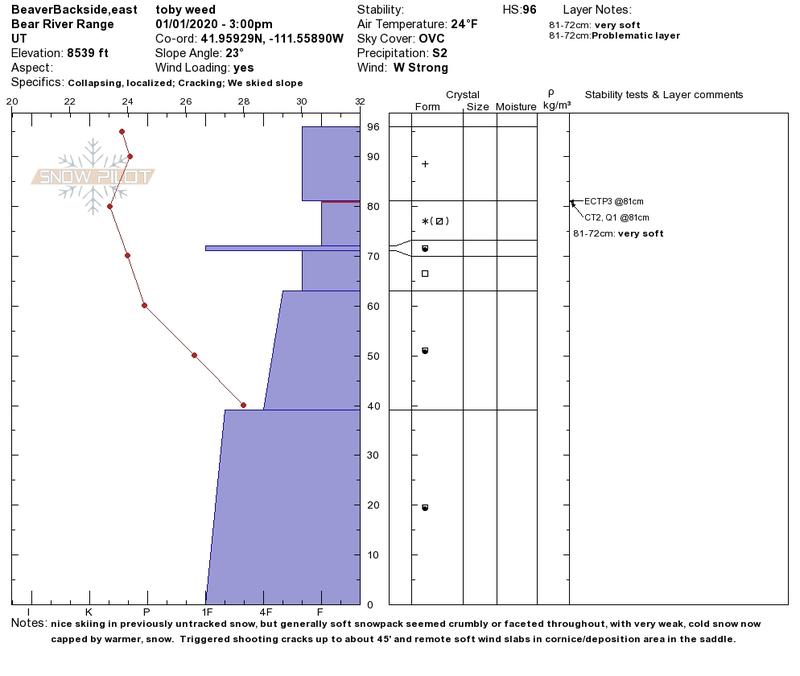
Human triggered avalanches involving wind drifted snow are likely today. Strong west winds dropped into terrain in the Bear River Range and blew all day during yesterday's storm 30 to 40 mph with gusts in the 50s, drifting tons of fresh snow into avalanche starting zones. We remote triggered cornice fall, small wind slabs and 50'-long shooting cracks in drifted terrain on Beaver Mountain's Backside yesterday afternoon.
- Watch for and avoid stiffer drifted snow near ridge lines and in and around terrain features like cliff bands, scoops, gully walls, and sub-ridges.
Avalanche Problem #2
New Snow
Type

Location

Likelihood

Size

Description
Avalanches of new snow are likely on steep slopes at upper and mid elevations and possible lower. Human triggered sluffs and soft slab avalanches are likely in steep terrain, and natural activity is possible.
Even small avalanches can be quite dangerous in shallow snow conditions.

Avalanche Problem #3
Persistent Weak Layer
Type

Location

Likelihood

Size

Description
The sugary October persistent weak layer near the ground on northerly facing upper elevation slopes appears to be dormant for now, but it could be reactivated in some places by today's new load of wind drifted snow. Dangerous hard slab avalanches could be triggered by smaller avalanches of wind drifted or new snow overrunning slopes with poor snow structure. It's always a good plan to avoid steep, thin, rocky terrain.
The cold weather last week created sugary weak surface snow in many areas, and some slopes were plagued by feathery surface hoar. Some of today's avalanches might be triggered remotely, from a distance or below. In many areas a new persistent weak layer was buried by the New Years storm, and some slopes may stay unstable for a while.
General Announcements
Thanks to the generous support of our Utah ski resorts and Ski Utah, we have discount lift tickets available. All proceeds from these go towards paying for avalanche forecasting and education! Get your tickets HERE.
EMAIL ADVISORY. If you would like to get the daily advisory by email you subscribe HERE.
Remember your information can save lives. If you see anything we should know about, please help us out by submitting snow and avalanche observations....HERE. You can also call us at 801-524-5304, email by clicking HERE, or include #utavy in your tweet or Instagram.
This forecast is from the USDA Forest Service, which is solely responsible for its content. The forecast describes general avalanche conditions and local variations always occur.
I will update this forecast before about 7:30 tomorrow morning.