Forecast for the Abajos Area Mountains

Dave Garcia
Issued by Dave Garcia for
Tuesday, March 1, 2022
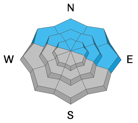
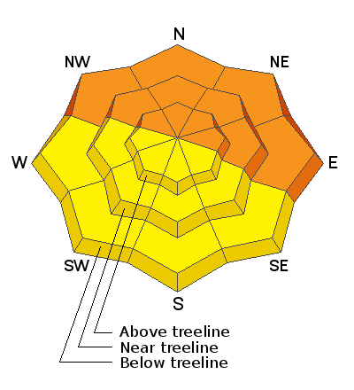
It will be a beautiful day in the mountains, but do not let your guard down. There is a slab present on a widespread weak layer of facets, and it continues to give obvious signs of instability. The avalanche danger remains CONSIDERABLE and human triggered avalanches are likely on northerly facing slopes as well as east and southeast facing ones where you are most likely to find this layer.

Human triggered avalanches are possible on all other slopes and the danger is MODERATE.
Low
Moderate
Considerable
High
Extreme
Learn how to read the forecast here
Weather and Snow
We can expect clear sunny skies today. This morning winds are blowing 5 - 10 out of the NE. The warming trend continues today, 10,000 ft. temperatures will top out close to 40 degrees. Things will cool off by Friday with another chance for snow starting Friday and into the weekend.
NWS Weather Forecast.
Snow totals and temps at Buckboard Flat (8924')
Snow totals and temps at Camp Jackson (8858')
Snowpack
On Thursday Eric found excellent powder snow and sensitive, dangerous avalanche conditions. Heading up North Creek, he was able to remotely trigger this avalanche (video below) as he passed underneath the slope. This is an obvious red flag sign of instability and areas that have deeper snow, will produce deeper and more dangerous avalanches. Another observer was in North Creek on Saturday and experienced widespread collapsing and cracking on any slope facing NW, N, & NE. Read their excellent observation HERE.
Avalanche Problem #1
Persistent Weak Layer
Type
Location
Likelihood
Size
Description
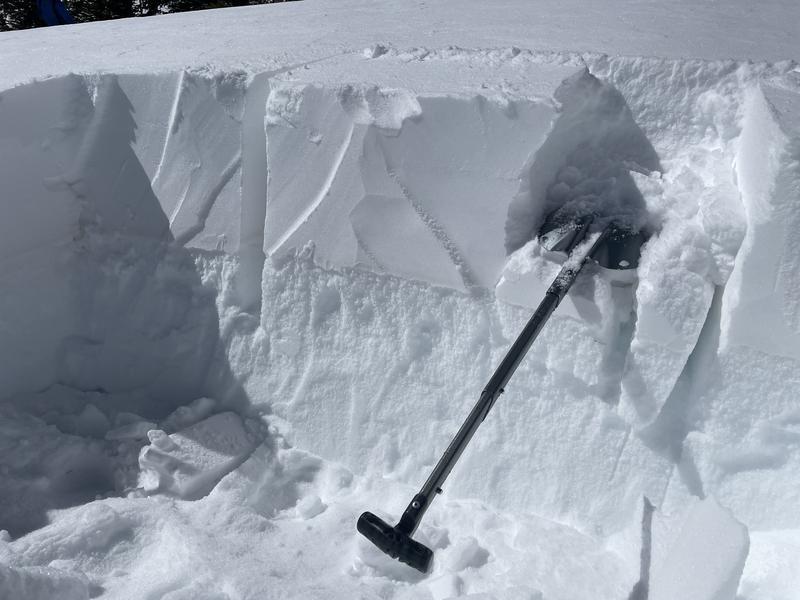
A persistent weak layer of faceted snow under the new snow from this week's snowfall (example photo below, the facets are the sugary looking snow under the new snow) can fracture and produce soft slab avalanches today. This layer exists mostly on northerly facing slopes but can be found on east facing slopes as well. Be aware that this weak layer exists at all elevations. Another observer in the Abajos yesterday got widespread collapsing on this layer on northerly facing slopes around 9000 feet on EVERY spot with a any amount of drifting. These are obvious signs of instability and should have our attention.
I wouldn't trust the snowpack and would be very conservative in my decision making on what slopes to cross and which ones to ride.

Avalanche Problem #2
Wet Snow
Type
Location
Likelihood
Size
Description
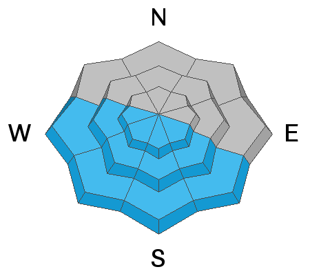
Temperatures will soar to almost 40 degrees F and it's time to be aware of wet activity on solar aspects. Sluffs and point releases of new snow may become possible today on slopes receiving direct sunshine. Many of these slope were nearly bare ground prior to last week's snowfall, but I would pay attention to how quickly the snow warms and become wet on south aspects today. If you see balls of snow rolling down the hill, or if you can squeeze water out of a snowball, it's time to move off sunny slopes.
General Announcements
Who's up for some free avalanche training? Get a refresher, become better prepared for an upcoming avalanche class, or just boost your skills. Go to https://learn.kbyg.org/ and scroll down to Step 2 for a series of interactive online avalanche courses produced by the UAC.
This forecast is from the U.S. Forest Service, which is solely responsible for its content. This forecast describes general avalanche conditions and local variations always occur.