Forecast for the Abajos Area Mountains

Issued by Mark Staples on
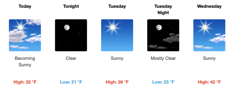
Monday morning, February 28, 2022
Monday morning, February 28, 2022
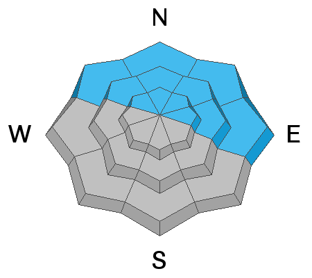
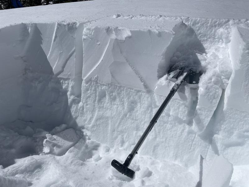
Warm sunny weather doesn't change the situation. Last week's new snow is resting on a widespread weak layer of facets, and it continues to give obvious signs of instability. For these reasons, the avalanche danger is CONSIDERABLE on northerly and east facing slopes where you are most likely to find this layer which is creating dangerous avalanche conditions.
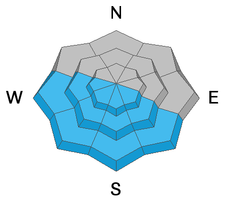
Human triggered avalanches are possible on all other slopes and the danger is MODERATE.
Human triggered avalanches are possible on all other slopes and the danger is MODERATE.

Low
Moderate
Considerable
High
Extreme
Learn how to read the forecast here