Forecast for the Abajos Area Mountains

Eric Trenbeath
Issued by Eric Trenbeath on
Saturday morning, February 14, 2026

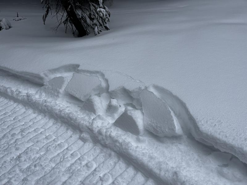
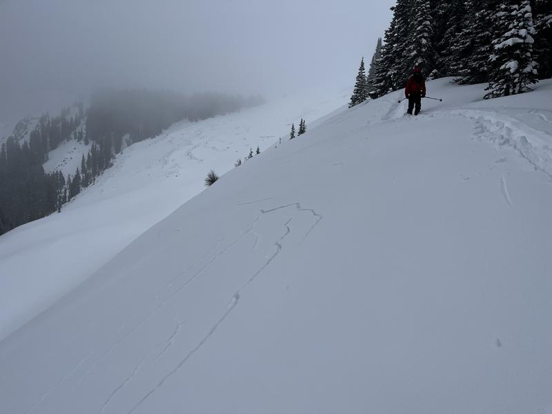
New snow has increased the likelihood for human triggered avalanches on steep, northerly facing slopes where the pre-existing snowpack was loose, weak, and sugary. In these areas, human triggered avalanches a foot deep or more are possible. Signs of instability include cracking in the snow surface and blocks of snow between your skis or near your sled track. Avoid steep, slopes where these signs are present.
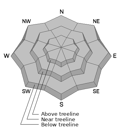
Low
Moderate
Considerable
High
Extreme
Learn how to read the forecast here
Special Announcements

SAVE THE DATES!

We are rescheduling our Moab Backcountry 101 Class to Feb 20, 21 in the hopes of more snow. Click here for information and registration. Moab and Monticello locals can use the discount code MOAB-LOCAL for a 10% discount.

Weather and Snow
NWS forecast for the Abajo Mountains.
Wind speed and direction on Abajo Peak.
Snow totals and temps at Buckboard Flat (8924')
Snow totals and temps at Camp Jackson (8858')
5-7 inches of new snow has fallen near 9000 feet with possibly up to 10 inches up high. Pre-existing snow was loose, weak, and sugary providing and unstable base for the new load. Human triggered avalanches failing on sugary, faceted snow at the old snow surface are possible. Less likely, but not out of the question are avalanches failing deeper in the snowpack. It's been a long dry spell, but conditions are primed and ready. With more snow in the forecast next week, expect increasingly more dangerous conditions ahead.
Blocks of snow outside of your sled track indicate slab formation.

Cracking in the snow surface is a sign of instability.

See all Abajo Observations here.
Additional Information
General Announcements
This forecast is from the U.S.D.A. Forest Service, which is solely responsible for its content. This forecast describes general avalanche conditions and local variations always occur.