Greg Gagne
Forecaster
Our Week in Review highlights significant snowfall, weather, and avalanche events of the previous week. (Review the archived forecasts for the Salt Lake mountains.)
The danger roses for the Salt Lake mountains from Friday, February 12 through Thursday, February 18:

Summary: A series of significant storms leading to a historic avalanche cycle, especially in Little Cottonwood Canyon. Storm and water (known as SWE for Snow Water Equivalent) totals include:
Little Cottonwood: 60-80" snow with 4.0-6.65" SWE
Big Cottonwood: 20-60" snow with 1.5-5.0" SWE
Park City Ridgeline: 20-30" snow with 1.5-2.0 SWE
Avalanche danger remained elevated throughout the week, peaking with Tuesday and Wednesday at Extreme Danger. All avalanches for the Salt Lake mountains can be found here.
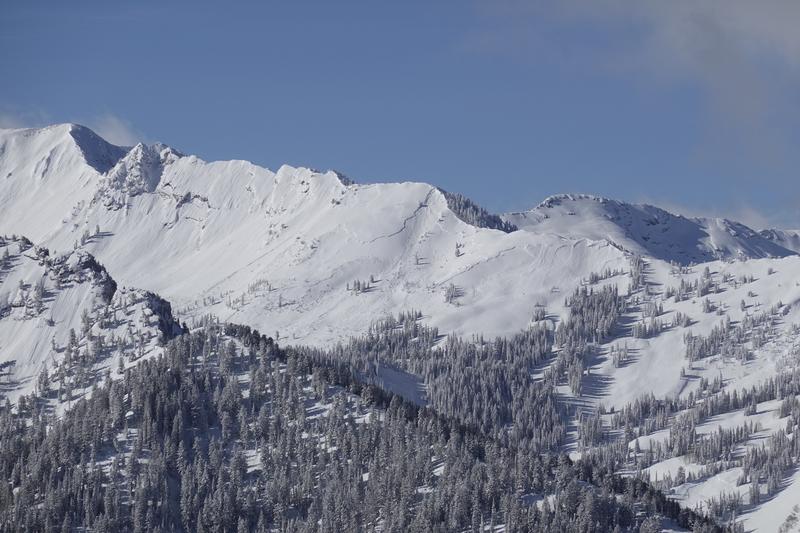
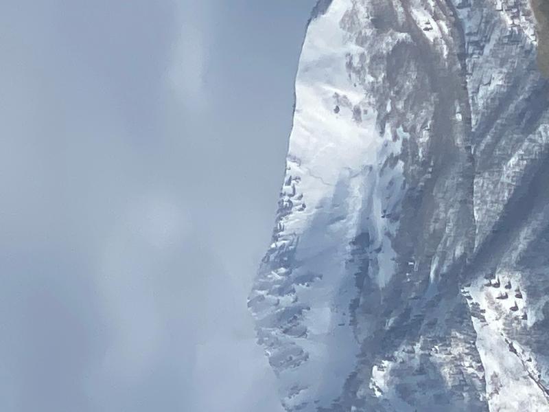
Friday, February 12: Snowfall began overnight and into Friday, with storm totals of ~12" in both Big and Little Cottonwood canyons. Sensitive storm snow and wind slabs with both natural and human-triggered avalanches reported during periods of high precipitation intensity during the afternoon. Significant avalanches include West Desolation Ridgeline, Reynolds Peak, and God's Lawnmower (photo below)

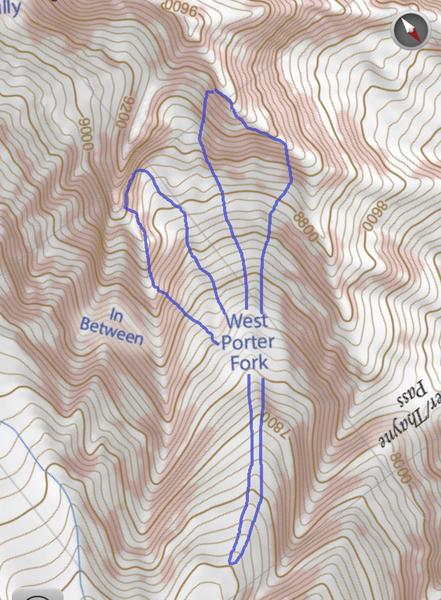
Saturday, February 13: Continued snowfall and winds on a southwest flow. Snow totals by the end of the day are generally 6-10", with heavier snowfall beginning late in the day. A natural avalanche cycle in Little Cottonwood, and two very significant natural avalanches occurring overnight into Sunday morning in Porter Fork in Millcreek Canyon. This includes West Porter (3.5' deep, 3500' wide, running nearly 2,000' vertical) where the starting zone was in the steep headwall at the top of the drainage.

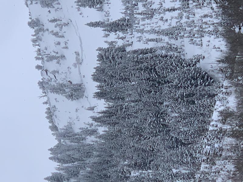
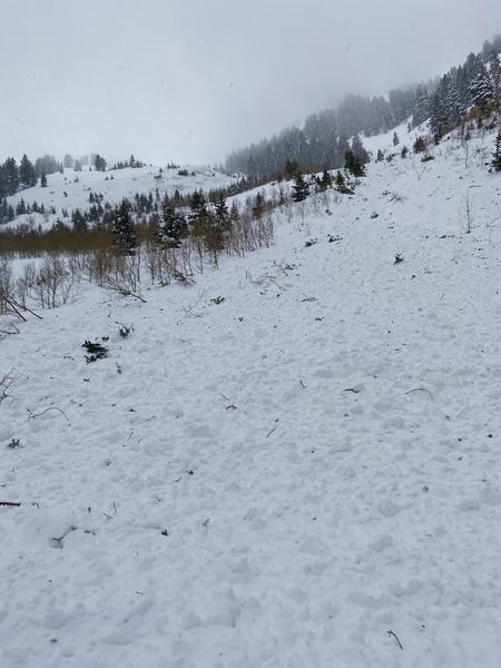
The Ice Box in Main Porter also naturally-avalanche sometime during the overnight hours, with a 3-4' crown and 200' wide:
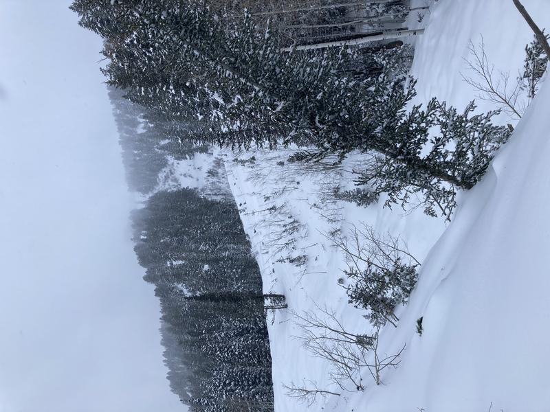
Sunday, February 14: An additional 8-12" of snowfall overnight (likely triggering the natural avalanches in Millcreek Canyon). A small break on Sunday with sun appearing during the afternoon. No new backcountry avalanches are reported during the day, but with clearing, continued evidence of the overnight cycle, including Mount Raymond:
Monday, February 15: Clear weather is short-lived as another storm moves into the region during the day, this one accompanied by strong winds at the upper elevations and heavy snowfall by Monday afternoon. Another natural cycle in Little Cottonwood Canyon, and a large natural avalanche in East Mineral Fork is also reported, running down to the creek.
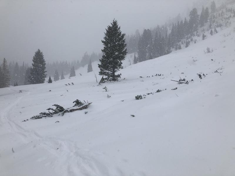
Tuesday, February 16: A rare danger rating of Extreme for the Salt Lake mountains, with heavy snowfall and strong winds. Numerous natural avalanches are reported, especially along the steep, south-facing slide paths in Little Cottonwood Canyon. Very few photos and observations of these avalanches, but two significant natural avalanches in Millcreek Canyon, Main Porter Fork and the slide path In Between, also in Main Porter Fork:
In Big Cottonwood Canyon, a large natural avalanche on the Catcher's Mitt on Kessler Peak, running down to the drainage bottom in Cardiff Fork:
Wednesday, February 17: With continued heavy snowfall, the danger rose for the Salt Lake mountains is as dangerous as it gets, with a widespread, prolonged natural avalanche cycle. Several large slide paths in Little Cottonwood reach the highway, burying the road with debris up to 15' in places,

Thursday, February 18: Clearing skies allow for visibility of the widespread natural avalanche cycle that occurred during the day on Wednesday. The visibility also allowed control work to be performed on some of the large avalanche paths in Big Cottonwood Canyon, including Stairs Gulch. The video is ~2 minutes long, but it's worth it!
Notable avalanches include