


Week in Review for Friday, March 6th - Thursday, March 12th, 2026
We look back at the key events from the previous week. Click HERE for archived forecasts.
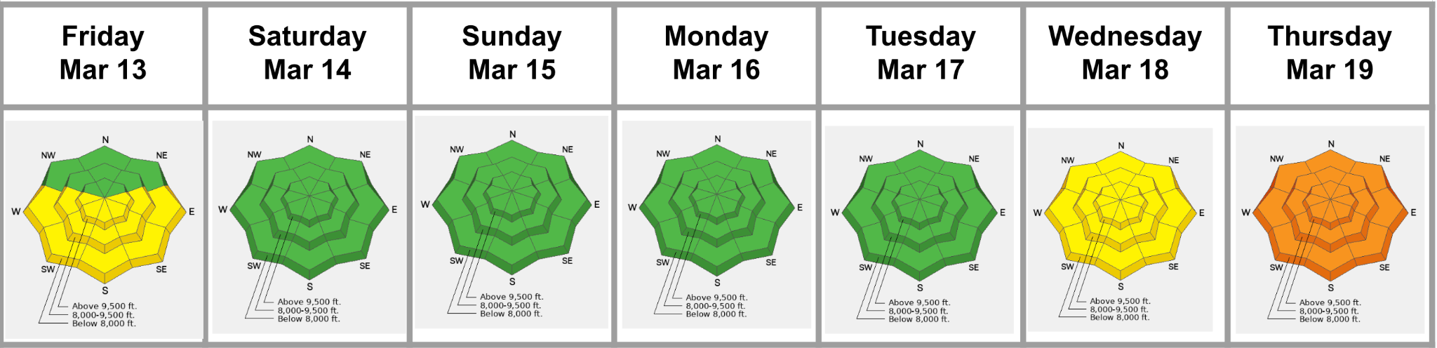
Summary: We (finally) drop the PWL as an avalanche problem on Saturday as we transition to an overall LOW avalanche danger. Glide avalanches continue to run in Broads, Mill B South, and Stairs Gulch. All eyes are on the incoming “heat dome” and expected record-breaking temperatures for mid to late week. The danger mirrors the forecaster's worries about wet slab avalanches. We issue a Press Release on Wednesday afternoon and a Special Avalanche Bulletin on Thursday.
Friday, March 13: Warming temps and direct sun drive the danger to MODERATE for all solar aspects. The PWL is rated as unlikely and LOW danger where it exists. Robby Young captures a natural glide avalanche running on Blue Ice in Broads Fork of BCC.
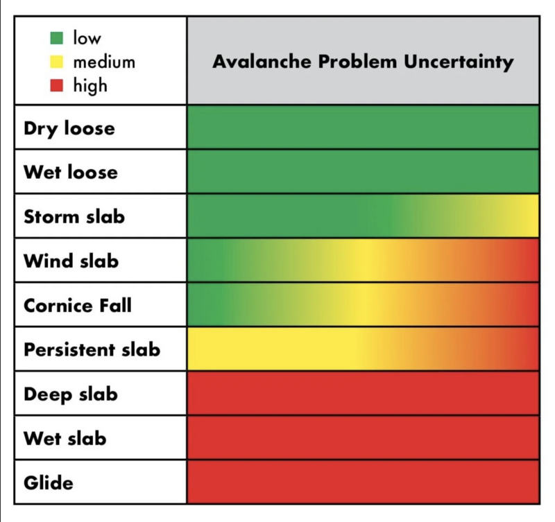
Saturday, March 14: With cloud cover, moderate to strong winds from the southwest, and an anticipated sharp cold front, the danger drops to LOW. Forecaster Brooke Maushund adds an excellent graphic from Joe Stock’s essay in The Avalanche Review that rates the different avalanche problems according to their inherent uncertainty and unpredictability.
Sunday, March 15: Saturday night’s cold front was accompanied by gusts over 100mph at 11,000’ and a trace to an inch of graupel. Temps plummet to the single digits. LOW danger.
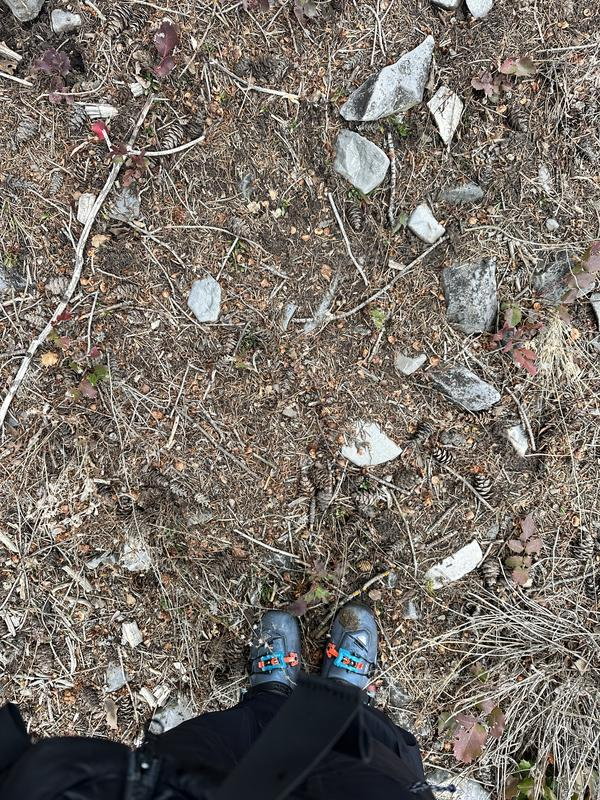
Monday, March 16: LOW danger prevails again as the snowpack is locked up tight. Even the solar aspects did not soften from their coral-like roughness. Nikki’s travels through Cardiff Fork continue to tell the tale of the winter -
Tuesday, March 17: LOW danger again prevails, although the higher temperatures allow for excellent corn skiing and riding on the solar aspects. Forecasters begin to talk of expected wet slab issues in the coming days,
Wednesday, March 18: With only a superficial refreeze, the danger is rated as MODERATE around the compass for wet loose avalanches.
Thursday, March 19: Overnight low temps drop only to the mid-40s at 10,000’ and 11,000’ and the danger rises to CONSIDERABLE on all aspects and elevations.




