Observer Name
Whitney Ward
Observation Date
Tuesday, February 24, 2026
Avalanche Date
Friday, February 20, 2026
Region
Skyline » Fairview Canyon » Blind Fork » GE Hill
Location Name or Route
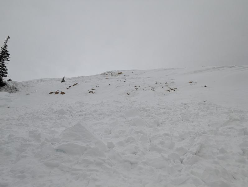
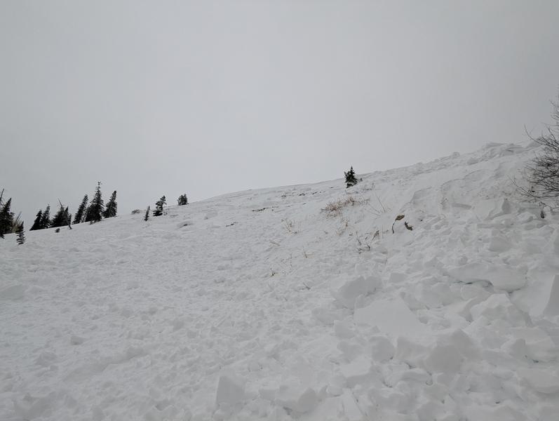
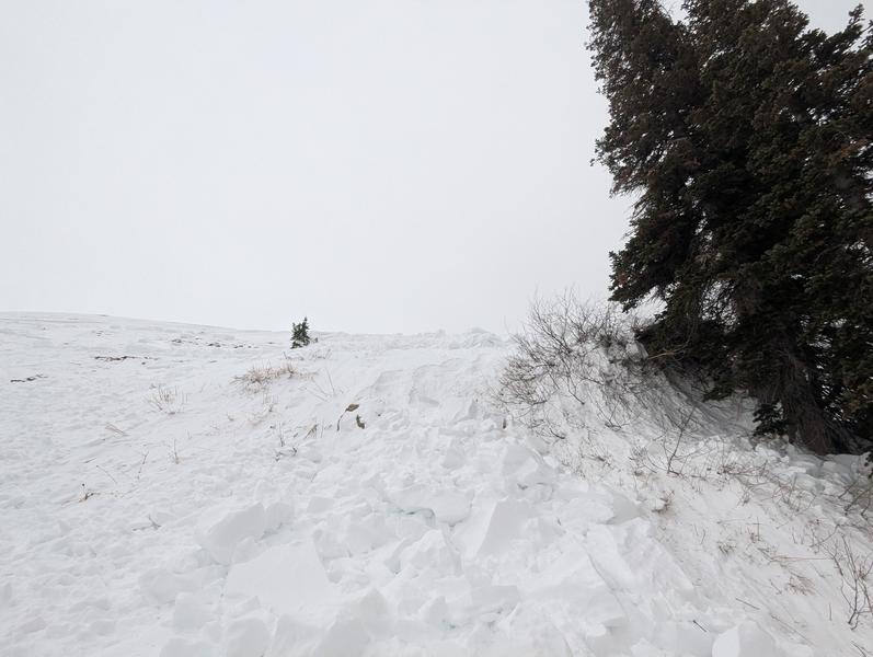
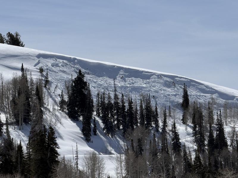
North Face Blind Fork Peak
Elevation
9,500'
Aspect
North
Trigger
Unknown
Avalanche Type
Soft Slab
Avalanche Problem
Persistent Weak Layer
Weak Layer
Facets
Depth
2.5'
Width
450'
Snow Profile Comments
Did two extended column tests on the top of the east facing aspect of Burnt Fork Peak. (right above Hwy 31). Each one failed during isolation on the facet layer. The top layer was a dense 18-24 inch wind slab (1f). There was considerable settling on all the wind loaded slopes (east -north) that we traveled.
Comments
We came across this older avalanche (probably slid last weekend). There were snowmobile tracks below on the road that could have remotely triggered it, but I am guessing that it was a natural release because of wind loading on the slope.
Coordinates


