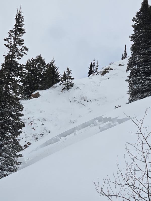
Another remote trigger today from adjacent low angle terrain. We were skinning up through low angle terrain over 300 feet away from the nearest flank of this avalanche. We felt large collapses lower in the drainage and one more at our last switchback, moving away from this slope. Near the crest of the ridge a member of our party spotted this slide. Upon closer inspection the adjacent slope spiderwebbed but did not release despite digital mapping showing it to be more 35* terrain. These large cracks were more like 170' from our skinner. What, to me, is particularly interesting here is that the skiers right flank ran all the way to the avalanche which released yesterday https://utahavalanchecenter.org/avalanche/101652This slope, like the left firewater slide, runs into trees.