Observer Name
Flynn
Observation Date
Thursday, February 19, 2026
Avalanche Date
Thursday, February 19, 2026
Region
Salt Lake » Parleys Canyon » Summit Park
Location Name or Route
Summit Park
Elevation
8,200'
Aspect
North
Trigger
Skier
Avalanche Type
Soft Slab
Avalanche Problem
Persistent Weak Layer
Weak Layer
Facets
Depth
20"
Width
25'
Comments
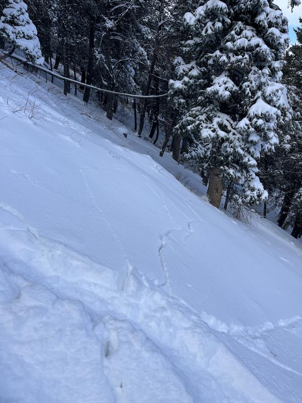
Precise coordinates: 40.73055, -111.620047, elevation: 8205’, aspect: 356 degrees N. Slope angle unknown, best guess is high 20s or low 30s. Intentionally triggered slide over a small convexity. Approximately 20” deep by 20-25’ wide, ran ~30’ into some brush/trees and came to a stop where the slope returned to a much lower angle. Noticed lots of cracking and collapsing on the new storm layer.


Coordinates


