Forecast for the Salt Lake Area Mountains

Issued by Bo Torrey on
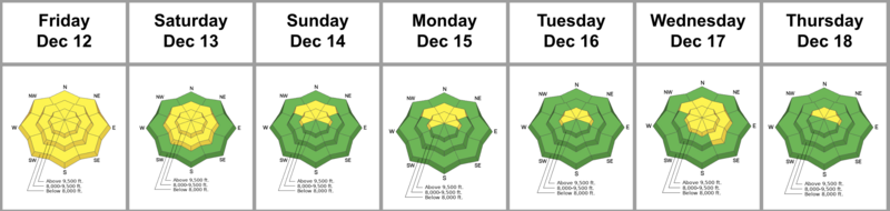
Saturday morning, December 20, 2025
Saturday morning, December 20, 2025
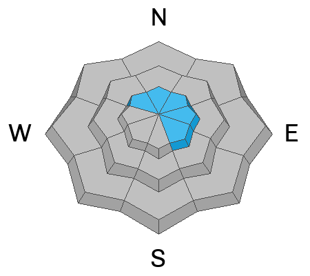
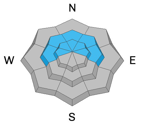
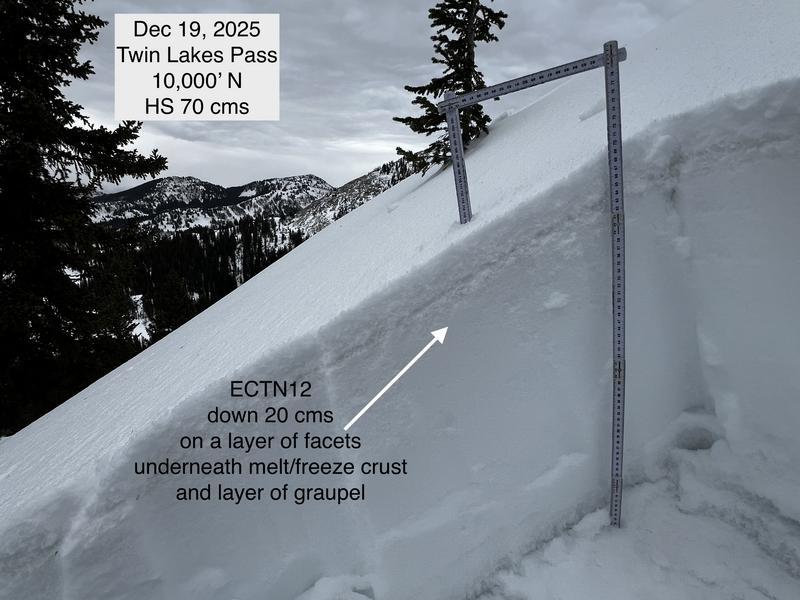
You will find Moderate avalanche danger on upper-elevation slopes facing W-SE. The problem is wind-drifted snow: look for cohesive slabs up to a foot thick beneath exposed ridges. While these wind slabs are dangerous on their own, they are also stressing persistent weak layers. Stick to non-wind-loaded slopes to avoid triggering these overlapping hazards.

Low
Moderate
Considerable
High
Extreme
Learn how to read the forecast here