Week in Review: (December 12 - December 18, 2025)
We look back at the key events from the previous week. Click
HERE for archived forecasts.
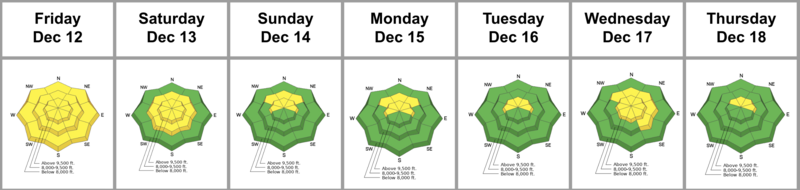
Summary: Storms battered the Pacific Northwest, Idaho, and Montana, but left northern Utah standing at the altar. The weather remained warm and dry with moderate to strong winds from the northwest. Unseasonably warm temperatures produced melt-freeze crusts on all aspects, including northerly facing aspects up to about 9300’. The overall danger flirted between MODERATE and LOW with PWL and Wet Avalanches as the primary concerns. We did not hear of any significant avalanches from the ski areas or from the backcountry until the next storm arrived on Wednesday.
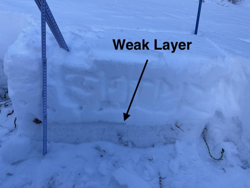
Friday: Sunny skies and warm temperatures abound. Overall stability is on the rise. Backcountry observers note occasional cracking and collapsing, and fairly consistent full propagation in snow pits with a one to two foot slab (last weekend’s storm) resting uncomfortably over the October/November PWL of facets. (UAC Backcountry 101 snow structure photo below).
Saturday: More of the same. Mountain temperatures again rise into the 30s and 40s F.
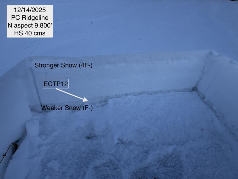
Sunday: More of the same. Mountain temperatures rise into the 50sF! Still, the snow seems comfortable with the sun and heat, and Wet Snow is pulled off as a problem. Forecaster Greg Gagne’s snow profile from Guardsman Pass below.
Monday: More of the same. The slab continues to lose some cohesiveness as it starts to weaken and facet from the top down.
Tuesday: More of the same. The danger is trending toward LOW. Greg Gagne’s forecast, The avalanche danger is mostly LOW and avalanches are unlikely. On some isolated, upper-elevation, northerly-facing slopes, there is a MODERATE danger where it is possible to trigger a slab avalanche 1-2 feet deep failing on a persistent weak layer down near the ground. The forecast sounds like a broken record. All eyes are on the Wednesday and weekend storm for some sort of salvation.
Dave Kelly and Nat Grainger in White Pine. They described the conditions as a “mixed bag of leaves, rocks, melt-freeze crust and damp snow. The trail was supportable, but off trail was a breakable mushy mess.”
Wednesday: On Tuesday night, the forecaster team agrees to drop the danger to LOW on Wednesday, only to see that the storm is slated to be more robust than originally thought. A morning “wintry mix” kicks off the storm with a rain/snow line up to 8000’. This is followed by a violent frontal passage in the early afternoon, accompanied by lightning, thunder, and strong winds. The danger is rated as MODERATE with some expectation that the PWL will again become active in localized, shady terrain at the mid and upper elevations. Wind Drifted Snow is added as an avalanche problem to the forecast. The storm winds down Wednesday night with the Cottonwoods receiving two to four inches of snow and upwards of one to one and a quarter inches of snow water equivalent. Much of this fell as graupel. No avalanches were reported at the ski areas or in the backcountry. See Colin Gregerson's video - Waterfalls of graupel, below.
Thursday: Thursday dawns clear with the next storm slated for later Friday into Saturday. No reports of avalanche activity. With low expectations, most skiers and riders report fun and surfy conditions in the graupel.