Forecast for the Salt Lake Area Mountains

Issued by Bo Torrey on
Friday morning, December 19, 2025
Friday morning, December 19, 2025
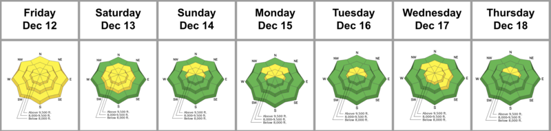
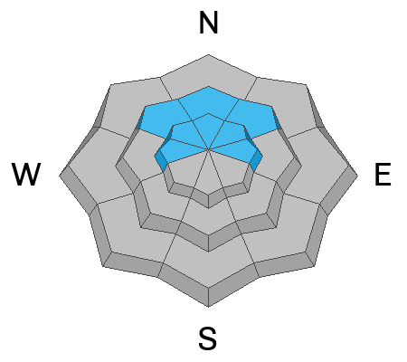
This morning, most terrain has an overall LOW avalanche danger. Higher elevation, more wind-exposed terrain is where you can find a MODERATE avalanche danger for triggering small hard or soft slabs of wind-drifted snow 6 to 10 inches deep.
As snow accumulates later today, expect shallow drifts to form on mid and upper elevation slopes facing NW-N-E-SE.

Low
Moderate
Considerable
High
Extreme
Learn how to read the forecast here