| During the month of April, Mark Miller will donate $75 to the charity of your choice (5 to chose from, including the Utah Avalanche Center!) Mark Miller Subaru has raised over $300k in the previous 6 Do Good Feel Good events. More Info here |  |
| During the month of April, Mark Miller will donate $75 to the charity of your choice (5 to chose from, including the Utah Avalanche Center!) Mark Miller Subaru has raised over $300k in the previous 6 Do Good Feel Good events. More Info here | |
| Advisory: Uintas Area Mountains | Issued by Craig Gordon for Saturday - March 28, 2015 - 5:20am |
|---|


|
bottom line The avalanche danger will rise to MODERATE and human triggered slides are possible on steep, sun baked slopes, especially during the heat of the day. Most other terrain offers a LOW avalanche danger.
|
 |
special announcement Click here for a short viddy shout-out giving huge thanks to all of our great partners for helping to make this program so successful! We'll be winding down next week and Sunday April 5th will be the last of our regularly scheduled advisories. |
 |
current conditions Clear skies overnight helped keep temperatures at bay, but none-the-less we're hovering right around freezing this morning. Winds are generally light and westerly, blowing just 10-15 mph even along the high peaks. Trailheads have taken a hard hit the past few weeks and it's slow going til you get up high to softer snow. However, it's worth the effort and the patience, as dry snow awaits at upper elevations. Click here for real-time temperatures, snowfall, and winds.
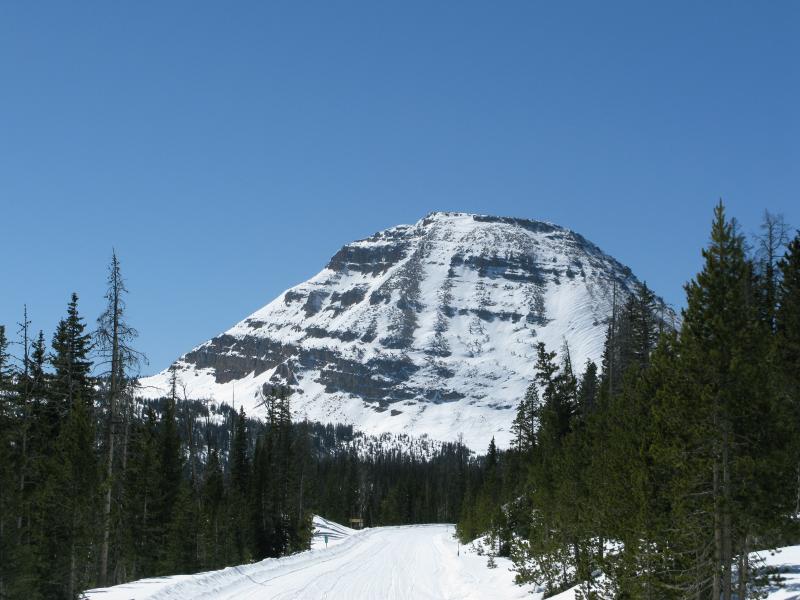
Beautiful views and predictable avalanche danger...
... lead to big terrain and adventurous descents on the eastern front.
|
 |
recent activity
A couple days old, this slab broke naturally during the midweek storm on the steep, wind loaded shoulder of Moffit Peak
|
| type | aspect/elevation | characteristics |
|---|

|

|
LIKELIHOOD
 LIKELY
UNLIKELY
SIZE
 LARGE
SMALL
TREND
 INCREASING DANGER
SAME
DECREASING DANGER
|
|
description
Spring is a pretty remarkable time of year for big rides, spectacular views, and amazing weather. While our snowpack has been vertically challenged all winter, the warm temperatures have produced a predictable, "go anywhere" base and a pretty straightforward avalanche danger. As most of the midweek storm snow instabilities settle out, our attention turns to wet avalanches on steep, sunbaked slopes. As the snow starts to heat up you'll want to think about changing the type of terrain you're riding on, especially if roller balls start cascading down the slope or you find yourself sinking into damp, unsupportable snow. In addition, you need to avoid terrain traps like gullies and road cuts where even a small slide can quickly pile up cement-like, bone snapping debris.
Cornices have the potential to break back further than you might expect, especially during the heat of the day.
|
 |
weather Clouds drift through the region later today as a weak cold front slides through the area. West and southwest winds increase and should be blowing in the 30's along the high ridges by days end. Temperatures climb into the low 50's before dipping into the mid 20's overnight. Cooler and mostly sunny for Sunday with a similar, dry cold front slated for Monday. After that the computer models don't agree on much. Perhaps we'll have a better handle on this for tomorrows update.
|
| general announcements Remember your information can save lives. If you see anything we should know about, please participate in the creation of our own community avalanche advisory by submitting snow and avalanche conditions. You can call me directly at 801-231-2170, email [email protected], or email by clicking HERE This is a great time of year to schedule a free avalanche awareness presentation for your group or club. You can contact me at 801-231-2170 or email [email protected] Donate to your favorite non-profit –The Utah Avalanche Center. The UAC depends on contributions from users like you to support our work. Benefit the Utah Avalanche Center when you buy or sell on ebay - set the Utah Avalanche Center as a favorite non-profit in your ebay account here and click on ebay gives when you buy or sell. You can choose to have your seller fees donated to the UAC, which doesn't cost you a penny. Utah Avalanche Center mobile app - Get your advisory on your iPhone along with great navigation and rescue tools. The information in this advisory is from the US Forest Service which is solely responsible for its content. This advisory describes general avalanche conditions and local variations always occur. I will update this advisory by 7:00 AM Sunday Mar. 29, 2015 or sooner if conditions warrant. |


_0.jpg)