| During the month of April, Mark Miller will donate $75 to the charity of your choice (5 to chose from, including the Utah Avalanche Center!) Mark Miller Subaru has raised over $300k in the previous 6 Do Good Feel Good events. More Info here |  |
| During the month of April, Mark Miller will donate $75 to the charity of your choice (5 to chose from, including the Utah Avalanche Center!) Mark Miller Subaru has raised over $300k in the previous 6 Do Good Feel Good events. More Info here | |
| Advisory: Moab Area Mountains | Issued by Eric Trenbeath for Tuesday - March 4, 2014 - 6:36am |
|---|


|
bottom line The overall avalanche danger is MODERATE at this time though there are three distinct avalanche problems. First, is the danger of triggering a stiff wind slab, primarily on slopes steeper then 35 degrees that face the north half of the compass. Second, is the danger of triggering a deeper, persistent slab, also on slopes steeper than 35 degrees, primarily with a northerly aspect. Third, is the danger for wet slide activity as the day heats up. This danger is primary on sun exposed slopes but could also be a factor on shady slopes at lower elevations.
|
 |
special avalanche bulletin
|
 |
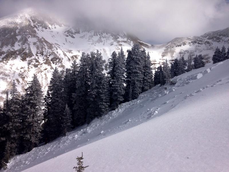
current conditions La Sal Mountains You can find a little bit of everything out there right now including a lot of wind hammered surfaces in exposed areas. Nevertheless, reports of smooth, creamy, settled snow conditions in are coming in. Seek out sheltered areas below tree line. Winds have been mostly light out of the SW, and they are currently averaging about 12 mph along ridge tops.It is a balmy 29 degrees at Geyser Pass Winter Trailhead (GPWT), and 20 degrees at 10,000'. There is 51" of snow on the ground in Gold Basin, and 30" at GPWT. Winds and temperature on Pre-Laurel Peak (11,705') Temperature and new snow totals in Gold Basin (10,050') Total snow depth and temperature near Geyser Pass Trailhead (9850') Abajo Mountains Winds on Abajo Peak are averaging 15 mph from the SW, and the temperature at Buckboard Flat is 28 degrees. Snow over the weekend improved conditions a bit but we are playing a difficult game of catch up this late in the season. Snow totals at Camp Jackson (8968') |
 |
recent activity Several people noted this natural release in Coyote Chute from over the weekend. Thanks to Chris Murray for his observation and photo.
|
| type | aspect/elevation | characteristics |
|---|

|

|
LIKELIHOOD
 LIKELY
UNLIKELY
SIZE
 LARGE
SMALL
TREND
 INCREASING DANGER
SAME
DECREASING DANGER
|
|
description
Stiff wind slabs formed over the weekend have gained strength though it may still be possible to trigger one in steep terrain. They also have the potential to step down into weaker buried layers. Most of these slabs will be found on mid to upper elevation terrain that faces the north half of the compass, but cross loading is also a factor on the lee sides of sub ridges and terrain features. Be alert to the usual signs of recently deposited wind slabs such as smooth, rounded pillows, or drifts, and suspect areas that have a hollow sound or feel to them. |
| type | aspect/elevation | characteristics |
|---|

|

|
LIKELIHOOD
LIKELY
UNLIKELY
SIZE
 LARGE
SMALL
TREND
INCREASING DANGER
SAME
DECREASING DANGER
|
|
description
The snow pack has had time to adjust to the most recent load. Nevertheless, there is plenty of weak snow under there. In the right place, the added weight of a skier or rider, could be just enough to tip the balance causing a deep and dangerous avalanche. Areas of weakest snow can be found in steep, rocky, or slightly wooded terrain, facing the north half of the compass, at upper mid to upper elevations. I would still exercise restraint in these areas. |
| type | aspect/elevation | characteristics |
|---|

|

|
LIKELIHOOD
LIKELY
UNLIKELY
SIZE
LARGE
SMALL
TREND
 INCREASING DANGER
SAME
DECREASING DANGER
|
|
description
As the days heat up, the danger will rise for loose, wet slide activity. Though the primary concern is on sun exposed slopes, shady aspects at lower elevations could also present a problem. Be alert to signs of instability such as sloppy snow over your boot tops, roller balls or cinnamon rolls coming down the mountain, and especially loose snow sluffing. If you notice any of these signs, it is time to get off of, and out from under steep terrain.
|
 |
weather Today, mountain cloudiness may produce a few snow showers that will linger into tonight. Winds will be on the increase, blowing 25-30 mph from the SW along ridge tops. High temperature at 10,000' will be around 34 degrees. Wednesday looks to be sunny with temperatures creeping up to around 36 degrees. A few clouds may start to move in on Thursday, but still look for mostly sunny skies with a high of near 40 degrees at 10,000'. |
| general announcements OBSERVATIONS: If you are out and about in the mountains, I'd love to know what you are seeing so please SUBMIT OBSERVATIONS You can read current OBSERVATIONS HERE. LUNA GROOMING INFORMATION: Trails have not been recently groomed. ROAD CONDITIONS: The road has seen plenty of traffic over the weekend. UAC MOBILE APP: Get your advisory on your iphone with this app
|


_2.jpg)