
| During the month of April, Mark Miller will donate $75 to the charity of your choice (5 to chose from, including the Utah Avalanche Center!) Mark Miller Subaru has raised over $300k in the previous 6 Do Good Feel Good events. More Info here |  |
| During the month of April, Mark Miller will donate $75 to the charity of your choice (5 to chose from, including the Utah Avalanche Center!) Mark Miller Subaru has raised over $300k in the previous 6 Do Good Feel Good events. More Info here | |
| Advisory: Logan Area Mountains | Issued by Toby Weed for Saturday - March 22, 2014 - 6:34am |
|---|

|
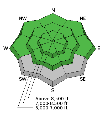
bottom line The snow stability is generally good and the danger is LOW or level 1 on most slopes in the backcountry. Use normal caution. Avoid drifted slopes and large cornices at upper elevations and steep sunny slopes with saturated snow in the heat of the day.
|
 |
special announcement Sale on all remaining discount lift tickets donated to the Utah Avalanche Center from Beaver Mountain, Wolf Mountain, Sundance, and Brian Head: The few remaining tickets are being blown out with all proceeds used to pay for avalanche advisories and education. Go here to get your tickets.
Snow coverage and conditions are stellar at Beaver Mountain this spring. 3-12-2014 |
 |
current conditions The Tony Grove Snotel at 8400' reports 25 degrees, and there's 108 inches of total snow, with 133% of average water content for the date. It's 15 degrees at the 9700' CSI Logan Peak weather station, and I'm reading average wind speeds in the lower teens from the northwest. Strong winds in the past few storms deposited brown dust across the zone. You might still find a bit of settled dusty "powder" up high in sheltered terrain, but exposed slopes are either scoured or drifted-in with stiff snow. Observers report hard (chatter with speed) well refrozen snow at upper elevations in the Wellsville Wilderness yesterday. The dusty snow is more spring-like and still fairly smooth down at mid and lower elevations in the Bear Rivers and in most sunny terrain.
A little fresh dusty snow from the middle of the week capping an even dustier surface, visible where this small cornice failed near the Top of the Garden City Bowls. 3-19-2014 (Pagnucco)
|
 |
recent activity It's been about three weeks since any significant avalanches stepping into old snow occurred in the Logan Zone. Shallow wind slabs and cornice falls are fairly frequent during and just after the spring storms, and easily predicted loose wet avalanches have been common with solar heating and seasonal warmth affecting fresh snow. Visit our Backcountry Observations Page for more details.
|
| type | aspect/elevation | characteristics |
|---|

|

|
LIKELIHOOD
 LIKELY
UNLIKELY
SIZE
 LARGE
SMALL
TREND
 INCREASING DANGER
SAME
DECREASING DANGER
|
|
description
Even when the danger is mostly LOW we need asses the danger on individual slopes and continue to use safe travel protocols. Low danger doesn't mean No danger. Avalanches are unlikely in most areas, which also means they are possible in some.
|
| type | aspect/elevation | characteristics |
|---|

|

|
LIKELIHOOD
LIKELY
UNLIKELY
SIZE
LARGE
SMALL
TREND
 INCREASING DANGER
SAME
DECREASING DANGER
|
|
description
Loose wet avalanches entraining the fresh snow will become possible in sunny terrain as the day warms up. As usual, avoid and stay out from under steep slopes with saturated surface snow, and pay close attention to trees and other terrain traps below you. Roller balls, pin-wheels, and sluffs indicate unstable wet surface snow, and entraining loose wet avalanches are possible in these conditions. If you start post-holing, or if you sink knee-deep or deeper into wet snow, it's time to leave and you should reconsider your route.
|
 |
weather Expect mostly sunny conditions in the mountains, with moderate northwest winds and 8500' high temperatures around 33 degrees. It'll be mostly clear tonight, with temperatures around 20 degrees and moderate southwest wind. Looks like a very nice and sunny weekend, with mostly clear skies, breezy west winds and high temperatures hovering around freezing. The first part of next week will be mild and sunny, but a storm is expected to impact the region late Wednesday, with snow in the mountains perhaps lasting through Friday. Check out our one-stop weather page........HERE |
| general announcements Utah Avalanche Center mobile app - Get your advisory on your iPhone along with great navigation and rescue tools. Remember your information can save lives. If you see anything we should know about, please participate in the creation of our own community avalanche advisory by submitting snow and avalanche conditions. You can also call us at 801-524-5304 or 800-662-4140, email by clicking HERE, or include #utavy in your tweet or Instagram. Follow us at UAClogan on Twitter I'll issue these advisories on Monday, Wednesday, Friday, and Saturday mornings through March, and will then switch to issuing weekend and intermittent advisories through April. This advisory is produced by the U.S.D.A. Forest Service, which is solely responsible for its content. It describes only general avalanche conditions and local variations always exist. |


_1.jpg)


.jpg)
