| Please join us at the 23rd annual Black Diamond Fall Fundraiser Party Thursday Sept 15. Tickets are on sale now here, at the Black Diamond store & at REI. Special bonus raffle for online ticket purchasers! |
| Please join us at the 23rd annual Black Diamond Fall Fundraiser Party Thursday Sept 15. Tickets are on sale now here, at the Black Diamond store & at REI. Special bonus raffle for online ticket purchasers! |
| Advisory: Uintas Area Mountains | Issued by Trent Meisenheimer for Saturday - March 19, 2016 - 5:42am |
|---|

|
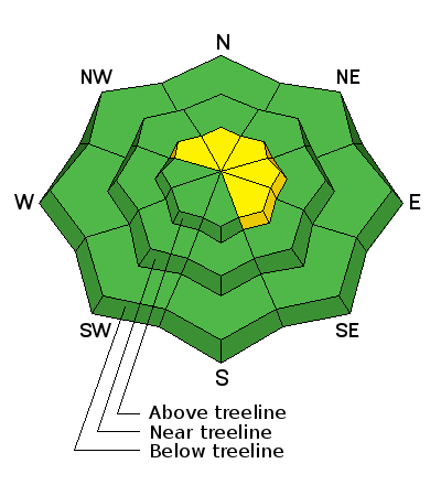
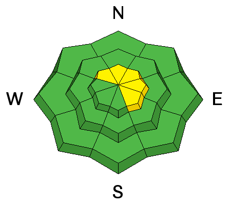
bottom line In the wind zone at and above treeline, a MODERATE avalanche danger exists and human triggered avalanches are possible on steep, wind drifted slopes, especially those that face the north half of the compass. Any slide that breaks to old snow near the ground has the potential to break deeper and wider than you might expect and can quickly ruin your day. Out of the wind the avalanche danger is generally LOW.
|
 |
special announcement Huge thanks to everyone at Park City Powder Cats for your very generous donation yesterday to the Avalanche Center. We deeply appreciate our great partnership and everything you do for our organization... y'all rock! Another shout out is to Criag Gordon and our amazing sled loaner program. It allows us to get into the mountains and see the current conditions which helps us make more accurate forecast. Weller Recreation and Tricity Polaris we can't thank you enough!
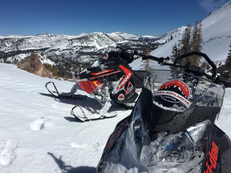
Photo from Mirror Lake taken yesterday. Please help guide our discussions of website maintenance, upgrades or possible changes in coming years. Take this brief survey. As a way of saying thanks we'll be raffling a free avalanche class and other free stuff like hats, beanies, water bottles, etc. |
 |
current conditions The west southwest winds have died down and are currently blowing 10-20mph with the occasional gust into the upper 20's across the high elevation terrain. Temperatures remain cold this morning and 10,000' temps are hovering in the teens. Riding conditions are about as good as it gets. Five star powder can be found on many aspects at upper elevations.
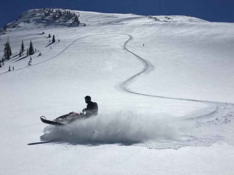
Photo taken yesterday showing the snow surface and the excellent riding conditions found in the Uinta mountains. Uinta weather station network info is found here. Trip reports and observations are found here.
|
 |
recent activity No avalanche activity was reported from the backcountry yesterday. Recent avalanche observations are found here See or trigger an avalanche? Shooting cracks? Hear a collapse? It's simple. Go here to fill out an observation.
|
| type | aspect/elevation | characteristics |
|---|

|
|
LIKELIHOOD
 LIKELY
UNLIKELY
SIZE
 LARGE
SMALL
TREND
 INCREASING DANGER
SAME
DECREASING DANGER
|
|
description
I think a lot of our wind drift issues are starting to relax and the snowpack is feeling comfortable in its own skin. While today's slabs might be a little stubborn, if triggered they'll have some mass behind them and they'll be packing a punch. If your travels take you into big, upper elevation terrain today.... Ride defensively and have an escape plan. Your best plan of attack is avoiding any fat, rounded piece of snow, especially if it sounds or feels hollow like a drum. The most obvious avalanche problem today will be the wind slabs at upper elevations. However, don't forget that shallow snowpack areas still exist and there is still a chance for triggering an avalanche that breaks to old snow. Steep, upper elevation, north facing slopes, especially those with a thin, weak snowpack need to be carefully evaluated or better yet, simply avoid terrain with these characteristics.
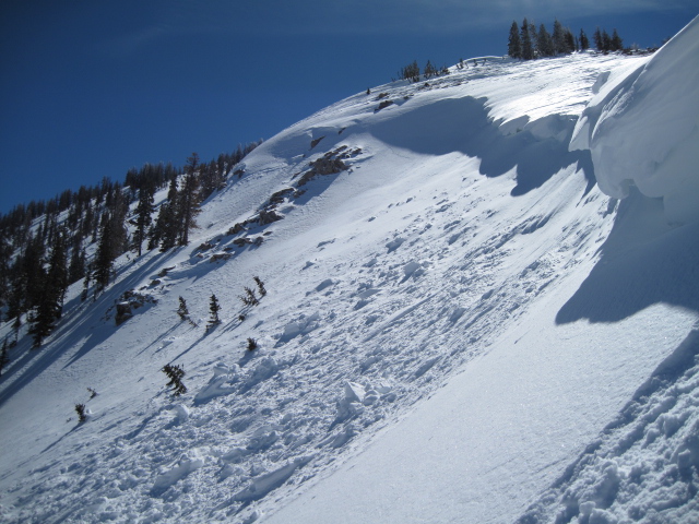
Cornices have grown quite large the past few days and may break back further than you might expect. Best to avoid being on or underneath these boxcar sized pieces of snow. (Photo: Ted Scroggin)
|
 |
weather We will see sunny skies as high pressure takes hold. Mountain temperatures will rise into the mid 30's and overnight lows will dip back into the 20's. West southwest winds should remain light 10-20 mph with the occasional gust in the upper 20's at high elevations. A strong warming trend is on tap for Sunday before unsettled weather returns for early next week.
|
| general announcements Remember your information can save lives. If you see anything we should know about, please participate in the creation of our own community avalanche advisory by submitting snow and avalanche conditions. You can call me directly at 801-231-2170, email [email protected], or email by clicking HERE If Craig is unavailable you can reach his partner Trent at 801-455-7239, email [email protected] This is a great time of year to schedule a free avalanche awareness presentation for your group or club. You can contact me at 801-231-2170 or email [email protected]. To register for the first in our series of on-the-snow sled specific classes you can register here. The information in this advisory is from the US Forest Service which is solely responsible for its content. This advisory describes general avalanche conditions and local variations always occur. The information in this advisory expires 24 hours after the date and time posted, but will be updated by 7:00 AM on Sunday, March 20th.
|