| Please join us at the 23rd annual Black Diamond Fall Fundraiser Party Thursday Sept 15. Tickets are on sale now here, at the Black Diamond store & at REI. Special bonus raffle for online ticket purchasers! |
| Please join us at the 23rd annual Black Diamond Fall Fundraiser Party Thursday Sept 15. Tickets are on sale now here, at the Black Diamond store & at REI. Special bonus raffle for online ticket purchasers! |
| Advisory: Uintas Area Mountains | Issued by Craig Gordon for Thursday - March 17, 2016 - 4:20am |
|---|

|
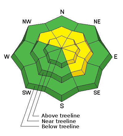
bottom line In the wind zone at and above treeline, a MODERATE avalanche danger exists and human triggered avalanches are possible on steep, wind drifted slopes, especially those that face the north half of the compass. Any slide that breaks to old snow near the ground has the potential to break deeper and wider than you might expect. Out of the wind the avalanche danger is generally LOW.
|
 |
special announcement Please help guide our discussions of website maintenance, upgrades or possible changes in coming years. Take this brief survey. As a way of saying thanks we'll be raffling a free avalanche class and other free stuff like hats, beanies, water bottles, etc. |
 |
current conditions A weak system sliding in from the north ushered in a band of clouds and a few flurries overnight. West and southwest winds are still a nusiance, blowing 35-55 mph along the high peaks. Temperatures are in the low to mid 20's which is about 10 degrees warmer than yesterday at this time. South facing snow took on some heat yesterday, but on a go-anywhere base, north facing terrain still offers cold snow and riding conditions are about as good as they get.
If you're confused by avalanche danger ratings, you're not alone. Check out a slick viddy describing how it all works.
Uinta weather station network info is found here. Trip reports and observations are found here.
|
 |
recent activity One report of a rider triggered slab breaking 1.5' deep and 40' wide on a steep leeward slope in the wind zone. Otherwise... no news of the weird. Recent avalanche observations are found here See or trigger an avalanche? Shooting cracks? Hear a collapse? It's simple. Go here to fill out an observation.
|
| type | aspect/elevation | characteristics |
|---|

|

|
LIKELIHOOD
 LIKELY
UNLIKELY
SIZE
 LARGE
SMALL
TREND
 INCREASING DANGER
SAME
DECREASING DANGER
|
|
description
Winds continue cranking along the high ridges and there's no shortage of new snow available to blow around and form drifts sensitive to the additional weight of a rider. In addition to the annoying winds, temperatures have risen and this combination might make today's drifts more connected than in the past few days. What this means is... once triggered, today's slabs have the potential to break a bit deeper and wider than you might expect and they'll be packing a punch. Found mostly on steep, upper elevation, leeward slopes, I wouldn't be too surprised to find a few fresh drifts cross-loaded in terrain features like chutes and gullies. Best bet for today is avoiding any fat, rounded piece of snow, especially if it sounds or feels hollow like a drum.
|
| type | aspect/elevation | characteristics |
|---|

|

|
LIKELIHOOD
 LIKELY
UNLIKELY
SIZE
 LARGE
SMALL
TREND
 INCREASING DANGER
SAME
DECREASING DANGER
|
|
description
Less obvious and certainly more dangerous is the possibility of triggering an avalanche that breaks to sugary snow near the ground. While not widespread, fact is, we still have terrain that harbors weak snow. The usual suspects come to mind... steep, upper elevation, north facing slopes, especially those with a thin, weak snowpack need to be carefully evaluated or better yet, simply avoid terrain with these characteristics.
|
 |
weather We might see a flurry or two, but in general conditions improve throughout the day leading to mostly sunny skies with temperatures warming into the low and mid 30's and overnight lows dipping into the 20's. Westerly winds blow in the 40's and 50's along the high ridges through Friday. As a ridge of high pressure builds over the region this weekend, expect a significant warming trend. Unsettled weather is on tap for early next week.
|
| general announcements Remember your information can save lives. If you see anything we should know about, please participate in the creation of our own community avalanche advisory by submitting snow and avalanche conditions. You can call me directly at 801-231-2170, email [email protected], or email by clicking HERE If Craig is unavailable you can reach his partner Trent at 801-455-7239, email [email protected] This is a great time of year to schedule a free avalanche awareness presentation for your group or club. You can contact me at 801-231-2170 or email [email protected]. To register for the first in our series of on-the-snow sled specific classes you can register here. The information in this advisory is from the US Forest Service which is solely responsible for its content. This advisory describes general avalanche conditions and local variations always occur. The information in this advisory expires 24 hours after the date and time posted, but will be updated by 7:00 AM on Friday, March 18th.
|


