| Please join us at the 23rd annual Black Diamond Fall Fundraiser Party Thursday Sept 15. Tickets are on sale now here, at the Black Diamond store & at REI. Special bonus raffle for online ticket purchasers! |
| Please join us at the 23rd annual Black Diamond Fall Fundraiser Party Thursday Sept 15. Tickets are on sale now here, at the Black Diamond store & at REI. Special bonus raffle for online ticket purchasers! |
| Advisory: Uintas Area Mountains | Issued by Craig Gordon for Wednesday - December 2, 2015 - 4:23am |
|---|


|
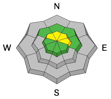
bottom line In general most terrain throughout the range offers a LOW avalanche danger. However, at and above treeline, the avalanche danger is MODERATE. While pockety at best, human triggered avalanches are possible, on steep, wind drifted slopes facing the north half of the compass.
|
 |
current conditions Skies are clear and temperatures a little inverted, climbing into the upper teens and low 20's along the ridges overnight. Trailhead temperatures are still in the single digits. Around midnight, winds switched to the west-southwest and are currently blowing 10-20 mph along the high peaks. The Uinta's are boney and in general you gotta stick to road rides or low angle grassy meadows. If there's a lump in the snow, chances are there's a sled wrecking rock hidden underneath... tread lightly! Our western Uinta weather station network is up and running. Click here for real time snow, winds, and temperatures.
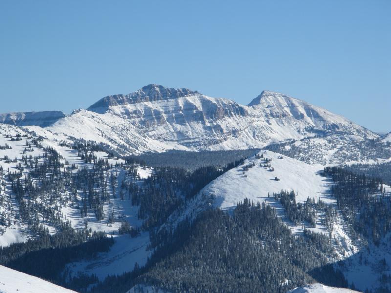
The range is white from far...
... closer inspection reveals it's far from white. Recent trip reports and observations are found here.
|
 |
recent activity No new avalanche activity to report. See or trigger an avalanche? Shooting cracks? Hear a collapse? It's simple. Go here to fill out an observation. |
| type | aspect/elevation | characteristics |
|---|

|
|
LIKELIHOOD
 LIKELY
UNLIKELY
SIZE
 LARGE
SMALL
TREND
 INCREASING DANGER
SAME
DECREASING DANGER
|
|
description
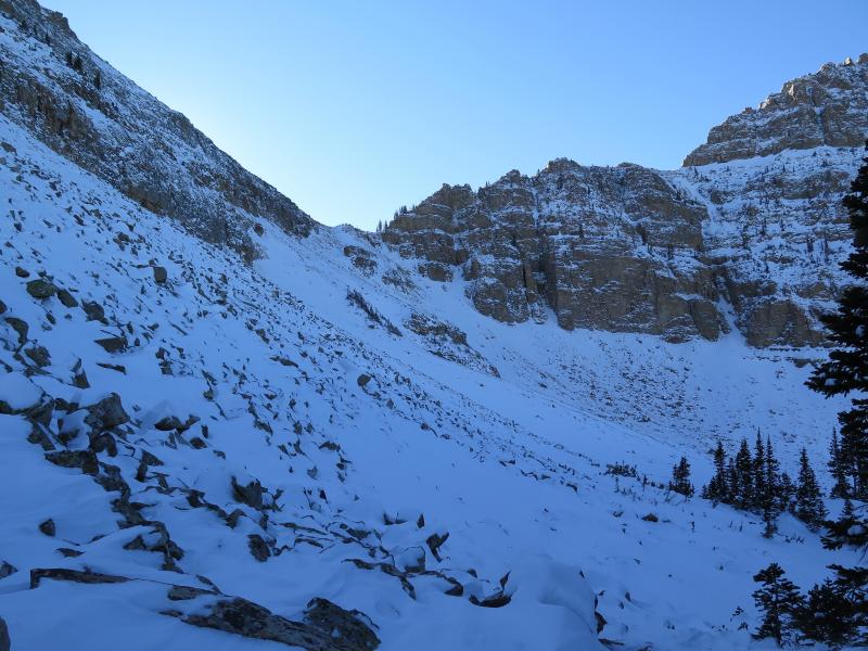
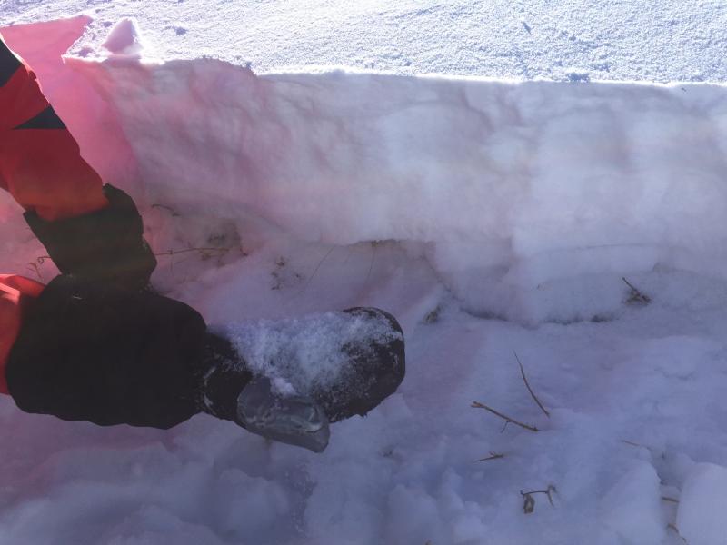
The Uinta's are super thin right now and our snowpack is losing strength. Since I generally have a glass half full kinda outlook, I'd say our snowpack is more structurally challenged rather than weak. However, I can't deny the fact that we've got issues and once it snows or if the wind starts to crank, we'll see avalanches.... and this is why. The snowpack is comprised of sugary facets near the ground, with a couple of mid-pack crusts of varying thickness and strength, topped off with 6" of light density snow in protected areas, and in more wind exposed terrain, a supportable wind slab. For right now, the avalanche danger is pretty straight-forward and a few fresh drifts along the leeward side of upper elevation ridges is today's main avalanche concern. Remember- even a shallow slide can take you for a nasty ride through rocks and stumps barely hidden under our shallow snowpack.
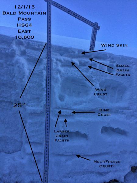
As usual, JG submitted a great write up of his travels and his snowpit diagram illustrates the overall structure.
Snow depths in our travels were a bit more on the shallow side.
In either case, the snow near the ground continues to lose strength. Click here to view more Uinta observations and trip reports.
|
 |
weather High pressure brings dry and warm weather the next couple days, with a few clouds drifting into the range late in the day. Highs climb into the low 30's with overnight lows dipping into the upper teens. Winds ramp up from the southwest on Thursday and Thursday night ahead of the next storm system. This relatively weak storm moves through northern Utah on Friday and Friday night. High pressure builds through the weekend with a hint of a storm around midweek.
|
| general announcements Remember your information can save lives. If you see anything we should know about, please participate in the creation of our own community avalanche advisory by submitting snow and avalanche conditions. You can call me directly at 801-231-2170, email [email protected], or email by clicking HERE This is a great time of year to schedule a free avalanche awareness presentation for your group or club. You can contact me at 801-231-2170 or email [email protected]. To register for the first in our series of on-the-snow sled specific classes you can register here. The information in this advisory is from the US Forest Service which is solely responsible for its content. This advisory describes general avalanche conditions and local variations always occur. The information in this advisory expires 24 hours after the date and time posted, but be will be updated by 7:00 AM on Saturday, December 5th.
|