| Please join us at the 23rd annual Black Diamond Fall Fundraiser Party Thursday Sept 15. Tickets are on sale now here, at the Black Diamond store & at REI. Special bonus raffle for online ticket purchasers! |
| Please join us at the 23rd annual Black Diamond Fall Fundraiser Party Thursday Sept 15. Tickets are on sale now here, at the Black Diamond store & at REI. Special bonus raffle for online ticket purchasers! |
| Advisory: Uintas Area Mountains | Issued by Craig Gordon for Sunday - November 15, 2015 - 5:23am |
|---|

|
bottom line For today, the avalanche danger is generally LOW. Tonight's storm may produce a few drifts sensitive to the additional weight of a rider, especially on steep, upper elevation, shady slopes. Remember- even a short ride in a shallow avalanche could leave you with bumps, bruises, or broken bones.
|
 |
special announcement This advisory expires 24 hours from the date and time posted, but will be updated by 7:00 AM Wednesday November 18th or sooner, especially if Monday's storm produces more water, wind, or snow than expected. |
 |
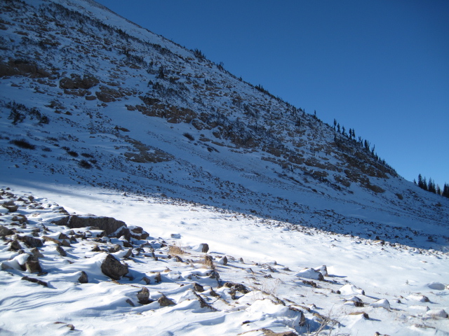
current conditions Skies are clear and temperatures in the mid to upper 20's. Ahead of a cold front slated to slide through the region late tonight, southeast winds started increasing last night, blowing 20-30 mph along the high ridges. Strong sunshine and warm temperatures have nuked the sunny slopes, but on the other side of the compass you'll find 6"-10" of snow that is growing weak and sugary, especially on the high elevation shady slopes.
|
 |
recent activity No recent avalanche activity to report, but we are posting observations from the backcountry on a daily basis now. See or trigger an avalanche? Shooting cracks? Hear a collapse? It's simple. Go here to fill out an observation. |
| type | aspect/elevation | characteristics |
|---|

|
|
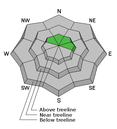
LIKELIHOOD
 LIKELY
UNLIKELY
SIZE
 LARGE
SMALL
TREND
 INCREASING DANGER
SAME
DECREASING DANGER
|
|
description
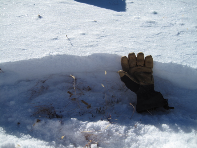
The snowpack is very shallow and there's really not enough snow to recreate on just yet. In general, the avalanche hazard is Low. However, our thin snowpack has grown weak and sugary on upper elevation shady slopes and Monday's storm system may produce enough snow and wind to create isolated areas where you could trigger an avalanche. If you're getting out and about after the storm remember to avoid steep, wind loaded slopes, especially if they appear fat and rounded. Triggering even a small slide right now could result in a season ending injury if you slam into a rock or stump lurking beneath this shallow facade of white.
In general there's less than a foot of snow on the eastern front and the snowpack is rapidly growing weak and sugary. Click here to see Ted's trip report from last week. |
 |
weather A sunny start to the day should give way to increasing clouds and wind. High temperatures reach into the mid 40's and southeast winds ramp up throughout the day, blowing into the 20's and 30's along the high peaks. The cold front slides through the state late tonight and we might be able to squeak 6" of snow out of this system before it winds down and exits the region late Monday. Looks like a mid week system grazes the region with perhaps another brush by late in the week. However, there are no big storms in sight.
|
| general announcements Remember your information can save lives. If you see anything we should know about, please participate in the creation of our own community avalanche advisory by submitting snow and avalanche conditions. You can call me directly at 801-231-2170, email [email protected], or email by clicking HERE This is a great time of year to schedule a free avalanche awareness presentation for your group or club. You can contact me at 801-231-2170 or email [email protected] The information in this advisory is from the US Forest Service which is solely responsible for its content. This advisory describes general avalanche conditions and local variations always occur. I will update this advisory as conditions warrant
|