| Please join us at the 23rd annual Black Diamond Fall Fundraiser Party Thursday Sept 15. Tickets are on sale now here, at the Black Diamond store & at REI. Special bonus raffle for online ticket purchasers! |
| Please join us at the 23rd annual Black Diamond Fall Fundraiser Party Thursday Sept 15. Tickets are on sale now here, at the Black Diamond store & at REI. Special bonus raffle for online ticket purchasers! |
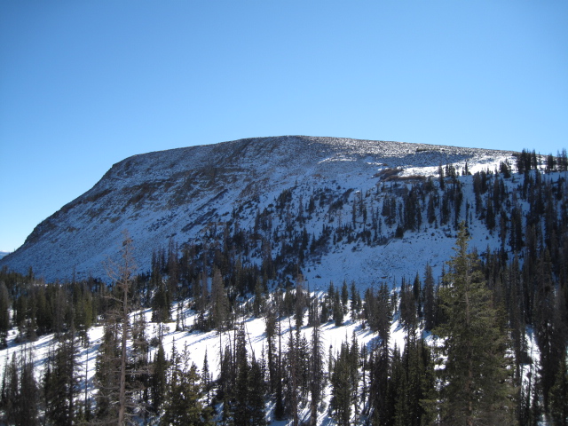
| Advisory: Uintas Area Mountains | Issued by Evelyn Lees for Tuesday - November 10, 2015 - 5:54pm |
|---|

|
bottom line With so little snow, the primary danger is hitting rocks and stumps and the avalanche danger is generally LOW. But there could be a few sensitive drifts on steeper, high elevation slopes that could be triggered. Once there is enough snow to recreate, there is enough snow for avalanches. Even a short ride in a sluff could leave you with bumps, bruises or broken bones. Until more snow comes, we will be issuing intermittent advisories.
|
 |
special announcement We're posting observations from the backcountry on a daily basis now. See or trigger an avalanche? Shooting cracks? Hear a collapse? It's simple. Go here to fill out an observation. |
 |
current conditions The storm reached the western Uintas today, with 4 to 8" of new snow by 5 pm this evening. Temperatures have plummeted into the teens and low 20s. Winds have shifted to the northeast, and increased slightly, into the 15 to 20 mph range, with gusts to 30 at the highest stations. An observation from last Saturday showed a shallow snowpack, which faceted over the past few days. Even with the new snow, you would need a very smooth ground surface beneath to do any recreating.
|
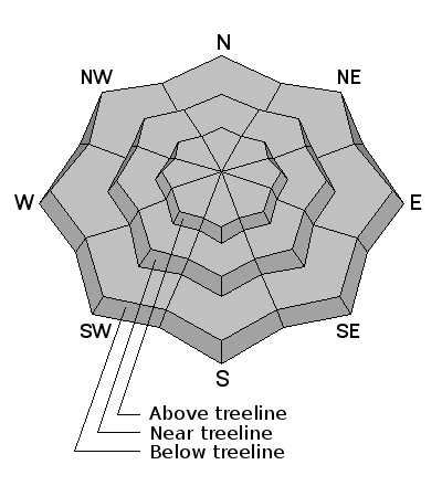
| type | aspect/elevation | characteristics |
|---|

|
|
LIKELIHOOD
 LIKELY
UNLIKELY
SIZE
 LARGE
SMALL
TREND
 INCREASING DANGER
SAME
DECREASING DANGER
|
|
description
The newest snow will bond poorly to some of the old snow surfaces, especially on the shady slopes. The snow will be most sensitive to a person any where the wind has drifted it into pillows, mostly along the high ridges and in open bowls.
It's time to get organized for the winter - check your beacon batteries, and make sure your shovel and probe are in good conditions.
|
 |
weather Another 2 to 4" of snow are possible tonight into Wednesday morning. Lows will be down in the single digits for the next few nights, with highs in the 30s. The next chance for snow looks to be Sunday night. |