| Please join us at the 23rd annual Black Diamond Fall Fundraiser Party Thursday Sept 15. Tickets are on sale now here, at the Black Diamond store & at REI. Special bonus raffle for online ticket purchasers! |
| Please join us at the 23rd annual Black Diamond Fall Fundraiser Party Thursday Sept 15. Tickets are on sale now here, at the Black Diamond store & at REI. Special bonus raffle for online ticket purchasers! |
| Advisory: Skyline Area Mountains | Issued by Brett Kobernik for Saturday - February 27, 2016 - 6:04am |
|---|


|
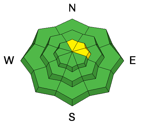
bottom line The avalanche danger remains mostly LOW along the Manti Skyline today. There is still a remote chance that you could trigger an avalanche that breaks to the ground in the high elevation very steep north through east facing terrain.
|
 |
current conditions A small storm on Tuesday laid down 3 to 5 inches of new snow. Temperatures have been gradually warming since then with daytime highs in the mid 40s. Wind has been fairly light from a westerly direction. Cold powder can still be found in many areas with good riding conditions. Sunny slopes have a melt freeze crust. Here are some observations from the last week:
|
 |
recent activity There were a few minor avalanches that occurred during the last storm all within the new snow and generally right along the ridges where the wind drifted snow. The last significant snowmobile triggered deep slab avalanche that was reported was a week ago Friday. |
| type | aspect/elevation | characteristics |
|---|

|
|
LIKELIHOOD
 LIKELY
UNLIKELY
SIZE
 LARGE
SMALL
TREND
 INCREASING DANGER
SAME
DECREASING DANGER
|
|
description
At this point, it seems pretty unlikely that someone will trigger a deep slab avalanche breaking into weak sugary snow near the ground. If it were to happen, upper elevation north through east facing slopes nearing 40 degrees in steepness is the most likely terrain locations. |
 |
weather A storm rides over the top of Utah which will bring only some clouds and a bump in wind speeds to our area today. Temperatures will remain mild with ridgetop highs around 40. The wind will be a bit gusty by mid day starting out from the southwest then switching northwest. We'll see some clouds on Sunday but overall it looks like another pretty nice day. A small storm is shaping up for Monday which might give us a little fresh snow. |
| general announcements We will publish full detailed advisories Saturday and Sunday mornings by 7am. We will also be publishing basic avalanche danger ratings & info during the week. If you are getting out into the mountains, we love to hear from you! You can SUBMIT OBSERVATIONS ONLINE or EMAIL US If you would like to have avalanche advisories emailed to you, SIGN UP HERE We can provide basic avalanche awareness presentations for your school, group or club. To enquire, CLICK HERE |


