| Please join us at the 23rd annual Black Diamond Fall Fundraiser Party Thursday Sept 15. Tickets are on sale now here, at the Black Diamond store & at REI. Special bonus raffle for online ticket purchasers! |
| Please join us at the 23rd annual Black Diamond Fall Fundraiser Party Thursday Sept 15. Tickets are on sale now here, at the Black Diamond store & at REI. Special bonus raffle for online ticket purchasers! |
| Advisory: Skyline Area Mountains | Issued by Brett Kobernik for Monday - December 7, 2015 - 7:00am |
|---|


|
bottom line The avalanche danger in most areas is LOW today. Watch for scattered wind drifts on the higher more east facing terrain which may still crack out. The avalanche danger will remain generally LOW for the next several days. Anticipate the avalanche danger to rise starting Friday as a series of storms moves through which may produce a good shot of snow.
|
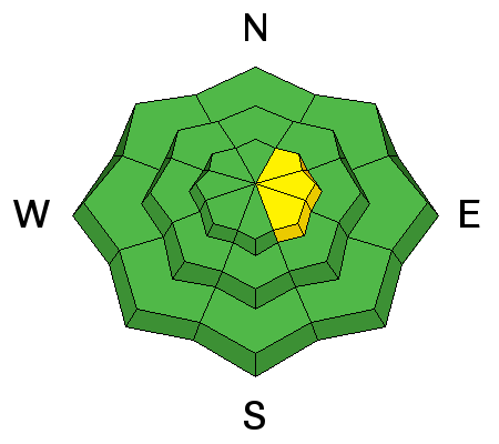
| type | aspect/elevation | characteristics |
|---|

|
|
LIKELIHOOD
 LIKELY
UNLIKELY
SIZE
 LARGE
SMALL
TREND
 INCREASING DANGER
SAME
DECREASING DANGER
|
|
description
A bump in wind speeds on Sunday may have formed some more fresh drifts along the upper elevation ridges and terrain features. Watch for wind drifts along the east facing terrain. These won't pose a huge threat for the most part but could knock you down and push you into rocks or trees. |
 |
weather |
| general announcements We will publish full detailed advisories Saturday and Sunday mornings by 7am. We will also be publishing basic avalanche danger ratings & info during the week. If you are getting out into the mountains, we love to hear from you! You can SUBMIT OBSERVATIONS ONLINE or EMAIL US If you would like to have avalanche advisories emailed to you, SIGN UP HERE We can provide basic avalanche awareness presentations for your school, group or club. To enquire, CLICK HERE |


