25th Annual Black Diamond Fall Fundraising Party
Thursday, September 13; 6:00-10:00 PM; Black Diamond Parking Lot
25th Annual Black Diamond Fall Fundraising Party
Thursday, September 13; 6:00-10:00 PM; Black Diamond Parking Lot
| Advisory: Salt Lake Area Mountains | Issued by Trent Meisenheimer for Sunday - February 19, 2017 - 4:50am |
|---|

|
bottom line The avalanche danger is Moderate on all mid and upper elevation slopes for wind slabs and storm snow avalanches. The biggest concern will be upper elevation northerly facing terrain where wind has deposited new snow over weak faceted snow, forming a slab. Wind slabs along upper elevation ridgelines will be more sensitive today and could be triggered from a distance.
|
 |
special announcement Waiting on touring partners to get ready? in the meantime give Drew Hardesty's blog a read: A Companion Piece to #NothingBadHappened called Hindsight 20/40 |
 |
current conditions Southerly winds continued to blow through the night and are currently spinning the 10,000' foot anemometers 15-20 mph gusting into the 40's. Lose some elevation and the wind speed relaxes to a more enjoyable speed of 10-15 mph with gusts into the 30's. Mountain temperatures are still on the warmer side with the rain snow/freezing line oscillating around 7000' feet in elevation. Upper elevation temperatures are in the 20's. Roughly 2-3" (0.2-0.4 h20) of new snow fell overnight. Slowly but surely we are starting to stack up the snow in the cottonwoods with 8-12" (0.5-1.5" h20) inches of new snow in the past 48hrs. An excellent week in Review: By Greg Gagne found HERE. |
 |
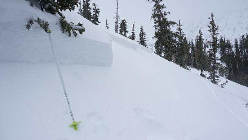
recent activity Most of the backcountry travelers yesterday reported shallow sluffs and small wind slabs that failed within the new snow. However, one party in Bells Canyon triggered an avalanche that propagated 60' feet wide and up to 15" inches deep. This avalanche failed on the weak faceted snow from the last prolonged high pressure. Nobody caught. Photo: Bells Canyon avalanche - Andrew Bentz, read is observation HERE.
|
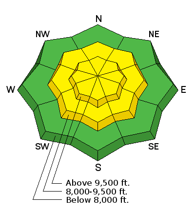
| type | aspect/elevation | characteristics |
|---|

|

|
LIKELIHOOD
 LIKELY
UNLIKELY
SIZE
 LARGE
SMALL
TREND
 INCREASING DANGER
SAME
DECREASING DANGER
|
|
description
As the southerly winds continue to drift and move the snow around you can expect to find fresh wind slabs off the lee side of ridgelines today. The biggest concern will be the upper elevation wind loaded northerly facing terrain where wind drifted snow sits above faceted snow. Any new wind drifted snow will be reactive on those aspects and could be triggered from a distance. Avoid rounded pillowy snow that looks wavy or sounds hollow like a drum. Video of Greg Gagne showing some weak faceted snow underneath the new snow. Strong snow, over weak snow, is never good.
|
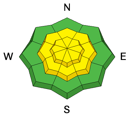
| type | aspect/elevation | characteristics |
|---|

|
|
LIKELIHOOD
LIKELY
UNLIKELY
SIZE
LARGE
SMALL
TREND
INCREASING DANGER
SAME
DECREASING DANGER
|
|
description
4-8" of new snow is expected throughout the day today. If the weather forecast comes together you'll want to shift your focus to all steep terrain including south facing and mid-elevation terrain where soft slabs over a foot deep could become reactive. Even out of the wind. |
 |
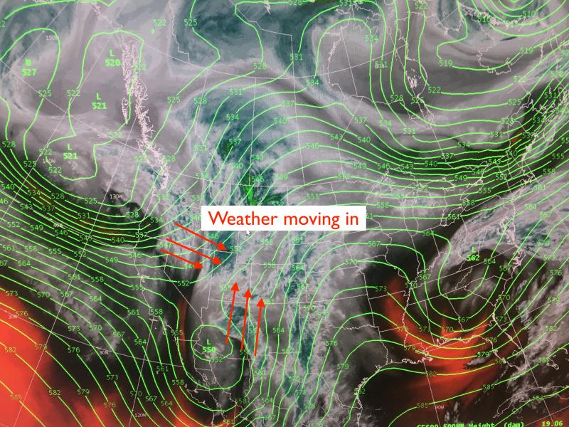
weather This morning we will keep the gusty southerly winds around where they are likely to average 15-20 mph gusting into the 40's across the mountain ridgelines. Around the noon hour the winds will veer to the west as a frontal passage pushes through the mountains of northern Utah. Temperatures will cool slightly and the rain/snow should drop closer to 6000' feet before rising again on Monday. You can expect 4-8" of snow today and possibly more in places favored by a southwest flow. There is talk on the street that a more organized colder system could drop into the state Tuesday evening through Wednesday day. Stay tuned.
|
general announcements
|